
Bond Pond Reservoir Report
Nearby: Squires Lake Dam Lake Ann Dam
Last Updated: April 1, 2026
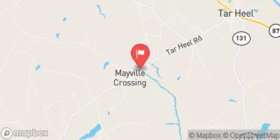
Bond Pond, also known as Bruce Pond Dam, is a private water resource located in Wilmington, North Carolina.
Summary
Built in 1971 by the USDA NRCS, this earth dam stands at a height of 26 feet and serves primarily for recreation purposes such as fishing and wildlife preservation. With a storage capacity of 30 acre-feet, Bond Pond covers a drainage area of 0.04 square miles and has a maximum discharge rate of 150 cubic feet per second.
The dam features an uncontrolled spillway with a width of 32 feet and is classified as having a low hazard potential. Despite a moderate risk assessment rating, the condition assessment for Bond Pond is currently listed as "Not Available". The dam has not been inspected in recent years and does not have an Emergency Action Plan (EAP) in place. However, it remains a popular spot for outdoor enthusiasts and serves as a vital resource for the local community.
Bond Pond offers a serene and picturesque setting for recreational activities, attracting visitors with its tranquil waters and abundant wildlife. As climate change continues to impact water resources, it is important to monitor and maintain structures like Bond Pond to ensure their safety and longevity. With its rich history and natural beauty, Bond Pond stands as a testament to the importance of preserving and protecting our water sources for future generations of water resource and climate enthusiasts.
°F
°F
mph
Wind
%
Humidity
15-Day Weather Outlook
Year Completed |
1971 |
Dam Length |
140 |
Dam Height |
26 |
River Or Stream |
Tr- Cape Fear River Ne |
Primary Dam Type |
Earth |
Drainage Area |
0.04 |
Nid Storage |
30 |
Outlet Gates |
Uncontrolled |
Hazard Potential |
Low |
Foundations |
Soil |
Nid Height |
26 |
Seasonal Comparison
5-Day Hourly Forecast Detail
Nearby Streamflow Levels
 Cape Fear R At Lock #1 Nr Kelly
|
1580cfs |
 Black River Near Tomahawk
|
140cfs |
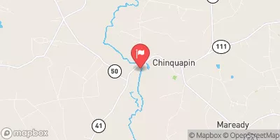 Northeast Cape Fear River Near Chinquapin
|
127cfs |
 New River Near Gum Branch
|
37cfs |
 Waccamaw River At Freeland
|
234cfs |
 Big Swamp Nr Tarheel
|
41cfs |
Dam Data Reference
Condition Assessment
SatisfactoryNo existing or potential dam safety deficiencies are recognized. Acceptable performance is expected under all loading conditions (static, hydrologic, seismic) in accordance with the minimum applicable state or federal regulatory criteria or tolerable risk guidelines.
Fair
No existing dam safety deficiencies are recognized for normal operating conditions. Rare or extreme hydrologic and/or seismic events may result in a dam safety deficiency. Risk may be in the range to take further action. Note: Rare or extreme event is defined by the regulatory agency based on their minimum
Poor A dam safety deficiency is recognized for normal operating conditions which may realistically occur. Remedial action is necessary. POOR may also be used when uncertainties exist as to critical analysis parameters which identify a potential dam safety deficiency. Investigations and studies are necessary.
Unsatisfactory
A dam safety deficiency is recognized that requires immediate or emergency remedial action for problem resolution.
Not Rated
The dam has not been inspected, is not under state or federal jurisdiction, or has been inspected but, for whatever reason, has not been rated.
Not Available
Dams for which the condition assessment is restricted to approved government users.
Hazard Potential Classification
HighDams assigned the high hazard potential classification are those where failure or mis-operation will probably cause loss of human life.
Significant
Dams assigned the significant hazard potential classification are those dams where failure or mis-operation results in no probable loss of human life but can cause economic loss, environment damage, disruption of lifeline facilities, or impact other concerns. Significant hazard potential classification dams are often located in predominantly rural or agricultural areas but could be in areas with population and significant infrastructure.
Low
Dams assigned the low hazard potential classification are those where failure or mis-operation results in no probable loss of human life and low economic and/or environmental losses. Losses are principally limited to the owner's property.
Undetermined
Dams for which a downstream hazard potential has not been designated or is not provided.
Not Available
Dams for which the downstream hazard potential is restricted to approved government users.
 Bond Pond