
Papio Creek W-3 Reservoir Report
Nearby: Wrich Dam 1 Wrich Dam 2
Last Updated: December 12, 2025
Papio Creek W-3 is a vital water resource structure located in Washington, Nebraska, with a primary purpose of flood risk reduction.
°F
°F
mph
Wind
%
Humidity
Summary
This earth dam, designed by USDA NRCS and completed in 1983, stands at a height of 44.5 feet and has a storage capacity of 269.7 acre-feet. With a drainage area of 0.35 square miles and a maximum discharge of 3343 cubic feet per second, the dam plays a crucial role in managing water flow in the TR-Big Papio Creek.
Managed by the Natural Resources Conservation Service, Papio Creek W-3 is regulated by the Nebraska Department of Natural Resources and undergoes regular inspections to ensure its structural integrity. Despite being classified as high hazard potential, the dam's condition assessment in 2020 deemed it to be satisfactory. The surrounding area, with a surface area of 4.7 acres, benefits from the protection provided by this key infrastructure, showcasing the importance of water resource management in mitigating climate-related risks in the region.
As climate change continues to impact water resources, structures like Papio Creek W-3 play a crucial role in safeguarding communities against flooding events. With a designated emergency action plan in place and regular inspections to monitor its condition, this earth dam stands as a testament to the collaborative efforts of local government and regulatory agencies in ensuring the safety and resilience of water infrastructure in Nebraska. For water resource and climate enthusiasts, Papio Creek W-3 serves as a fascinating case study in effective flood risk reduction and water management strategies.
Year Completed |
1983 |
Dam Length |
1110 |
Dam Height |
44.5 |
River Or Stream |
TR-BIG PAPIO CREEK |
Primary Dam Type |
Earth |
Surface Area |
4.7 |
Hydraulic Height |
43 |
Drainage Area |
0.35 |
Nid Storage |
269.7 |
Structural Height |
48.5 |
Hazard Potential |
High |
Foundations |
Soil |
Nid Height |
49 |
Seasonal Comparison
Weather Forecast
Nearby Streamflow Levels
 Big Papillion Cr
|
38cfs |
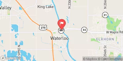 Elkhorn River At Waterloo
|
1120cfs |
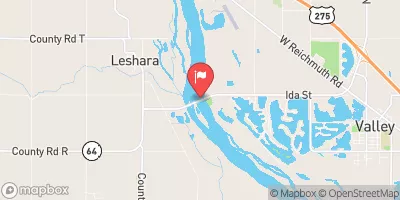 Platte River Nr Leshara
|
5270cfs |
 Maple Creek Near Nickerson
|
60cfs |
 Missouri River At Omaha
|
17800cfs |
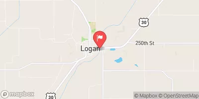 Boyer River At Logan
|
417cfs |
Dam Data Reference
Condition Assessment
SatisfactoryNo existing or potential dam safety deficiencies are recognized. Acceptable performance is expected under all loading conditions (static, hydrologic, seismic) in accordance with the minimum applicable state or federal regulatory criteria or tolerable risk guidelines.
Fair
No existing dam safety deficiencies are recognized for normal operating conditions. Rare or extreme hydrologic and/or seismic events may result in a dam safety deficiency. Risk may be in the range to take further action. Note: Rare or extreme event is defined by the regulatory agency based on their minimum
Poor A dam safety deficiency is recognized for normal operating conditions which may realistically occur. Remedial action is necessary. POOR may also be used when uncertainties exist as to critical analysis parameters which identify a potential dam safety deficiency. Investigations and studies are necessary.
Unsatisfactory
A dam safety deficiency is recognized that requires immediate or emergency remedial action for problem resolution.
Not Rated
The dam has not been inspected, is not under state or federal jurisdiction, or has been inspected but, for whatever reason, has not been rated.
Not Available
Dams for which the condition assessment is restricted to approved government users.
Hazard Potential Classification
HighDams assigned the high hazard potential classification are those where failure or mis-operation will probably cause loss of human life.
Significant
Dams assigned the significant hazard potential classification are those dams where failure or mis-operation results in no probable loss of human life but can cause economic loss, environment damage, disruption of lifeline facilities, or impact other concerns. Significant hazard potential classification dams are often located in predominantly rural or agricultural areas but could be in areas with population and significant infrastructure.
Low
Dams assigned the low hazard potential classification are those where failure or mis-operation results in no probable loss of human life and low economic and/or environmental losses. Losses are principally limited to the owner's property.
Undetermined
Dams for which a downstream hazard potential has not been designated or is not provided.
Not Available
Dams for which the downstream hazard potential is restricted to approved government users.
Area Campgrounds
| Location | Reservations | Toilets |
|---|---|---|
 Wilson Island State Rec Area
|
||
 Glenn Cunningham Lake
|
||
 Lake Cunningham
|
 Papio Creek W-3
 Blair City boat ramp