Cheney Re Nr Cheney Reservoir
As of July 21, 2026, Cheney Re Nr Cheney is holding 175,100 ac-ft of water — 12314% of normal storage for this date. Storage data refreshed throughout the day.

Cheney Re Nr Cheney
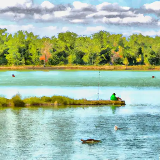
Cheney Reservoir is located in Cheney, KS, and was completed in 1964. It is one of the largest bodies of water in Kansas with a capacity of over 9 billion gallons. The reservoir serves as a primary source of drinking water for the city of Wichita and also provides irrigation and recreational opportunities for surrounding communities. The hydrology of the reservoir is primarily fed by the Ninnescah River and other small streams, with surface flow and snowpack providers playing a small role. Agriculture is a major industry in the area, and the reservoir provides a source of irrigation for crops. Recreational activities include fishing, boating, camping, and hiking. The reservoir has been a popular destination for anglers, with healthy populations of walleye, crappie, and catfish. The area is also home to several campgrounds and parks, making it a popular destination for outdoor enthusiasts.
Daily levels at Cheney Re Nr Cheney
Storage volume, pool elevation, and total release plotted from the operating agency's daily observations.
Reservoir storage, acre-ft
ac-ft · code 00054
Chlorophylls, water, fluorometric, 650-700 nm, in situ sensor, micrograms per liter
ug/l · code 62361
Chlorophylls, water, in situ, fluorometric method, excitation at 470 ±15 nm, emission at 685 ±20 nm, relative fluorescence units (RFU)
RFU · code 32320
Colored dissolved organic matter (CDOM), water, in situ, fluorometric method, relative fluorescence units (RFU)
RFU · code 32322
Colored dissolved organic matter (CDOM), water, in situ, single band excitation, fluorescence emission, ppb QSE
ug/l QSE · code 32295
Cyanobacteria (blue-green algae), YSI in vivo fluorescence of phycocyanin, excitation at 595, emission at 650 nm, cells per milliliter
#/ml · code 95202
Dissolved oxygen, water, unfiltered, % saturation
% saturatn · code 00301
Lake or reservoir water surface elevation above NGVD 1929, ft
ft · code 62614
Nitrate plus nitrite, water, in situ, mg/L as N
mg/l as N · code 99133
Photosynthetically active radiation (average flux density on a horizontal surface during measurement interval), µmol of photons/m²/s
umol/m2/s · code 99988
Phycocyanins (cyanobacteria), water, in situ, fluorometric method, excitation at 590 ±15 nm, emission at 685 ±20 nm, relative fluorescence units (RFU)
RFU · code 32321
Wind direction, degrees clockwise from north
Deg · code 00036
Wind speed, mph
mph · code 00035
Plan around the weather
Same NOAA / yr.no feed Snoflo's iOS app uses. Watch the precipitation column on the meteogram -- rain on the basin upstream typically lifts inflow 24-72 hours later.
Next 5 days, hour by hour
Temperature line with weather symbols on top, snow + rain accumulation as columns, humidity as a dotted line.
5-day forecast table
Every 3 hours, broken out across temperature, snow, rain, humidity, and wind. Each cell is colour-coded relative to the column min/max.
| Time | Condition | Temp (°F) | Snow (in) | Rain (in) | Humidity (%) | Wind (mps) | Wind dir |
|---|---|---|---|---|---|---|---|
| Loading detailed forecast… | |||||||
15-day temperature & precipitation
Daily temperatures, snow, and rain projected over the next two weeks.
Nearby streamflow gauges
USGS streamgauges around Cheney Re Nr Cheney -- inflows here typically show up in storage 24-72 hours later.
| Streamgauge | Discharge | View |
|---|---|---|
| Nf Ninnescah R At Cheney Dam | 0 cfs | → |
| Sf Ninnescah R Nr Murdock | 97 cfs | → |
| Nf Ninnescah R Ab Cheney Re | 27 cfs | → |
| Arkansas R Nr Hutchinson | 219 cfs | → |
| Cowskin C At 119th St At Wichita | 1 cfs | → |
| Floodway At Arkansas R At Wichita | · | → |


About Cheney Re Nr Cheney
Where does the data for Cheney Re Nr Cheney come from?
Daily storage, pool elevation, and release rates are sourced from USGS, USBR, and USACE monitoring stations. Weather forecast comes from NOAA / yr.no -- the same feed Snoflo's iOS app uses.
How often is the report updated?
Storage observations are updated daily by the operating agency. The 15-day weather forecast refreshes throughout the day. Snoflo caches and renders the most recent observation -- check the "as of" timestamp on the storage card.
What does the Hazard hazard rating mean?
The Corps of Engineers' hazard potential classification grades probable consequences if the dam fails: High = probable loss of human life; Significant = no probable loss of human life but possible economic loss / environmental damage; Low = no probable loss of human life, only minor economic / environmental losses. See the Dam Data Reference card below for the full definitions.
What's "% of normal"?
The current storage value compared to the historical average storage on this calendar day. 100% = right on average; values above 100% mean above-normal storage (wet year); values below mean below-normal (dry year or drought).
Can I get alerts when storage crosses a threshold?
Yes -- alerts are managed in the Snoflo iOS app. Favorite this reservoir, set a threshold, and you'll get a push the moment conditions cross.