


Lisle Pond Dam Reservoir Report
Last Updated: May 1, 2026
Nearby: Heine Lake Dam Chaffin Lake Dam
°F
°F
mph
Wind
%
Humidity
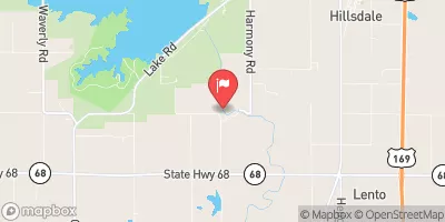
Lisle Pond Dam, located in Cass County, Missouri, was completed in 1911 and serves as a recreational structure along the TR-Cave Spring Creek.
Summary
The dam, primarily owned by a private entity, stands at a height of 31 feet and has a storage capacity of 365 acre-feet. With a surface area of 22 acres and a normal storage capacity of 147 acre-feet, the dam provides a serene setting for water resource and climate enthusiasts to enjoy various outdoor activities.
Despite its low hazard potential, the dam's condition assessment is currently labeled as "Not Rated," indicating a need for further evaluation. While the dam does not fall under state regulation or inspection, its location within the Tulsa District of the US Army Corps of Engineers adds an additional layer of oversight. As an earth dam with a buttress core type, Lisle Pond Dam is a testament to early 20th-century engineering and continues to offer a picturesque backdrop for visitors to appreciate the intersection of water resources and natural beauty.
For those interested in exploring the intersection of water resources and climate, Lisle Pond Dam presents a unique opportunity to observe a historic recreational structure that has stood the test of time. With its serene surroundings and potential for outdoor activities, the dam offers a glimpse into the importance of sustainable water management practices in maintaining ecological balance. As discussions around climate change and water scarcity continue to evolve, Lisle Pond Dam stands as a reminder of the enduring relationship between humanity and the natural world.
Regional Streamflow Levels
 South Grand River At Archie
|
504cfs |
 Big Bull C Nr Hillsdale
|
14cfs |
 Marais Des Cygnes R At La Cygne
|
12200cfs |
 Blue R Nr Stanley
|
54cfs |
 Blue R At Kenneth Rd
|
86cfs |
 L Bull C Nr Spring Hill
|
7cfs |
15-Day Long Term Forecast
Year Completed |
1911 |
Dam Height |
31 |
River Or Stream |
TR-CAVE SPRING CREEK |
Primary Dam Type |
Earth |
Surface Area |
22 |
Drainage Area |
1060 |
Nid Storage |
365 |
Structural Height |
31 |
Hazard Potential |
Low |
Foundations |
Unlisted/Unknown |
Nid Height |
31 |
Seasonal Comparison
5-Day Hourly Forecast Detail
Dam Data Reference
Condition Assessment
SatisfactoryNo existing or potential dam safety deficiencies are recognized. Acceptable performance is expected under all loading conditions (static, hydrologic, seismic) in accordance with the minimum applicable state or federal regulatory criteria or tolerable risk guidelines.
Fair
No existing dam safety deficiencies are recognized for normal operating conditions. Rare or extreme hydrologic and/or seismic events may result in a dam safety deficiency. Risk may be in the range to take further action. Note: Rare or extreme event is defined by the regulatory agency based on their minimum
Poor A dam safety deficiency is recognized for normal operating conditions which may realistically occur. Remedial action is necessary. POOR may also be used when uncertainties exist as to critical analysis parameters which identify a potential dam safety deficiency. Investigations and studies are necessary.
Unsatisfactory
A dam safety deficiency is recognized that requires immediate or emergency remedial action for problem resolution.
Not Rated
The dam has not been inspected, is not under state or federal jurisdiction, or has been inspected but, for whatever reason, has not been rated.
Not Available
Dams for which the condition assessment is restricted to approved government users.
Hazard Potential Classification
HighDams assigned the high hazard potential classification are those where failure or mis-operation will probably cause loss of human life.
Significant
Dams assigned the significant hazard potential classification are those dams where failure or mis-operation results in no probable loss of human life but can cause economic loss, environment damage, disruption of lifeline facilities, or impact other concerns. Significant hazard potential classification dams are often located in predominantly rural or agricultural areas but could be in areas with population and significant infrastructure.
Low
Dams assigned the low hazard potential classification are those where failure or mis-operation results in no probable loss of human life and low economic and/or environmental losses. Losses are principally limited to the owner's property.
Undetermined
Dams for which a downstream hazard potential has not been designated or is not provided.
Not Available
Dams for which the downstream hazard potential is restricted to approved government users.