


Tom Smith Lake West Reservoir Report
Last Updated: May 1, 2026
°F
°F
mph
Wind
%
Humidity
Tom Smith Lake West, located in Jackson County, Missouri, is a privately owned dam on a tributary of the Blue River.
Summary
The dam, designed by David Brucker, is classified as an Earth dam with a buttress core type and stands at a height of 50 feet. With a storage capacity of 302 acre-feet and a surface area of 13.6 acres, the dam serves multiple purposes while also posing a high hazard potential.
Maintained by the Dam and Reservoir Safety Program in Missouri, Tom Smith Lake West has undergone regular inspections, with its condition assessed as satisfactory as of August 2009. Despite its moderate risk level, the dam has a history of meeting regulatory guidelines and having emergency action plans in place. It is crucial for water resource and climate enthusiasts to monitor the maintenance and operation of Tom Smith Lake West to ensure the safety and sustainability of this vital water resource.
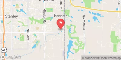
The location of Tom Smith Lake West near Stanley, KS, highlights its significance in managing water resources in the region. With a drainage area of 419 square miles and a normal storage capacity of 232 acre-feet, the dam plays a crucial role in flood control and water supply management. As climate change continues to impact water resources, the proper regulation and maintenance of dams like Tom Smith Lake West are essential to mitigate risks and ensure the resilience of our water infrastructure in the face of evolving environmental challenges.
Regional Streamflow Levels
 Blue R At Kenneth Rd
|
86cfs |
 Blue River At Blue Ridge Blvd Ext In Kc
|
137cfs |
 Tomahawk C Nr Overland Park
|
38cfs |
 Indian C At State Line Rd
|
135cfs |
 Blue R Nr Stanley
|
54cfs |
 Blue River At Kansas City
|
300cfs |
15-Day Long Term Forecast
Dam Length |
990 |
Dam Height |
50 |
River Or Stream |
TRIB. BLUE RIVER |
Surface Area |
13.6 |
Hydraulic Height |
50 |
Drainage Area |
419 |
Nid Storage |
302 |
Structural Height |
50 |
Outlet Gates |
Uncontrolled |
Hazard Potential |
High |
Foundations |
Unlisted/Unknown |
Nid Height |
50 |
Seasonal Comparison
5-Day Hourly Forecast Detail
Dam Data Reference
Condition Assessment
SatisfactoryNo existing or potential dam safety deficiencies are recognized. Acceptable performance is expected under all loading conditions (static, hydrologic, seismic) in accordance with the minimum applicable state or federal regulatory criteria or tolerable risk guidelines.
Fair
No existing dam safety deficiencies are recognized for normal operating conditions. Rare or extreme hydrologic and/or seismic events may result in a dam safety deficiency. Risk may be in the range to take further action. Note: Rare or extreme event is defined by the regulatory agency based on their minimum
Poor A dam safety deficiency is recognized for normal operating conditions which may realistically occur. Remedial action is necessary. POOR may also be used when uncertainties exist as to critical analysis parameters which identify a potential dam safety deficiency. Investigations and studies are necessary.
Unsatisfactory
A dam safety deficiency is recognized that requires immediate or emergency remedial action for problem resolution.
Not Rated
The dam has not been inspected, is not under state or federal jurisdiction, or has been inspected but, for whatever reason, has not been rated.
Not Available
Dams for which the condition assessment is restricted to approved government users.
Hazard Potential Classification
HighDams assigned the high hazard potential classification are those where failure or mis-operation will probably cause loss of human life.
Significant
Dams assigned the significant hazard potential classification are those dams where failure or mis-operation results in no probable loss of human life but can cause economic loss, environment damage, disruption of lifeline facilities, or impact other concerns. Significant hazard potential classification dams are often located in predominantly rural or agricultural areas but could be in areas with population and significant infrastructure.
Low
Dams assigned the low hazard potential classification are those where failure or mis-operation results in no probable loss of human life and low economic and/or environmental losses. Losses are principally limited to the owner's property.
Undetermined
Dams for which a downstream hazard potential has not been designated or is not provided.
Not Available
Dams for which the downstream hazard potential is restricted to approved government users.
 Longview Reservoir At Kansas City