


Vanvleet Dam Reservoir Report
Last Updated: April 28, 2026
Nearby: Axtell Dam Haag Dam
°F
°F
mph
Wind
%
Humidity
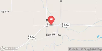
Vanvleet Dam, located in Red Willow County, Nebraska, is a local government-owned structure designed by USDA NRCS and regulated by the Nebraska Department of Natural Resources.
Summary
Completed in 1935, the earth dam stands at a height of 17 feet and has a length of 440 feet, providing flood risk reduction and other purposes along the TR-Beaver Creek. Despite its poor condition assessment, the dam has a low hazard potential and a storage capacity of 115 acre-feet.
Situated in the Lebanon area, Vanvleet Dam is a key feature in the local water resource management system, serving as a vital flood control structure for the surrounding community. The dam's foundation is soil-based, with a buttress and stone core construction, contributing to its resilience and stability. With a drainage area of 0.8 square miles, the dam plays a crucial role in regulating water flow and mitigating downstream flood risks.
Ensuring the safety and integrity of Vanvleet Dam is essential, given its age and condition. Regular inspections are conducted, with the last assessment dating back to July 2018. Despite its poor condition rating, the dam's low hazard potential indicates that it poses minimal risk to the area. As climate change continues to impact water resources, maintaining and upgrading structures like Vanvleet Dam will be crucial in safeguarding communities and ecosystems against the growing threat of extreme weather events.
Regional Streamflow Levels
15-Day Long Term Forecast
Year Completed |
1935 |
Dam Length |
440 |
Dam Height |
17 |
River Or Stream |
TR-BEAVER CREEK |
Primary Dam Type |
Earth |
Surface Area |
17 |
Hydraulic Height |
17 |
Drainage Area |
0.8 |
Nid Storage |
115 |
Structural Height |
17 |
Hazard Potential |
Low |
Foundations |
Soil |
Nid Height |
17 |
Seasonal Comparison
5-Day Hourly Forecast Detail
Dam Data Reference
Condition Assessment
SatisfactoryNo existing or potential dam safety deficiencies are recognized. Acceptable performance is expected under all loading conditions (static, hydrologic, seismic) in accordance with the minimum applicable state or federal regulatory criteria or tolerable risk guidelines.
Fair
No existing dam safety deficiencies are recognized for normal operating conditions. Rare or extreme hydrologic and/or seismic events may result in a dam safety deficiency. Risk may be in the range to take further action. Note: Rare or extreme event is defined by the regulatory agency based on their minimum
Poor A dam safety deficiency is recognized for normal operating conditions which may realistically occur. Remedial action is necessary. POOR may also be used when uncertainties exist as to critical analysis parameters which identify a potential dam safety deficiency. Investigations and studies are necessary.
Unsatisfactory
A dam safety deficiency is recognized that requires immediate or emergency remedial action for problem resolution.
Not Rated
The dam has not been inspected, is not under state or federal jurisdiction, or has been inspected but, for whatever reason, has not been rated.
Not Available
Dams for which the condition assessment is restricted to approved government users.
Hazard Potential Classification
HighDams assigned the high hazard potential classification are those where failure or mis-operation will probably cause loss of human life.
Significant
Dams assigned the significant hazard potential classification are those dams where failure or mis-operation results in no probable loss of human life but can cause economic loss, environment damage, disruption of lifeline facilities, or impact other concerns. Significant hazard potential classification dams are often located in predominantly rural or agricultural areas but could be in areas with population and significant infrastructure.
Low
Dams assigned the low hazard potential classification are those where failure or mis-operation results in no probable loss of human life and low economic and/or environmental losses. Losses are principally limited to the owner's property.
Undetermined
Dams for which a downstream hazard potential has not been designated or is not provided.
Not Available
Dams for which the downstream hazard potential is restricted to approved government users.