


Mission Creek 6-B Reservoir Report
Last Updated: May 3, 2026
Nearby: Mission Creek 6-3 Mission Creek 6-A
°F
°F
mph
Wind
%
Humidity
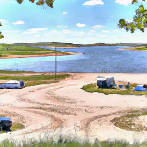
Mission Creek 6-B is a crucial flood risk reduction structure located in Pawnee, Nebraska.
Summary
Built in 1977 by the USDA NRCS, this earth dam stands at a height of 27 feet and has a hydraulic height of 24 feet. With a storage capacity of 904.9 acre-feet and a drainage area of 0.5 square miles, the dam plays a vital role in mitigating flood risks in the area.
Managed by the local government and regulated by the Nebraska Department of Natural Resources, Mission Creek 6-B has a low hazard potential and is assessed to be in satisfactory condition as of the last inspection in June 2016. The dam's primary purpose is flood risk reduction, and it serves as a critical infrastructure to protect the surrounding community from potential flooding events. With its stone core and soil foundation, the dam has been designed to withstand the challenges posed by Mission Creek.
In the event of an emergency, the dam has established protocols for risk management, though specific details such as Emergency Action Plans and inundation maps are yet to be updated. With its strategic location and design, Mission Creek 6-B continues to be a significant asset for water resource and climate enthusiasts, showcasing the importance of sound infrastructure in safeguarding communities against natural disasters.
Regional Streamflow Levels
 Big Blue R At Barneston Nebr
|
187cfs |
 Big Blue R At Marysville
|
206cfs |
 Turkey C Nr Seneca
|
23cfs |
 Black Vermillion R Nr Frankfort
|
113cfs |
 L Blue R Nr Barnes
|
240cfs |
 North Fork Big Nemaha River At Humboldt
|
63cfs |
15-Day Long Term Forecast
Year Completed |
1977 |
Dam Length |
1766 |
Dam Height |
27 |
River Or Stream |
TR-MISSION CREEK |
Primary Dam Type |
Earth |
Surface Area |
26 |
Hydraulic Height |
24 |
Drainage Area |
0.5 |
Nid Storage |
904.9 |
Structural Height |
29 |
Hazard Potential |
Low |
Foundations |
Soil |
Nid Height |
29 |
Seasonal Comparison
5-Day Hourly Forecast Detail
Dam Data Reference
Condition Assessment
SatisfactoryNo existing or potential dam safety deficiencies are recognized. Acceptable performance is expected under all loading conditions (static, hydrologic, seismic) in accordance with the minimum applicable state or federal regulatory criteria or tolerable risk guidelines.
Fair
No existing dam safety deficiencies are recognized for normal operating conditions. Rare or extreme hydrologic and/or seismic events may result in a dam safety deficiency. Risk may be in the range to take further action. Note: Rare or extreme event is defined by the regulatory agency based on their minimum
Poor A dam safety deficiency is recognized for normal operating conditions which may realistically occur. Remedial action is necessary. POOR may also be used when uncertainties exist as to critical analysis parameters which identify a potential dam safety deficiency. Investigations and studies are necessary.
Unsatisfactory
A dam safety deficiency is recognized that requires immediate or emergency remedial action for problem resolution.
Not Rated
The dam has not been inspected, is not under state or federal jurisdiction, or has been inspected but, for whatever reason, has not been rated.
Not Available
Dams for which the condition assessment is restricted to approved government users.
Hazard Potential Classification
HighDams assigned the high hazard potential classification are those where failure or mis-operation will probably cause loss of human life.
Significant
Dams assigned the significant hazard potential classification are those dams where failure or mis-operation results in no probable loss of human life but can cause economic loss, environment damage, disruption of lifeline facilities, or impact other concerns. Significant hazard potential classification dams are often located in predominantly rural or agricultural areas but could be in areas with population and significant infrastructure.
Low
Dams assigned the low hazard potential classification are those where failure or mis-operation results in no probable loss of human life and low economic and/or environmental losses. Losses are principally limited to the owner's property.
Undetermined
Dams for which a downstream hazard potential has not been designated or is not provided.
Not Available
Dams for which the downstream hazard potential is restricted to approved government users.
 Burchard Lake State Wildlife Area
 Big Indian NRD Rec Area
 Feits Memorial Park
 Rockford Lake State Rec Area
 Marysville City Park
 Iron Horse Trail Lake
 Tuttle C Lk Nr Manhattan
 Wolf - Wildcat