
Frey Dam Reservoir Report
Last Updated: January 11, 2026
Frey Dam, located in Richardson County, Nebraska, stands as a testament to human engineering and ingenuity in the realm of water resource management.
°F
°F
mph
Wind
%
Humidity
Summary
Completed in 2006, this private-owned Earth dam serves multiple purposes including flood risk reduction and other water management activities along the TR-Easly Creek. With a height of 22 feet and a length of 521 feet, the dam has a storage capacity of 87 acre-feet, providing crucial water supply and control for the surrounding area.
Despite its low hazard potential, Frey Dam undergoes regular inspections and maintenance to ensure its structural integrity and safety. The dam, constructed with a stone core and supported by a soil foundation, has a hydraulic height of 21 feet and a structural height of 34 feet. With a drainage area of 0.6 square miles and a maximum discharge capacity of 247 cubic feet per second, the dam plays a vital role in regulating water flow and minimizing flood risks in the region.
Managed by the Nebraska Department of Natural Resources, Frey Dam stands as a beacon of responsible water resource management, exemplifying the collaborative efforts between private owners and state regulatory agencies in safeguarding water resources and mitigating climate-related risks. Its satisfactory condition assessment and regular inspections underscore the commitment to ensuring the safety and efficacy of this essential infrastructure for the community it serves.
Year Completed |
2006 |
Dam Length |
521 |
Dam Height |
22 |
River Or Stream |
TR-EASLY CREEK |
Primary Dam Type |
Earth |
Surface Area |
3 |
Hydraulic Height |
21 |
Drainage Area |
0.6 |
Nid Storage |
87 |
Structural Height |
34 |
Hazard Potential |
Low |
Foundations |
Soil |
Nid Height |
34 |
Seasonal Comparison
Weather Forecast
Nearby Streamflow Levels
 North Fork Big Nemaha River At Humboldt
|
85cfs |
 Turkey C Nr Seneca
|
31cfs |
 Big Nemaha River At Falls City
|
388cfs |
 Missouri River At Rulo
|
27400cfs |
 Little Nemaha River At Auburn
|
134cfs |
 Tarkio River At Fairfax Mo
|
62cfs |
Dam Data Reference
Condition Assessment
SatisfactoryNo existing or potential dam safety deficiencies are recognized. Acceptable performance is expected under all loading conditions (static, hydrologic, seismic) in accordance with the minimum applicable state or federal regulatory criteria or tolerable risk guidelines.
Fair
No existing dam safety deficiencies are recognized for normal operating conditions. Rare or extreme hydrologic and/or seismic events may result in a dam safety deficiency. Risk may be in the range to take further action. Note: Rare or extreme event is defined by the regulatory agency based on their minimum
Poor A dam safety deficiency is recognized for normal operating conditions which may realistically occur. Remedial action is necessary. POOR may also be used when uncertainties exist as to critical analysis parameters which identify a potential dam safety deficiency. Investigations and studies are necessary.
Unsatisfactory
A dam safety deficiency is recognized that requires immediate or emergency remedial action for problem resolution.
Not Rated
The dam has not been inspected, is not under state or federal jurisdiction, or has been inspected but, for whatever reason, has not been rated.
Not Available
Dams for which the condition assessment is restricted to approved government users.
Hazard Potential Classification
HighDams assigned the high hazard potential classification are those where failure or mis-operation will probably cause loss of human life.
Significant
Dams assigned the significant hazard potential classification are those dams where failure or mis-operation results in no probable loss of human life but can cause economic loss, environment damage, disruption of lifeline facilities, or impact other concerns. Significant hazard potential classification dams are often located in predominantly rural or agricultural areas but could be in areas with population and significant infrastructure.
Low
Dams assigned the low hazard potential classification are those where failure or mis-operation results in no probable loss of human life and low economic and/or environmental losses. Losses are principally limited to the owner's property.
Undetermined
Dams for which a downstream hazard potential has not been designated or is not provided.
Not Available
Dams for which the downstream hazard potential is restricted to approved government users.
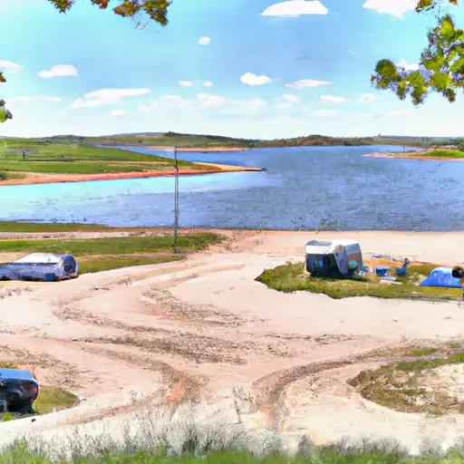
Area Campgrounds
| Location | Reservations | Toilets |
|---|---|---|
 Sabetha Lake
|
||
 Pony Creek Lake
|
||
 Humboldt Lake Park
|
||
 Iron Horse Trail Lake
|
 Frey Dam