Pomona Lk Nr Quenemo Reservoir Report
Nearby: Stockwater Pond Lyndon Lake Dam
Last Updated: February 22, 2026
Pomona Lake near Quenemo, KS in Kansas is a man-made lake constructed by the U.S.
Summary
Army Corps of Engineers in 1963. The lake is located in Osage County and covers an area of 4,000 acres, with 52 miles of shoreline. The purpose of the lake is to provide flood control, water supply, recreational opportunities, and support wildlife habitat. The Pomona Dam is built on the Marais des Cygnes River and is operated by the U.S. Army Corps of Engineers.
The hydrology of Pomona Lake is supplied by three main sources: the Marais des Cygnes River, the Dragoon Creek, and the 110-mile levee that surrounds the lake. The lake has a drainage area of 322 square miles, with a maximum depth of 40 feet and an average depth of 16.5 feet. The surface flow of Pomona Lake is regulated by the U.S. Army Corps of Engineers to maintain safe water levels for recreational activities and flood control.
The snowpack in the area contributes to the hydrology of Pomona Lake, with snowmelt filling the reservoir during the spring months. The lake also supports agricultural activities in the surrounding areas, providing irrigation water to farmers in Osage County. Recreational activities at Pomona Lake include boating, fishing, hunting, hiking, camping, and wildlife viewing. The lake is a popular destination for outdoor enthusiasts, attracting visitors from across Kansas and the surrounding states.
°F
°F
mph
Wind
%
Humidity
15-Day Weather Outlook
Reservoir Details
| Lake Or Reservoir Water Surface Elevation Above Ngvd 1929, Ft 24hr Change | -0.01% |
| Percent of Normal | 100% |
| Minimum |
969.84 ft
2013-04-09 |
| Maximum |
1,001.81 ft
2019-06-08 |
| Average | 973 ft |
| Hydraulic_Height | 111 |
| Drainage_Area | 322 |
| Year_Completed | 1963 |
| Nid_Storage | 254600 |
| Structural_Height | 110 |
| River_Or_Stream | HUNDRED TEN MILE CREEK |
| Foundations | Soil |
| Surface_Area | 4000 |
| Hazard_Potential | High |
| Outlet_Gates | Uncontrolled - 0 |
| Dam_Length | 7750 |
| Primary_Dam_Type | Rockfill |
| Nid_Height | 111 |
Seasonal Comparison
Reservoir Storage, Acre-Ft Levels
Lake Or Reservoir Water Surface Elevation Above Ngvd 1929, Ft Levels
5-Day Hourly Forecast Detail
Nearby Streamflow Levels
 Hundred And Ten Mile C Nr Quenemo
|
485cfs |
 Salt C At Lyndon
|
24cfs |
 Marais Des Cygnes R Nr Pomona
|
1990cfs |
 Marais Des Cygnes R At Melvern
|
1400cfs |
 Dragoon C Nr Burlingame
|
24cfs |
 Marais Des Cygnes R Nr Ottawa
|
1860cfs |
Dam Data Reference
Condition Assessment
SatisfactoryNo existing or potential dam safety deficiencies are recognized. Acceptable performance is expected under all loading conditions (static, hydrologic, seismic) in accordance with the minimum applicable state or federal regulatory criteria or tolerable risk guidelines.
Fair
No existing dam safety deficiencies are recognized for normal operating conditions. Rare or extreme hydrologic and/or seismic events may result in a dam safety deficiency. Risk may be in the range to take further action. Note: Rare or extreme event is defined by the regulatory agency based on their minimum
Poor A dam safety deficiency is recognized for normal operating conditions which may realistically occur. Remedial action is necessary. POOR may also be used when uncertainties exist as to critical analysis parameters which identify a potential dam safety deficiency. Investigations and studies are necessary.
Unsatisfactory
A dam safety deficiency is recognized that requires immediate or emergency remedial action for problem resolution.
Not Rated
The dam has not been inspected, is not under state or federal jurisdiction, or has been inspected but, for whatever reason, has not been rated.
Not Available
Dams for which the condition assessment is restricted to approved government users.
Hazard Potential Classification
HighDams assigned the high hazard potential classification are those where failure or mis-operation will probably cause loss of human life.
Significant
Dams assigned the significant hazard potential classification are those dams where failure or mis-operation results in no probable loss of human life but can cause economic loss, environment damage, disruption of lifeline facilities, or impact other concerns. Significant hazard potential classification dams are often located in predominantly rural or agricultural areas but could be in areas with population and significant infrastructure.
Low
Dams assigned the low hazard potential classification are those where failure or mis-operation results in no probable loss of human life and low economic and/or environmental losses. Losses are principally limited to the owner's property.
Undetermined
Dams for which a downstream hazard potential has not been designated or is not provided.
Not Available
Dams for which the downstream hazard potential is restricted to approved government users.
Area Campgrounds
| Location | Reservations | Toilets |
|---|---|---|
 Outlet Park - Pomona Reservoir
|
||
 Pomona State Park
|
||
 Michigan Valley - Pomona Reservoir
|
||
 Outlet Park - Melvern
|

 Pomona Dam
 Pomona Lk Nr Quenemo
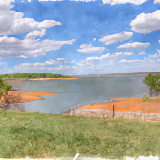 Melvern Lk Nr Melvern