


Upper Little Black A-7 Dam Reservoir Report
Last Updated: April 15, 2026
Nearby: Mallard Lake Upper Little Black A-2
°F
°F
mph
Wind
%
Humidity
The Upper Little Black A-7 Dam in Ripley, Missouri, is a vital structure designed by the USDA NRCS to serve as a flood risk reduction measure along the Little Black River.
Summary
Completed in 1984, this earth dam stands at a height of 54 feet and has a length of 1600 feet, with a maximum storage capacity of 5793 acre-feet. The dam plays a crucial role in protecting the surrounding area from potential flooding events, given its high hazard potential and the need for regular inspections and maintenance to ensure its structural integrity.
Located in the Memphis District, the Upper Little Black A-7 Dam is under local government ownership and falls under the jurisdiction of the DAM AND RESERVOIR SAFETY PROG in Missouri. With a satisfactory condition assessment as of 2007, the dam's primary purpose is flood risk reduction, reflecting its importance in safeguarding the community of Grandin and the surrounding areas. Despite its moderate risk assessment, the dam's design and construction by the Natural Resources Conservation Service demonstrate a commitment to water resource management and climate resilience in the region.
As a significant element of water resource infrastructure in Missouri, the Upper Little Black A-7 Dam stands as a testament to the collaborative efforts between local government and federal agencies in mitigating flood risks and ensuring public safety. With its capacity to store and regulate water flow along the Little Black River, this dam remains a critical asset in managing water resources and protecting communities from potential inundation. For water resource and climate enthusiasts, the Upper Little Black A-7 Dam serves as a focal point for understanding the intersection of infrastructure, natural hazards, and environmental stewardship in the face of changing climate patterns.
Regional Streamflow Levels
 Little Black River Below Fairdealing
|
42cfs |
 Black River At Poplar Bluff
|
817cfs |
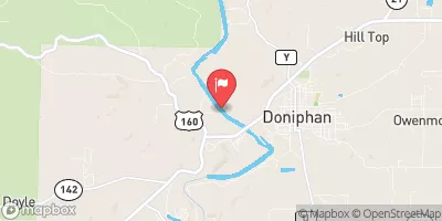 Current River At Doniphan
|
1770cfs |
 Black River At Leeper
|
551cfs |
 Current River At Van Buren
|
1160cfs |
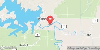 St. Francis River At Wappapello
|
999cfs |
15-Day Long Term Forecast
Year Completed |
1984 |
Dam Length |
1600 |
Dam Height |
54 |
River Or Stream |
LITTLE BLACK |
Primary Dam Type |
Earth |
Surface Area |
64 |
Drainage Area |
6507 |
Nid Storage |
5793 |
Structural Height |
54 |
Outlet Gates |
None |
Hazard Potential |
High |
Foundations |
Rock |
Nid Height |
54 |
Seasonal Comparison
5-Day Hourly Forecast Detail
Dam Data Reference
Condition Assessment
SatisfactoryNo existing or potential dam safety deficiencies are recognized. Acceptable performance is expected under all loading conditions (static, hydrologic, seismic) in accordance with the minimum applicable state or federal regulatory criteria or tolerable risk guidelines.
Fair
No existing dam safety deficiencies are recognized for normal operating conditions. Rare or extreme hydrologic and/or seismic events may result in a dam safety deficiency. Risk may be in the range to take further action. Note: Rare or extreme event is defined by the regulatory agency based on their minimum
Poor A dam safety deficiency is recognized for normal operating conditions which may realistically occur. Remedial action is necessary. POOR may also be used when uncertainties exist as to critical analysis parameters which identify a potential dam safety deficiency. Investigations and studies are necessary.
Unsatisfactory
A dam safety deficiency is recognized that requires immediate or emergency remedial action for problem resolution.
Not Rated
The dam has not been inspected, is not under state or federal jurisdiction, or has been inspected but, for whatever reason, has not been rated.
Not Available
Dams for which the condition assessment is restricted to approved government users.
Hazard Potential Classification
HighDams assigned the high hazard potential classification are those where failure or mis-operation will probably cause loss of human life.
Significant
Dams assigned the significant hazard potential classification are those dams where failure or mis-operation results in no probable loss of human life but can cause economic loss, environment damage, disruption of lifeline facilities, or impact other concerns. Significant hazard potential classification dams are often located in predominantly rural or agricultural areas but could be in areas with population and significant infrastructure.
Low
Dams assigned the low hazard potential classification are those where failure or mis-operation results in no probable loss of human life and low economic and/or environmental losses. Losses are principally limited to the owner's property.
Undetermined
Dams for which a downstream hazard potential has not been designated or is not provided.
Not Available
Dams for which the downstream hazard potential is restricted to approved government users.