Smithville Reservoir Near Smithville Reservoir Report
Nearby: Helvey Park Dam Bainbridge Lake Dam
Last Updated: February 24, 2026
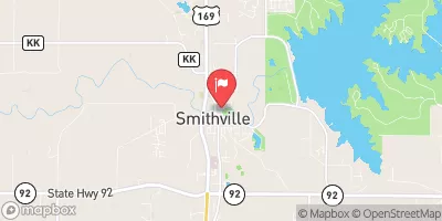
Smithville Reservoir is a popular recreational destination located near Smithville, MO in Missouri.
Summary
It was created in 1972 as a result of the construction of the Smithville Dam on the Little Platte River. The reservoir has a capacity of 7,200 acre-feet of water, and its primary purpose is to provide flood control for the Kansas City metropolitan area.
The reservoir is fed by several small streams that flow into the Little Platte River. The Little Platte River is the primary surface flow provider for the reservoir. During the winter months, the reservoir is also fed by snowmelt from the surrounding fields and hills.
In addition to flood control, the reservoir is also used for recreation and agricultural purposes. The lake provides opportunities for boating, fishing, and swimming, and the surrounding area is popular for hunting and wildlife watching. The reservoir also serves as a source of irrigation water for nearby agricultural fields. Overall, Smithville Reservoir is an important resource for the local community and surrounding areas.
°F
°F
mph
Wind
%
Humidity
15-Day Weather Outlook
Reservoir Details
| Lake Or Reservoir Water Surface Elevation Above Ngvd 1929, Ft 24hr Change | 0.0% |
| Percent of Normal | 100% |
| Minimum |
861.22 ft
2018-10-06 |
| Maximum |
882.9 ft
2021-02-18 |
| Average | 862 ft |
| Hydraulic_Height | 75 |
| Drainage_Area | 213 |
| Year_Completed | 1979 |
| Nid_Storage | 246500 |
| Structural_Height | 105 |
| River_Or_Stream | LITTLE PLATTE RIVER |
| Surface_Area | 7190 |
| Hazard_Potential | High |
| Dam_Length | 4000 |
| Primary_Dam_Type | Earth |
| Nid_Height | 105 |
Seasonal Comparison
Lake Or Reservoir Water Surface Elevation Above Ngvd 1929, Ft Levels
5-Day Hourly Forecast Detail
Nearby Streamflow Levels
Dam Data Reference
Condition Assessment
SatisfactoryNo existing or potential dam safety deficiencies are recognized. Acceptable performance is expected under all loading conditions (static, hydrologic, seismic) in accordance with the minimum applicable state or federal regulatory criteria or tolerable risk guidelines.
Fair
No existing dam safety deficiencies are recognized for normal operating conditions. Rare or extreme hydrologic and/or seismic events may result in a dam safety deficiency. Risk may be in the range to take further action. Note: Rare or extreme event is defined by the regulatory agency based on their minimum
Poor A dam safety deficiency is recognized for normal operating conditions which may realistically occur. Remedial action is necessary. POOR may also be used when uncertainties exist as to critical analysis parameters which identify a potential dam safety deficiency. Investigations and studies are necessary.
Unsatisfactory
A dam safety deficiency is recognized that requires immediate or emergency remedial action for problem resolution.
Not Rated
The dam has not been inspected, is not under state or federal jurisdiction, or has been inspected but, for whatever reason, has not been rated.
Not Available
Dams for which the condition assessment is restricted to approved government users.
Hazard Potential Classification
HighDams assigned the high hazard potential classification are those where failure or mis-operation will probably cause loss of human life.
Significant
Dams assigned the significant hazard potential classification are those dams where failure or mis-operation results in no probable loss of human life but can cause economic loss, environment damage, disruption of lifeline facilities, or impact other concerns. Significant hazard potential classification dams are often located in predominantly rural or agricultural areas but could be in areas with population and significant infrastructure.
Low
Dams assigned the low hazard potential classification are those where failure or mis-operation results in no probable loss of human life and low economic and/or environmental losses. Losses are principally limited to the owner's property.
Undetermined
Dams for which a downstream hazard potential has not been designated or is not provided.
Not Available
Dams for which the downstream hazard potential is restricted to approved government users.



 Smithville Dam
 Smithville Reservoir Near Smithville