
Upper Big Nemaha J-28 Reservoir Report
Last Updated: December 6, 2025
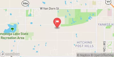
Upper Big Nemaha J-28 is a vital structure located in Johnson, Nebraska, designed by the USDA NRCS to serve flood risk reduction purposes.
°F
°F
mph
Wind
%
Humidity
Summary
Completed in 1978, this earth dam stands at a height of 36 feet, with a hydraulic height of 33 feet and a structural height of 38 feet. It has a normal storage capacity of 18 acre-feet and a maximum discharge of 217 cubic feet per second. The dam is regulated by the Nebraska Department of Natural Resources and undergoes regular inspections to ensure its satisfactory condition and low hazard potential.
Situated on TR-Hooker Creek, Upper Big Nemaha J-28 plays a crucial role in managing water resources in the region, with a drainage area of 0.2 square miles and a surface area of 3 acres. The dam provides flood protection for the surrounding area and contributes to the overall water management efforts in the state. Owned by the local government, this structure is a testament to the collaborative efforts between federal and state agencies to safeguard communities from potential flood risks.
With its strategic location and effective design, Upper Big Nemaha J-28 exemplifies the fusion of engineering and environmental stewardship in water resource management. Its construction and operation reflect a commitment to sustainable practices and proactive risk mitigation. As a key component in the local flood control system, this dam stands as a testament to the resilience and foresight of Nebraska's water resource and climate management initiatives.
Year Completed |
1978 |
Dam Length |
485 |
Dam Height |
36 |
River Or Stream |
TR-HOOKER CREEK |
Primary Dam Type |
Earth |
Surface Area |
3 |
Hydraulic Height |
33 |
Drainage Area |
0.2 |
Nid Storage |
46 |
Structural Height |
38 |
Hazard Potential |
Low |
Foundations |
Soil |
Nid Height |
38 |
Seasonal Comparison
Weather Forecast
Nearby Streamflow Levels

Dam Data Reference
Condition Assessment
SatisfactoryNo existing or potential dam safety deficiencies are recognized. Acceptable performance is expected under all loading conditions (static, hydrologic, seismic) in accordance with the minimum applicable state or federal regulatory criteria or tolerable risk guidelines.
Fair
No existing dam safety deficiencies are recognized for normal operating conditions. Rare or extreme hydrologic and/or seismic events may result in a dam safety deficiency. Risk may be in the range to take further action. Note: Rare or extreme event is defined by the regulatory agency based on their minimum
Poor A dam safety deficiency is recognized for normal operating conditions which may realistically occur. Remedial action is necessary. POOR may also be used when uncertainties exist as to critical analysis parameters which identify a potential dam safety deficiency. Investigations and studies are necessary.
Unsatisfactory
A dam safety deficiency is recognized that requires immediate or emergency remedial action for problem resolution.
Not Rated
The dam has not been inspected, is not under state or federal jurisdiction, or has been inspected but, for whatever reason, has not been rated.
Not Available
Dams for which the condition assessment is restricted to approved government users.
Hazard Potential Classification
HighDams assigned the high hazard potential classification are those where failure or mis-operation will probably cause loss of human life.
Significant
Dams assigned the significant hazard potential classification are those dams where failure or mis-operation results in no probable loss of human life but can cause economic loss, environment damage, disruption of lifeline facilities, or impact other concerns. Significant hazard potential classification dams are often located in predominantly rural or agricultural areas but could be in areas with population and significant infrastructure.
Low
Dams assigned the low hazard potential classification are those where failure or mis-operation results in no probable loss of human life and low economic and/or environmental losses. Losses are principally limited to the owner's property.
Undetermined
Dams for which a downstream hazard potential has not been designated or is not provided.
Not Available
Dams for which the downstream hazard potential is restricted to approved government users.
 Upper Big Nemaha J-28