Spring Creek 18-A Reservoir Report
Last Updated: January 11, 2026
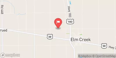
Spring Creek 18-A is a crucial water resource structure located in Dawson, Nebraska, designed by the USDA NRCS to reduce flood risks in the area.
°F
°F
mph
Wind
%
Humidity
Summary
Completed in 1976, this earth dam stands at a height of 20 feet and spans 740 feet in length, providing a storage capacity of 492 acre-feet to manage water levels in the TR-STUMP DITCH. With a low hazard potential and a satisfactory condition assessment, the dam is regulated and inspected by the Nebraska Department of Natural Resources to ensure its functionality and safety.
Owned by the local government, Spring Creek 18-A serves as a vital flood risk reduction tool in the region, with a normal storage capacity of 22 acre-feet and a drainage area of 1.9 square miles. The dam plays a crucial role in mitigating potential water-related disasters and protecting the surrounding community from flooding events. Its strategic location and effective design make it a key asset for water resource and climate enthusiasts interested in sustainable water management practices in Nebraska.
With its stone core and soil foundation, Spring Creek 18-A is a testament to the collaborative efforts of the Natural Resources Conservation Service and local authorities in safeguarding water resources. Regularly inspected and maintained, this structure serves as a model for effective dam management and underscores the importance of proactive measures in addressing climate-related challenges. As a focal point for flood risk reduction in the region, Spring Creek 18-A exemplifies the intersection of environmental stewardship and community resilience in the face of changing climate dynamics.
Year Completed |
1976 |
Dam Length |
740 |
Dam Height |
20 |
River Or Stream |
TR-STUMP DITCH |
Primary Dam Type |
Earth |
Surface Area |
11 |
Hydraulic Height |
18 |
Drainage Area |
1.9 |
Nid Storage |
492 |
Structural Height |
20 |
Hazard Potential |
Low |
Foundations |
Soil |
Nid Height |
20 |
Seasonal Comparison
Weather Forecast
Nearby Streamflow Levels
 Spring Creek Nr Overton
|
4cfs |
 Buffalo Creek Nr Overton Nebr
|
2cfs |
 Platte River Near Overton
|
880cfs |
 Elm Creek Nr Elm Creek
|
0cfs |
 Platte R Mid Ch
|
877cfs |
 South Platte River At North Platte
|
1290cfs |
Dam Data Reference
Condition Assessment
SatisfactoryNo existing or potential dam safety deficiencies are recognized. Acceptable performance is expected under all loading conditions (static, hydrologic, seismic) in accordance with the minimum applicable state or federal regulatory criteria or tolerable risk guidelines.
Fair
No existing dam safety deficiencies are recognized for normal operating conditions. Rare or extreme hydrologic and/or seismic events may result in a dam safety deficiency. Risk may be in the range to take further action. Note: Rare or extreme event is defined by the regulatory agency based on their minimum
Poor A dam safety deficiency is recognized for normal operating conditions which may realistically occur. Remedial action is necessary. POOR may also be used when uncertainties exist as to critical analysis parameters which identify a potential dam safety deficiency. Investigations and studies are necessary.
Unsatisfactory
A dam safety deficiency is recognized that requires immediate or emergency remedial action for problem resolution.
Not Rated
The dam has not been inspected, is not under state or federal jurisdiction, or has been inspected but, for whatever reason, has not been rated.
Not Available
Dams for which the condition assessment is restricted to approved government users.
Hazard Potential Classification
HighDams assigned the high hazard potential classification are those where failure or mis-operation will probably cause loss of human life.
Significant
Dams assigned the significant hazard potential classification are those dams where failure or mis-operation results in no probable loss of human life but can cause economic loss, environment damage, disruption of lifeline facilities, or impact other concerns. Significant hazard potential classification dams are often located in predominantly rural or agricultural areas but could be in areas with population and significant infrastructure.
Low
Dams assigned the low hazard potential classification are those where failure or mis-operation results in no probable loss of human life and low economic and/or environmental losses. Losses are principally limited to the owner's property.
Undetermined
Dams for which a downstream hazard potential has not been designated or is not provided.
Not Available
Dams for which the downstream hazard potential is restricted to approved government users.

 Spring Creek 18-A
 Lake Helen