
Grassy Creek Watershed Dam G- 48 Reservoir Report
Last Updated: December 5, 2025
Grassy Creek Watershed Dam G-48, located in Lewis, Missouri, was completed in 2005 by the USDA NRCS and serves as a vital structure for flood risk reduction in the area.
°F
°F
mph
Wind
%
Humidity
Summary
The dam is primarily an earth type structure with a height of 23 feet and a length of 370 feet, providing a maximum storage capacity of 83 acre-feet. Situated on Grassy Creek, the dam helps regulate water flow and minimize the risk of flooding, benefiting the local community and surrounding wildlife.
Despite its low hazard potential and moderate risk assessment, Grassy Creek Watershed Dam G-48 has not been rated for its condition assessment. The dam features an uncontrolled spillway and outlet gates, with a hydraulic height matching its structural height of 27 feet. With a drainage area of 121.6 square miles, the dam plays a crucial role in managing water resources in the region. While it is not currently under state jurisdiction or regulation, the dam's construction and operation are overseen by the USDA NRCS, highlighting the importance of federal agencies in managing water infrastructure for flood control and environmental protection in Missouri.
Year Completed |
2005 |
Dam Length |
370 |
Dam Height |
23 |
River Or Stream |
GRASSY CREEK |
Primary Dam Type |
Earth |
Surface Area |
2 |
Hydraulic Height |
23 |
Drainage Area |
121.6 |
Nid Storage |
83 |
Structural Height |
27 |
Outlet Gates |
Uncontrolled |
Hazard Potential |
Low |
Foundations |
Soil |
Nid Height |
27 |
Seasonal Comparison
Weather Forecast
Nearby Streamflow Levels
 South Fabius River Near Taylor
|
12cfs |
 Wyaconda River Above Canton
|
13cfs |
 North River At Palmyra
|
21cfs |
 Salt River Near Shelbina
|
30cfs |
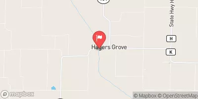 Salt River At Hagers Grove
|
1cfs |
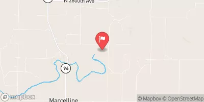 Bear Creek Near Marcelline
|
5cfs |
Dam Data Reference
Condition Assessment
SatisfactoryNo existing or potential dam safety deficiencies are recognized. Acceptable performance is expected under all loading conditions (static, hydrologic, seismic) in accordance with the minimum applicable state or federal regulatory criteria or tolerable risk guidelines.
Fair
No existing dam safety deficiencies are recognized for normal operating conditions. Rare or extreme hydrologic and/or seismic events may result in a dam safety deficiency. Risk may be in the range to take further action. Note: Rare or extreme event is defined by the regulatory agency based on their minimum
Poor A dam safety deficiency is recognized for normal operating conditions which may realistically occur. Remedial action is necessary. POOR may also be used when uncertainties exist as to critical analysis parameters which identify a potential dam safety deficiency. Investigations and studies are necessary.
Unsatisfactory
A dam safety deficiency is recognized that requires immediate or emergency remedial action for problem resolution.
Not Rated
The dam has not been inspected, is not under state or federal jurisdiction, or has been inspected but, for whatever reason, has not been rated.
Not Available
Dams for which the condition assessment is restricted to approved government users.
Hazard Potential Classification
HighDams assigned the high hazard potential classification are those where failure or mis-operation will probably cause loss of human life.
Significant
Dams assigned the significant hazard potential classification are those dams where failure or mis-operation results in no probable loss of human life but can cause economic loss, environment damage, disruption of lifeline facilities, or impact other concerns. Significant hazard potential classification dams are often located in predominantly rural or agricultural areas but could be in areas with population and significant infrastructure.
Low
Dams assigned the low hazard potential classification are those where failure or mis-operation results in no probable loss of human life and low economic and/or environmental losses. Losses are principally limited to the owner's property.
Undetermined
Dams for which a downstream hazard potential has not been designated or is not provided.
Not Available
Dams for which the downstream hazard potential is restricted to approved government users.
 Grassy Creek Watershed Dam G- 48