


Upper Lake Royer Reservoir Report
Last Updated: April 25, 2026
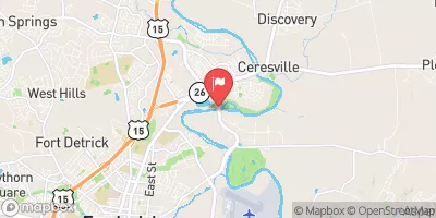
Nearby: Lower Lake Royer Wohelo Lake
°F
°F
mph
Wind
%
Humidity
Upper Lake Royer, located in Rouzerville, PA, is a historic earth dam built in 1898 by the US Navy DOD USA to serve as a water supply source for the local government of Washington County, Maryland.
Summary
With a height of 12 feet and a length of 550 feet, the dam has a storage capacity of 54 acre-feet and a surface area of 7 acres. It is primarily used for irrigation and water supply purposes, drawing water from Falls Creek-TR to meet the needs of the surrounding area.
Managed by the Maryland Dam Safety regulatory agency, Upper Lake Royer has undergone structural modifications in 1993 to ensure its continued functionality and safety. The dam is equipped with an uncontrolled spillway with a width of 35 feet and can discharge up to 350 cubic feet per second. Despite being classified as low hazard potential with a fair condition assessment, the dam is subject to regular inspections every 5 years to monitor its integrity and address any maintenance needs. In the event of an emergency, the dam's emergency action plan is expected to follow established guidelines to mitigate risks and ensure public safety.
Water resource and climate enthusiasts interested in the history and management of dams will find Upper Lake Royer a fascinating case study. Its strategic location, engineering design, and operational details offer valuable insights into the role of dams in providing essential water resources for communities while also highlighting the importance of regulatory oversight and risk management to ensure their long-term sustainability. With its moderate risk assessment and ongoing monitoring, Upper Lake Royer serves as a critical infrastructure for water supply and irrigation in the region, demonstrating the intersection of human ingenuity and environmental stewardship in managing water resources.
Regional Streamflow Levels

15-Day Long Term Forecast
Years Modified |
1993 - Structural |
Year Completed |
1898 |
Dam Length |
550 |
Dam Height |
12 |
River Or Stream |
Falls Creek-TR |
Primary Dam Type |
Earth |
Surface Area |
7 |
Drainage Area |
1.6 |
Nid Storage |
54 |
Outlet Gates |
Slide (sluice gate) - 0 |
Hazard Potential |
Low |
Foundations |
Rock, Soil |
Nid Height |
12 |
Seasonal Comparison
5-Day Hourly Forecast Detail
Dam Data Reference
Condition Assessment
SatisfactoryNo existing or potential dam safety deficiencies are recognized. Acceptable performance is expected under all loading conditions (static, hydrologic, seismic) in accordance with the minimum applicable state or federal regulatory criteria or tolerable risk guidelines.
Fair
No existing dam safety deficiencies are recognized for normal operating conditions. Rare or extreme hydrologic and/or seismic events may result in a dam safety deficiency. Risk may be in the range to take further action. Note: Rare or extreme event is defined by the regulatory agency based on their minimum
Poor A dam safety deficiency is recognized for normal operating conditions which may realistically occur. Remedial action is necessary. POOR may also be used when uncertainties exist as to critical analysis parameters which identify a potential dam safety deficiency. Investigations and studies are necessary.
Unsatisfactory
A dam safety deficiency is recognized that requires immediate or emergency remedial action for problem resolution.
Not Rated
The dam has not been inspected, is not under state or federal jurisdiction, or has been inspected but, for whatever reason, has not been rated.
Not Available
Dams for which the condition assessment is restricted to approved government users.
Hazard Potential Classification
HighDams assigned the high hazard potential classification are those where failure or mis-operation will probably cause loss of human life.
Significant
Dams assigned the significant hazard potential classification are those dams where failure or mis-operation results in no probable loss of human life but can cause economic loss, environment damage, disruption of lifeline facilities, or impact other concerns. Significant hazard potential classification dams are often located in predominantly rural or agricultural areas but could be in areas with population and significant infrastructure.
Low
Dams assigned the low hazard potential classification are those where failure or mis-operation results in no probable loss of human life and low economic and/or environmental losses. Losses are principally limited to the owner's property.
Undetermined
Dams for which a downstream hazard potential has not been designated or is not provided.
Not Available
Dams for which the downstream hazard potential is restricted to approved government users.
 Adirondack Shelters Camping Area
 Capital Camps & Retreat Center
 Owens Creek Campground
 Poplar Grove I Group Camping Area
 Owens Creek - Catoctin Mountain National Park
 Poplar Grove II Group Camping Area