


Sauer Lake Dam Reservoir Report
Last Updated: May 6, 2026
°F
°F
mph
Wind
%
Humidity
Sauer Lake Dam, located in East Farmington, Ohio, is a private Earth dam designed by William G.
Summary
Sauer in 1955 for recreational purposes. The dam stands at a height of 14 feet and stretches 280 feet in length, creating a reservoir with a storage capacity of 55.9 acre-feet. Despite its primary purpose for recreation, the dam also serves as a regulatory structure under the supervision of the Department of Natural Resources in Ohio.
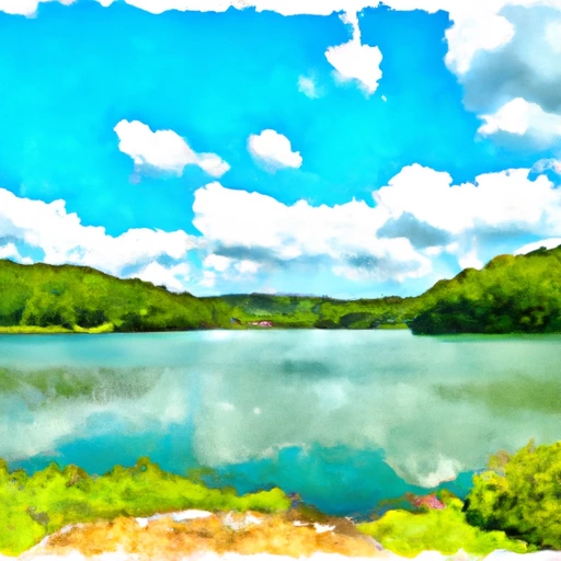
With a low hazard potential and poor condition assessment as of the last inspection in 2016, Sauer Lake Dam poses minimal risk to the surrounding area. Although its emergency action plan was last revised in 2020, there are no detailed risk assessments or management measures in place. Despite these challenges, the dam continues to offer a serene setting for water resource and climate enthusiasts to enjoy the beauty of Mud Run and its rich natural surroundings in Trumbull County, Ohio.
Regional Streamflow Levels
15-Day Long Term Forecast
Year Completed |
1955 |
Dam Length |
280 |
Dam Height |
14 |
River Or Stream |
MUD RUN |
Primary Dam Type |
Earth |
Surface Area |
6.2 |
Drainage Area |
1.26 |
Nid Storage |
55.9 |
Hazard Potential |
Low |
Nid Height |
14 |
Seasonal Comparison
5-Day Hourly Forecast Detail
Dam Data Reference
Condition Assessment
SatisfactoryNo existing or potential dam safety deficiencies are recognized. Acceptable performance is expected under all loading conditions (static, hydrologic, seismic) in accordance with the minimum applicable state or federal regulatory criteria or tolerable risk guidelines.
Fair
No existing dam safety deficiencies are recognized for normal operating conditions. Rare or extreme hydrologic and/or seismic events may result in a dam safety deficiency. Risk may be in the range to take further action. Note: Rare or extreme event is defined by the regulatory agency based on their minimum
Poor A dam safety deficiency is recognized for normal operating conditions which may realistically occur. Remedial action is necessary. POOR may also be used when uncertainties exist as to critical analysis parameters which identify a potential dam safety deficiency. Investigations and studies are necessary.
Unsatisfactory
A dam safety deficiency is recognized that requires immediate or emergency remedial action for problem resolution.
Not Rated
The dam has not been inspected, is not under state or federal jurisdiction, or has been inspected but, for whatever reason, has not been rated.
Not Available
Dams for which the condition assessment is restricted to approved government users.
Hazard Potential Classification
HighDams assigned the high hazard potential classification are those where failure or mis-operation will probably cause loss of human life.
Significant
Dams assigned the significant hazard potential classification are those dams where failure or mis-operation results in no probable loss of human life but can cause economic loss, environment damage, disruption of lifeline facilities, or impact other concerns. Significant hazard potential classification dams are often located in predominantly rural or agricultural areas but could be in areas with population and significant infrastructure.
Low
Dams assigned the low hazard potential classification are those where failure or mis-operation results in no probable loss of human life and low economic and/or environmental losses. Losses are principally limited to the owner's property.
Undetermined
Dams for which a downstream hazard potential has not been designated or is not provided.
Not Available
Dams for which the downstream hazard potential is restricted to approved government users.
Area Campgrounds
| Location | Reservations | Toilets |
|---|---|---|
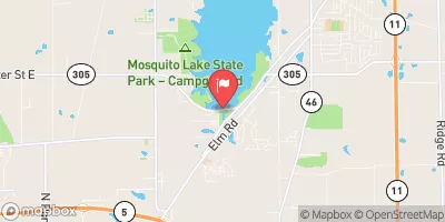
 Mosquito Lake State Park
|
||
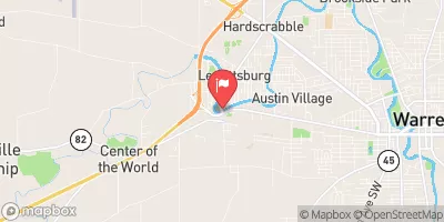
 Kool Lakes Family Campground
|
||
 Camp Asbury
|
||
 Headwaters Park Camping
|
||
 West Branch State Park
|
||
 Punderson State Park
|
 Lake Arthur At Moraine State Park
 Eldon Russell Park
 Dam At Peninsula To End Of Canal Near Confluence With Chippewa Creek
 Aurora Pond
 Deer Creek Reservoir
 East 72nd Street Fishing Area