
Upper Big Nemaha G-2 Reservoir Report
Last Updated: December 6, 2025
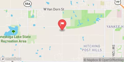
Upper Big Nemaha G-2 is a vital water resource structure located in Gage, Nebraska, designed by the USDA NRCS and completed in 1978.
°F
°F
mph
Wind
%
Humidity
Summary
This earth dam stands at a height of 27 feet, with a structural height of 29 feet and a length of 669 feet. It serves multiple purposes, including flood risk reduction and other water management activities, with a storage capacity of 185 acre-feet and a drainage area of 0.9 square miles.
Managed by the local government and regulated by the Nebraska Department of Natural Resources, Upper Big Nemaha G-2 has a low hazard potential and is assessed to be in fair condition as of the last inspection in June 2020. With a maximum discharge capacity of 455 cubic feet per second, this structure plays a crucial role in the management of TR-Hooker Creek and the surrounding areas. Climate and water resource enthusiasts will find this data-rich summary of Upper Big Nemaha G-2 to be a valuable insight into the infrastructure supporting water management efforts in Nebraska.
This water resource structure, under the jurisdiction of the Nebraska DNR, showcases the collaboration between federal agencies like the Natural Resources Conservation Service and local governments to ensure effective water management in the region. With a focus on safety and efficient operations, Upper Big Nemaha G-2 stands as a testament to the importance of sustainable water resource infrastructure in mitigating flood risks and maintaining water quality. Enthusiasts interested in the intersection of water resources and climate resilience will find the details of this dam's design, purpose, and condition to be both informative and engaging.
Year Completed |
1978 |
Dam Length |
669 |
Dam Height |
27 |
River Or Stream |
TR-HOOKER CREEK |
Primary Dam Type |
Earth |
Surface Area |
10 |
Hydraulic Height |
27 |
Drainage Area |
0.9 |
Nid Storage |
185 |
Structural Height |
29 |
Hazard Potential |
Low |
Foundations |
Soil |
Nid Height |
29 |
Seasonal Comparison
Weather Forecast
Nearby Streamflow Levels

Dam Data Reference
Condition Assessment
SatisfactoryNo existing or potential dam safety deficiencies are recognized. Acceptable performance is expected under all loading conditions (static, hydrologic, seismic) in accordance with the minimum applicable state or federal regulatory criteria or tolerable risk guidelines.
Fair
No existing dam safety deficiencies are recognized for normal operating conditions. Rare or extreme hydrologic and/or seismic events may result in a dam safety deficiency. Risk may be in the range to take further action. Note: Rare or extreme event is defined by the regulatory agency based on their minimum
Poor A dam safety deficiency is recognized for normal operating conditions which may realistically occur. Remedial action is necessary. POOR may also be used when uncertainties exist as to critical analysis parameters which identify a potential dam safety deficiency. Investigations and studies are necessary.
Unsatisfactory
A dam safety deficiency is recognized that requires immediate or emergency remedial action for problem resolution.
Not Rated
The dam has not been inspected, is not under state or federal jurisdiction, or has been inspected but, for whatever reason, has not been rated.
Not Available
Dams for which the condition assessment is restricted to approved government users.
Hazard Potential Classification
HighDams assigned the high hazard potential classification are those where failure or mis-operation will probably cause loss of human life.
Significant
Dams assigned the significant hazard potential classification are those dams where failure or mis-operation results in no probable loss of human life but can cause economic loss, environment damage, disruption of lifeline facilities, or impact other concerns. Significant hazard potential classification dams are often located in predominantly rural or agricultural areas but could be in areas with population and significant infrastructure.
Low
Dams assigned the low hazard potential classification are those where failure or mis-operation results in no probable loss of human life and low economic and/or environmental losses. Losses are principally limited to the owner's property.
Undetermined
Dams for which a downstream hazard potential has not been designated or is not provided.
Not Available
Dams for which the downstream hazard potential is restricted to approved government users.
 Upper Big Nemaha G-2