


Ratliff Pond Dam Reservoir Report
Last Updated: May 3, 2026
Nearby: Harrington Pond Crawford Lake Dam
°F
°F
mph
Wind
%
Humidity
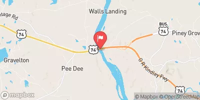
Ratliff Pond Dam, located in Anson, North Carolina, is a privately-owned structure built in 1993 with a primary purpose of serving as a Fish and Wildlife Pond.
Summary
Designed by the USDA NRCS, this Earth-type dam stands at a structural height of 22 feet and has a hydraulic height of 18 feet. With a storage capacity of 188 acre-feet and a surface area of 18 acres, Ratliff Pond Dam plays a crucial role in managing the water resources of the Cedar Creek - Tr watershed.
Despite being classified as having a low hazard potential, the dam's condition has not been recently assessed as it was last inspected in March 2013. The dam's emergency action plan status and risk assessment are also not clearly defined. However, with the dam being uncontrolled in terms of spillway type and outlet gates, there may be room for improvement in terms of risk management measures and emergency preparedness. As water resource and climate enthusiasts, it is important to stay informed about the state of infrastructure like Ratliff Pond Dam to ensure the safety and sustainability of our local water systems.
Regional Streamflow Levels
 Pee Dee R Nr Rockingham
|
1880cfs |
 Black Creek Near Mcbee
|
49cfs |
 Rocky River Near Norwood
|
144cfs |
 Pee Dee River Nr Bennettsville
|
2120cfs |
 Black Creek Near Hartsville
|
69cfs |
 Rocky River Nr Stanfield
|
173cfs |
15-Day Long Term Forecast
Year Completed |
1993 |
Dam Length |
575 |
River Or Stream |
Cedar Creek - Tr |
Primary Dam Type |
Earth |
Surface Area |
18 |
Hydraulic Height |
18 |
Drainage Area |
873 |
Nid Storage |
188 |
Structural Height |
22 |
Outlet Gates |
Uncontrolled |
Hazard Potential |
Low |
Foundations |
Soil |
Nid Height |
22 |
Seasonal Comparison
5-Day Hourly Forecast Detail
Dam Data Reference
Condition Assessment
SatisfactoryNo existing or potential dam safety deficiencies are recognized. Acceptable performance is expected under all loading conditions (static, hydrologic, seismic) in accordance with the minimum applicable state or federal regulatory criteria or tolerable risk guidelines.
Fair
No existing dam safety deficiencies are recognized for normal operating conditions. Rare or extreme hydrologic and/or seismic events may result in a dam safety deficiency. Risk may be in the range to take further action. Note: Rare or extreme event is defined by the regulatory agency based on their minimum
Poor A dam safety deficiency is recognized for normal operating conditions which may realistically occur. Remedial action is necessary. POOR may also be used when uncertainties exist as to critical analysis parameters which identify a potential dam safety deficiency. Investigations and studies are necessary.
Unsatisfactory
A dam safety deficiency is recognized that requires immediate or emergency remedial action for problem resolution.
Not Rated
The dam has not been inspected, is not under state or federal jurisdiction, or has been inspected but, for whatever reason, has not been rated.
Not Available
Dams for which the condition assessment is restricted to approved government users.
Hazard Potential Classification
HighDams assigned the high hazard potential classification are those where failure or mis-operation will probably cause loss of human life.
Significant
Dams assigned the significant hazard potential classification are those dams where failure or mis-operation results in no probable loss of human life but can cause economic loss, environment damage, disruption of lifeline facilities, or impact other concerns. Significant hazard potential classification dams are often located in predominantly rural or agricultural areas but could be in areas with population and significant infrastructure.
Low
Dams assigned the low hazard potential classification are those where failure or mis-operation results in no probable loss of human life and low economic and/or environmental losses. Losses are principally limited to the owner's property.
Undetermined
Dams for which a downstream hazard potential has not been designated or is not provided.
Not Available
Dams for which the downstream hazard potential is restricted to approved government users.
Area Campgrounds
| Location | Reservations | Toilets |
|---|---|---|
 Sugarloaf Mountain Rec Area - Sand Hills State Forest
|
||
 Cheraw State Park
|
||
 Williams Farm
|
||
 H. Cooper Black
|
 Headwaters South Of High Point And Guilford County Line To Confluence With Pee Dee River
 Headwaters 1 Mile Above Montgomery County Line To Confluence With Uwharrie River
 Blewett Falls Lake Grassy Island
 Baldwins Pond
 Buck Branch
 Broadacres Lake
 Broadacres Lakes