


Tiefenthaler Lake Dam Reservoir Report
Last Updated: May 3, 2026
Nearby: Echo Lake Dam #2 Lake Joy Dam
°F
°F
mph
Wind
%
Humidity
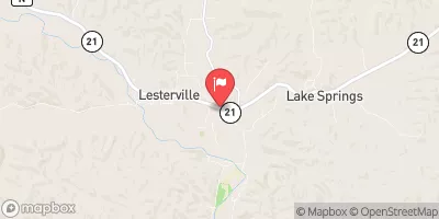
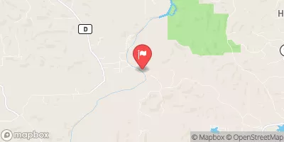
Tiefenthaler Lake Dam, located in Salem, Dent County, Missouri, is a private-owned structure designed by Robert Nagler and completed in 1978 for recreational purposes.
Summary
The dam, standing at a height of 39 feet and stretching 715 feet in length, holds a maximum storage capacity of 546 acre-feet with a surface area of 41 acres. Its primary source agency is the state of Missouri, and it is regulated, permitted, inspected, and enforced by the Dam and Reservoir Safety Program. The dam poses a high hazard potential but is currently in satisfactory condition as of the last assessment in 2007.
Situated on Hamilton Hollow Crooked Creek, Tiefenthaler Lake Dam serves as a vital water resource for the surrounding area, draining a watershed area of 794 acres and capable of discharging a maximum of 1803 cubic feet per second. The spillway, with a width of 50 feet, is uncontrolled and serves as a safety measure in times of excess water flow. The dam's risk assessment is moderate, with no specific risk management measures or assigned risk summary available at this time.
For water resource and climate enthusiasts, Tiefenthaler Lake Dam presents a fascinating case study in dam infrastructure management and safety protocols. Its combination of recreational use, high hazard potential, and state regulation offers a unique perspective on the intersection of human activity and natural resource conservation. As we continue to navigate the challenges of climate change and water scarcity, understanding the intricacies of dams like Tiefenthaler Lake Dam becomes increasingly important for ensuring the safety and sustainability of our water resources.
Regional Streamflow Levels
 Meramec River At Cook Station
|
110cfs |
 Meramec River Near Steelville
|
816cfs |
 Current River Above Akers
|
562cfs |
 East Fork Black River Nr Lesterville
|
32cfs |
 East Fork Black River At Lesterville
|
44cfs |
 Meramec River Near Sullivan
|
1770cfs |
15-Day Long Term Forecast
Year Completed |
1978 |
Dam Length |
715 |
Dam Height |
39 |
River Or Stream |
HAMILTON HOLLOW CROOKED CREEK |
Surface Area |
41 |
Drainage Area |
794 |
Nid Storage |
546 |
Structural Height |
39 |
Outlet Gates |
None |
Hazard Potential |
High |
Foundations |
Rock |
Nid Height |
39 |
Seasonal Comparison
5-Day Hourly Forecast Detail
Dam Data Reference
Condition Assessment
SatisfactoryNo existing or potential dam safety deficiencies are recognized. Acceptable performance is expected under all loading conditions (static, hydrologic, seismic) in accordance with the minimum applicable state or federal regulatory criteria or tolerable risk guidelines.
Fair
No existing dam safety deficiencies are recognized for normal operating conditions. Rare or extreme hydrologic and/or seismic events may result in a dam safety deficiency. Risk may be in the range to take further action. Note: Rare or extreme event is defined by the regulatory agency based on their minimum
Poor A dam safety deficiency is recognized for normal operating conditions which may realistically occur. Remedial action is necessary. POOR may also be used when uncertainties exist as to critical analysis parameters which identify a potential dam safety deficiency. Investigations and studies are necessary.
Unsatisfactory
A dam safety deficiency is recognized that requires immediate or emergency remedial action for problem resolution.
Not Rated
The dam has not been inspected, is not under state or federal jurisdiction, or has been inspected but, for whatever reason, has not been rated.
Not Available
Dams for which the condition assessment is restricted to approved government users.
Hazard Potential Classification
HighDams assigned the high hazard potential classification are those where failure or mis-operation will probably cause loss of human life.
Significant
Dams assigned the significant hazard potential classification are those dams where failure or mis-operation results in no probable loss of human life but can cause economic loss, environment damage, disruption of lifeline facilities, or impact other concerns. Significant hazard potential classification dams are often located in predominantly rural or agricultural areas but could be in areas with population and significant infrastructure.
Low
Dams assigned the low hazard potential classification are those where failure or mis-operation results in no probable loss of human life and low economic and/or environmental losses. Losses are principally limited to the owner's property.
Undetermined
Dams for which a downstream hazard potential has not been designated or is not provided.
Not Available
Dams for which the downstream hazard potential is restricted to approved government users.
Area Campgrounds
| Location | Reservations | Toilets |
|---|---|---|
 Red Bluff
|
||
 Little Scotia Dispersed
|
||
 Ozark Trail Gunstock Hollow
|
||
 Hazel Creek
|
||
 Hazel Creek Campground
|
||
 Council Bluff Recreation Area
|
 Clearwater Lake Near Piedmont
 Council Bluff Lake Trail Washington County
River Runs
-
 State Highway 49 Bridge Near Dillard, Missouri To Forest Boundary In Sections 13/24, T38N, R3W
-
 Confluence With Alley Spring (Branch) To Confluence With Current River (Does Not Include River Segment In Gap Between Parkland Units)
-
 Missouri State Highway 17 To Fort Leonard Wood (Army Base)
-
 Northern Boundary Of Fort Leonard Wood To North Section Line Of Sec 31, T36N, R10W
-
 Western Edge Of Ozark National Scenic Riverways To Confluence With Alley Spring (Branch)
-
 Forest Boundary At North Section Line Of Sec 4, T33N, R5E To Forest Boundary At South Section Line Of Sec 35, T32N, R5E
 Timberline Lake
 Parole Lake
 Howell Lake
 Crane Lake Recreation Area