
Caney Basin Dam Reservoir Report
Nearby: Eftink Lake Dam Oran 25 Club Dam
Last Updated: December 8, 2025
Caney Basin Dam, located in Scott County, Missouri, is a vital structure designed for flood risk reduction along Caney Creek.
°F
°F
mph
Wind
%
Humidity
Summary
Completed in 1910, this earth dam stands at a height of 47 feet and stretches 1150 feet in length. With a storage capacity of 51,100 acre-feet and a normal storage of 30,375 acre-feet, the dam plays a crucial role in managing water resources in the region.
The dam's spillway, with a width of 110 feet, is uncontrolled, and the structure is regulated by the DAM AND RESERVOIR SAFETY PROG, ensuring that it meets inspection and enforcement requirements. Despite being classified as having a high hazard potential, the dam is currently assessed as satisfactory, with a moderate risk level. The last inspection in 2015 found the structure to be in good condition, with regular inspections scheduled every three years to maintain its integrity.
Caney Basin Dam's historical significance, combined with its impact on water management and flood control in the area, makes it a crucial asset for environmental enthusiasts and climate advocates. Its presence not only safeguards the surrounding communities from flooding risks but also contributes to the overall resilience of the region against natural disasters.
Year Completed |
1910 |
Dam Length |
1150 |
Dam Height |
47 |
River Or Stream |
CANEY CREEK |
Primary Dam Type |
Earth |
Surface Area |
1939 |
Drainage Area |
20176 |
Nid Storage |
51100 |
Structural Height |
47 |
Outlet Gates |
None |
Hazard Potential |
High |
Foundations |
Rock |
Nid Height |
47 |
Seasonal Comparison
Weather Forecast
Nearby Streamflow Levels
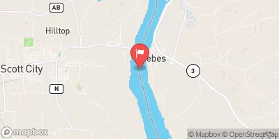 Mississippi River At Thebes
|
94900cfs |
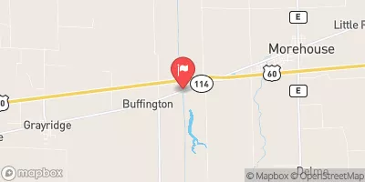 Little River Ditch No. 1 Near Morehouse
|
129cfs |
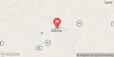 Castor River At Zalma
|
253cfs |
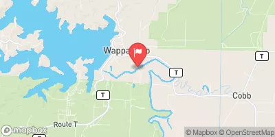 St. Francis River At Wappapello
|
685cfs |
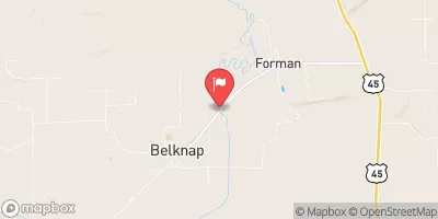 Cache River At Forman
|
20cfs |
 South Fork Saline Creek Near Perryville
|
10cfs |
Dam Data Reference
Condition Assessment
SatisfactoryNo existing or potential dam safety deficiencies are recognized. Acceptable performance is expected under all loading conditions (static, hydrologic, seismic) in accordance with the minimum applicable state or federal regulatory criteria or tolerable risk guidelines.
Fair
No existing dam safety deficiencies are recognized for normal operating conditions. Rare or extreme hydrologic and/or seismic events may result in a dam safety deficiency. Risk may be in the range to take further action. Note: Rare or extreme event is defined by the regulatory agency based on their minimum
Poor A dam safety deficiency is recognized for normal operating conditions which may realistically occur. Remedial action is necessary. POOR may also be used when uncertainties exist as to critical analysis parameters which identify a potential dam safety deficiency. Investigations and studies are necessary.
Unsatisfactory
A dam safety deficiency is recognized that requires immediate or emergency remedial action for problem resolution.
Not Rated
The dam has not been inspected, is not under state or federal jurisdiction, or has been inspected but, for whatever reason, has not been rated.
Not Available
Dams for which the condition assessment is restricted to approved government users.
Hazard Potential Classification
HighDams assigned the high hazard potential classification are those where failure or mis-operation will probably cause loss of human life.
Significant
Dams assigned the significant hazard potential classification are those dams where failure or mis-operation results in no probable loss of human life but can cause economic loss, environment damage, disruption of lifeline facilities, or impact other concerns. Significant hazard potential classification dams are often located in predominantly rural or agricultural areas but could be in areas with population and significant infrastructure.
Low
Dams assigned the low hazard potential classification are those where failure or mis-operation results in no probable loss of human life and low economic and/or environmental losses. Losses are principally limited to the owner's property.
Undetermined
Dams for which a downstream hazard potential has not been designated or is not provided.
Not Available
Dams for which the downstream hazard potential is restricted to approved government users.
 Caney Basin Dam