
Jackson Mill Dam Reservoir Report
Nearby: Weston Dam Polk Creek No.9
Last Updated: December 26, 2025
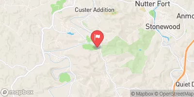
Jackson Mill Dam, located in Lewis County, West Virginia, is a state-regulated structure with a primary purpose of water supply.
°F
°F
mph
Wind
%
Humidity
Summary
Built in 1960, this earth-type dam stands at a height of 29 feet and has a hydraulic height of 26 feet, with a capacity for storing 29 acre-feet of water. The dam is situated on the TR West Fork river and serves the city of Jackson Mill.
Despite its significant hazard potential, the dam's condition assessment is rated as poor, with the last inspection conducted in April 2015. With a history of state regulation, permitting, and inspection, the dam has faced challenges in maintaining its structural integrity. As water resource and climate enthusiasts, a closer examination of the condition and risk management measures of Jackson Mill Dam could offer valuable insights into the importance of maintaining and safeguarding our water infrastructure in the face of changing environmental conditions.
Year Completed |
1960 |
Dam Length |
157 |
Dam Height |
29 |
River Or Stream |
TR WEST FORK |
Primary Dam Type |
Earth |
Surface Area |
2 |
Hydraulic Height |
26 |
Nid Storage |
29 |
Hazard Potential |
Significant |
Nid Height |
29 |
Seasonal Comparison
Weather Forecast
Nearby Streamflow Levels
 W.F. River At Butcherville
|
132cfs |
 West Fork R Bl Stonewall Jackson Dam Nr Weston
|
107cfs |
 West Fork River Near Mount Clare
|
271cfs |
 Sand Run Near Buckhannon
|
11cfs |
 Buckhannon River At Hall
|
594cfs |
 Middle Fork River At Audra
|
347cfs |
Dam Data Reference
Condition Assessment
SatisfactoryNo existing or potential dam safety deficiencies are recognized. Acceptable performance is expected under all loading conditions (static, hydrologic, seismic) in accordance with the minimum applicable state or federal regulatory criteria or tolerable risk guidelines.
Fair
No existing dam safety deficiencies are recognized for normal operating conditions. Rare or extreme hydrologic and/or seismic events may result in a dam safety deficiency. Risk may be in the range to take further action. Note: Rare or extreme event is defined by the regulatory agency based on their minimum
Poor A dam safety deficiency is recognized for normal operating conditions which may realistically occur. Remedial action is necessary. POOR may also be used when uncertainties exist as to critical analysis parameters which identify a potential dam safety deficiency. Investigations and studies are necessary.
Unsatisfactory
A dam safety deficiency is recognized that requires immediate or emergency remedial action for problem resolution.
Not Rated
The dam has not been inspected, is not under state or federal jurisdiction, or has been inspected but, for whatever reason, has not been rated.
Not Available
Dams for which the condition assessment is restricted to approved government users.
Hazard Potential Classification
HighDams assigned the high hazard potential classification are those where failure or mis-operation will probably cause loss of human life.
Significant
Dams assigned the significant hazard potential classification are those dams where failure or mis-operation results in no probable loss of human life but can cause economic loss, environment damage, disruption of lifeline facilities, or impact other concerns. Significant hazard potential classification dams are often located in predominantly rural or agricultural areas but could be in areas with population and significant infrastructure.
Low
Dams assigned the low hazard potential classification are those where failure or mis-operation results in no probable loss of human life and low economic and/or environmental losses. Losses are principally limited to the owner's property.
Undetermined
Dams for which a downstream hazard potential has not been designated or is not provided.
Not Available
Dams for which the downstream hazard potential is restricted to approved government users.
 Jackson Mill Dam