Grand-Rapids

Climate Recreation Community Catastrophe

Grand-Rapids
Eden Index

Climate 7.4 Recreation 4.6 Community 2.2 Safeguard

5.1/10

Located in western Michigan, Grand Rapids experiences a humid continental climate with warm summers and cold winters. 
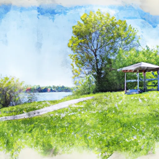
The city is bordered by the Grand River, which provides opportunities for recreational activities such as fishing, kayaking, and boating. The river is also a source of drinking water for the city, and hydrology constituents are closely monitored to ensure water quality. There are numerous parks and nature preserves in the area, including Millennium Park and the Frederik Meijer Gardens and Sculpture Park, offering hiking and biking trails, as well as outdoor concerts and events. Grand Rapids is also home to several ski resorts and golf courses, providing year-round outdoor recreation opportunities.

What is the Eden Index?

The Snoflo Eden Index serves as a comprehensive rating system for regions, evaluating their desirability through a holistic assessment of climate health, outdoor recreation opportunities, and natural disaster risk, acknowledging the profound impact of these factors on livability and well-being.


Climate Health Indicator (CHI): 7.4


Grand-Rapids receives approximately 950mm of rain per year, with humidity levels near 82% and air temperatures averaging around 9°C. Grand-Rapids has a plant hardyness factor of 6, meaning plants and agriculture in this region thrive during a short period during spring and early summer. Most plants will die off during the colder winter months. By considering the ideal temperature range, reliable water supplies, clean air, and stable seasonal rain or snowpacks, the Climate Health Indicator (CHI) underscores the significance of a healthy climate as the foundation for quality living.

A healthy climate is paramount for ensuring a high quality of life and livability in a region, fostering both physical well-being and environmental harmony. This can be characterized by ideal temperatures, reliable access to water supplies, clean air, and consistent seasonal rain or snowpacks.


Weather Forecast


Streamflow Conditions

Southeastern Lake Michigan

Area Rivers

Southeastern Lake Michigan


Snowpack Depths

Southeastern Lake Michigan


Reservoir Storage Capacity

Southeastern Lake Michigan


Groundwater Levels


Recreational Opportunity Index (ROI): 4.6


The Recreational Opportunity Index (ROI) recognizes the value of outdoor recreational options, such as parks, hiking trails, camping sites, and fishing spots, while acknowledging that climate plays a pivotal role in ensuring the comfort and consistency of these experiences. Access to outdoor recreational opportunities, encompassing activities such as parks, hiking, camping, and fishing, is crucial for overall well-being, and the climate plays a pivotal role in enabling and enhancing these experiences, ensuring that individuals can engage in nature-based activities comfortably and consistently.


Camping Areas

Campground Campsites Reservations Toilets Showers Elevation
Mitchell State Park 200 1,296 ft
Silver Creek - State Forest 26 942 ft
Bill Wagner Memorial Park 22 595 ft
Hungerford Lake 6 1,116 ft
Peterson Bridge 26 820 ft
Bray Creek - State Forest 9 853 ft
Pike Lake County Campground None 810 ft
Schecks Place Trail Camp - State Forest 0 824 ft
St. James Township 12 607 ft
Deep Lake - Yankee Springs State Rec Area 120 877 ft
Big Bend Park 230 852 ft
Leverentz Lake - State Forest 25 847 ft
Ravine 7 1,102 ft
Croton Township Park None 679 ft
Traverse City State Park 340 589 ft
Wabash City RV Park None 661 ft
Rambadt City Park None 1,039 ft
Carrieville - State Forest 25 956 ft
Schecks Place - State Forest 30 822 ft
Ed H. Henning Park 60 700 ft
Pettibone Lake None 897 ft
Arbutus No. 4 - State Forest 36 817 ft
Mt. Etna State Rec Area None 819 ft
Salamonie State Lake - Lost Bridge West SRA 250 794 ft
Kosciusko County Fairgrounds 40 821 ft
Newaygo State Park 100 864 ft
Oxbow Park 200 826 ft
Indian Lake 7 966 ft
Nottawa Park 20 831 ft
LeeIanau State Park 50 599 ft
Brower County Park None 836 ft
Markin Glen County Park 38 780 ft
Lincoln Bridge - State Forest 9 924 ft
Beaver Island - State Forest 25 593 ft
Lake Clare Park Camp 18 746 ft
Brookside City Park 12 705 ft
Lake Dubonnet Trail Camp - State Forest 50 864 ft
Diamond Lake Co Park 60 953 ft
Lost Bridge State Rec Area - Salamonie Lake None 794 ft
Seaton Creek 47 872 ft
Gun Lake - Yankee Springs State Rec Area 200 743 ft
Elkhart County Fairgrounds 222 803 ft
Old Grade 20 874 ft
Utley Lake 9 808 ft

Catastrophe Safeguard Index (CSI):


The Catastrophe Safeguard Index (CSI) recognizes that natural disaster risk, encompassing floods, fires, hurricanes, and tornadoes, can drastically affect safety and the overall appeal of an area. The level of natural disaster risk in a region significantly affects safety and the overall livability, with climate change amplifying these risks by potentially increasing the frequency and intensity of events like floods, fires, hurricanes, and tornadoes, thereby posing substantial challenges to community resilience and well-being.


Community Resilience Indicator (CRI): 2.2


The Community Resilience Indicator (CRI) recognizes that education, healthcare, and socioeconomics are crucial to the well-being of a region. The CRI acknowledges the profound impact of these elements on residents' overall quality of life. By evaluating educational resources, healthcare accessibility, and economic inclusivity, the index captures the essential aspects that contribute to a thriving community, fostering resident satisfaction, equity, and social cohesion.


Log Your Visit

When was your last visit to ?

Add a Photo

How was it? How were conditions?

Rate the


Submit

Leave A Review


Submit

Upload an Image


Favorite Limit Reached