Norcross

Climate Recreation Community Catastrophe

Norcross
Eden Index

Climate 7.8 Recreation 6.3 Community 4.1 Safeguard

6.3/10

Norcross, Georgia is located in Gwinnett County, in the Atlanta metropolitan area. The city experiences a humid subtropical climate characterized by hot, humid summers and mild winters. Average temperatures range from the 40s (°F) in winter to the 90s in summer. Norcross receives around 50 inches of precipitation annually.

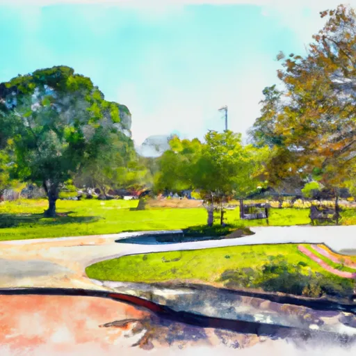
The city is surrounded by several water bodies, including the Chattahoochee River and numerous lakes. These hydrological constituents provide opportunities for various outdoor recreational activities such as fishing, boating, and kayaking. The nearby Chattahoochee River National Recreation Area offers hiking trails, picnic spots, and camping sites. Moreover, residents and visitors can enjoy numerous parks within Norcross that offer amenities such as sports fields, playgrounds, and walking trails, making it an ideal location for outdoor enthusiasts.

What is the Eden Index?

The Snoflo Eden Index serves as a comprehensive rating system for regions, evaluating their desirability through a holistic assessment of climate health, outdoor recreation opportunities, and natural disaster risk, acknowledging the profound impact of these factors on livability and well-being.


Climate Health Indicator (CHI): 7.8


Norcross receives approximately 1346mm of rain per year, with humidity levels near 86% and air temperatures averaging around 16°C. Norcross has a plant hardyness factor of 7, meaning plants and agriculture in this region tend to thrive during the non-winter months. By considering the ideal temperature range, reliable water supplies, clean air, and stable seasonal rain or snowpacks, the Climate Health Indicator (CHI) underscores the significance of a healthy climate as the foundation for quality living.

A healthy climate is paramount for ensuring a high quality of life and livability in a region, fostering both physical well-being and environmental harmony. This can be characterized by ideal temperatures, reliable access to water supplies, clean air, and consistent seasonal rain or snowpacks.


Weather Forecast


Streamflow Conditions

Altamaha

Area Rivers

Altamaha


Snowpack Depths

Altamaha


Reservoir Storage Capacity

Altamaha


Groundwater Levels


Recreational Opportunity Index (ROI): 6.3


The Recreational Opportunity Index (ROI) recognizes the value of outdoor recreational options, such as parks, hiking trails, camping sites, and fishing spots, while acknowledging that climate plays a pivotal role in ensuring the comfort and consistency of these experiences. Access to outdoor recreational opportunities, encompassing activities such as parks, hiking, camping, and fishing, is crucial for overall well-being, and the climate plays a pivotal role in enabling and enhancing these experiences, ensuring that individuals can engage in nature-based activities comfortably and consistently.


Camping Areas

Campground Campsites Reservations Toilets Showers Elevation
Frank Gross 9 2,356 ft
Andersonville City Campground 25 350 ft
Double Camp/Citgo Creek 50 1,486 ft
Yarberry Peninsula None 841 ft
Lotterdale Cove None 881 ft
Charleston - Lake Lanier None 1,185 ft
Spivey Cove 17 2,009 ft
North River Composite 31 1,970 ft
Deep Hole 18 1,993 ft
Sawnee None 1,070 ft
Poland Creek 35 861 ft
Poteete Creek None 1,832 ft
Shoal Creek - Lake Lanier None 1,117 ft
Morganton Point 82 1,753 ft
Hanging Dog 49 1,668 ft
Cooper Creek 17 2,164 ft
Indian Boundary Rec Area 191 1,813 ft
Amicalola Falls State Park None 1,779 ft
Shady Grove - Lake Lanier None 1,113 ft
High Falls State Park None 600 ft
Dam Creek 10 1,880 ft
Notchy Creek - Tellico Lake None 844 ft
Holly Flats 17 1,935 ft
State Line 10 2,602 ft
Jake Best 7 1,195 ft
Toqua Beach - Tellico Lake 76 823 ft
Big Oak Cove 12 2,585 ft
Davis Branch 5 2,281 ft
Bald Ridge Creek None 1,097 ft
Mulky 11 2,172 ft
Stone Mountain Park Campground 430 1,558 ft
Whitewater Creek County Park 48 293 ft

Catastrophe Safeguard Index (CSI):


The Catastrophe Safeguard Index (CSI) recognizes that natural disaster risk, encompassing floods, fires, hurricanes, and tornadoes, can drastically affect safety and the overall appeal of an area. The level of natural disaster risk in a region significantly affects safety and the overall livability, with climate change amplifying these risks by potentially increasing the frequency and intensity of events like floods, fires, hurricanes, and tornadoes, thereby posing substantial challenges to community resilience and well-being.


Community Resilience Indicator (CRI): 4.1


The Community Resilience Indicator (CRI) recognizes that education, healthcare, and socioeconomics are crucial to the well-being of a region. The CRI acknowledges the profound impact of these elements on residents' overall quality of life. By evaluating educational resources, healthcare accessibility, and economic inclusivity, the index captures the essential aspects that contribute to a thriving community, fostering resident satisfaction, equity, and social cohesion.


Log Your Visit

When was your last visit to ?

Add a Photo

How was it? How were conditions?

Rate the


Submit

Leave A Review


Submit

Upload an Image


Favorite Limit Reached