Saint-Charles

Climate Recreation Community Catastrophe

Saint-Charles
Eden Index

Climate 8.3 Recreation 3.7 Community 3.3 Safeguard

5.4/10

Located in St. Charles County, Missouri, Saint Charles is a vibrant city with a population of around 70,000 people. The city experiences a humid continental climate with hot summers and cold winters. Summers are typically warm and humid, with temperatures averaging in the high 80s Fahrenheit. Winters are cold, with temperatures dipping below freezing, and occasional snowfall.

The city is bordered by two major water bodies, the Missouri River to the north and the Mississippi River to the east. These rivers not only enhance the scenic beauty of Saint Charles but also provide various hydrology constituents. The rivers support a diverse ecosystem, and fishing enthusiasts can catch species like catfish, bass, and crappie.

Outdoor recreation opportunities in Saint Charles are abundant. The city is home to numerous parks and trails, such as Frontier Park and Katy Trail State Park, offering opportunities for hiking, biking, and picnicking. The Missouri River provides a perfect setting for boating, kayaking, and canoeing. Additionally, the nearby Klondike Park offers camping and fishing facilities, making it an ideal spot for nature lovers.

Overall, Saint Charles, Missouri, offers a pleasant climate, access to two major rivers, and a range of outdoor activities, making it an attractive destination for both residents and visitors.

What is the Eden Index?

The Snoflo Eden Index serves as a comprehensive rating system for regions, evaluating their desirability through a holistic assessment of climate health, outdoor recreation opportunities, and natural disaster risk, acknowledging the profound impact of these factors on livability and well-being.


Climate Health Indicator (CHI): 8.3


Saint-Charles receives approximately 1031mm of rain per year, with humidity levels near 82% and air temperatures averaging around 13°C. Saint-Charles has a plant hardyness factor of 6, meaning plants and agriculture in this region thrive during a short period during spring and early summer. Most plants will die off during the colder winter months.
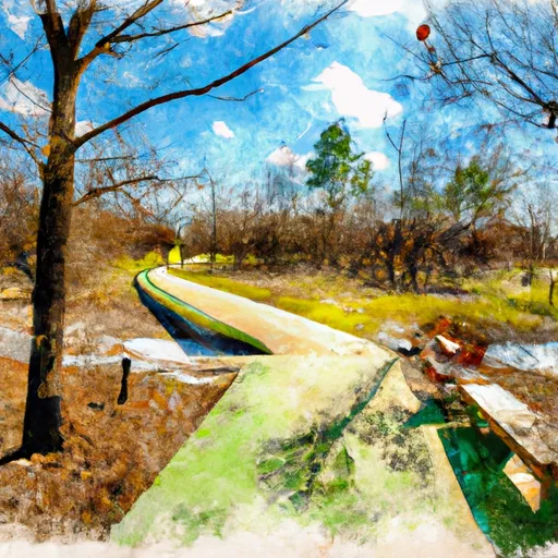
 By considering the ideal temperature range, reliable water supplies, clean air, and stable seasonal rain or snowpacks, the Climate Health Indicator (CHI) underscores the significance of a healthy climate as the foundation for quality living.

A healthy climate is paramount for ensuring a high quality of life and livability in a region, fostering both physical well-being and environmental harmony. This can be characterized by ideal temperatures, reliable access to water supplies, clean air, and consistent seasonal rain or snowpacks.


Weather Forecast


Streamflow Conditions

Upper Mississippi-Salt

Area Rivers

Upper Mississippi-Salt


Snowpack Depths

Upper Mississippi-Salt


Reservoir Storage Capacity

Upper Mississippi-Salt


Groundwater Levels


Recreational Opportunity Index (ROI): 3.7


The Recreational Opportunity Index (ROI) recognizes the value of outdoor recreational options, such as parks, hiking trails, camping sites, and fishing spots, while acknowledging that climate plays a pivotal role in ensuring the comfort and consistency of these experiences. Access to outdoor recreational opportunities, encompassing activities such as parks, hiking, camping, and fishing, is crucial for overall well-being, and the climate plays a pivotal role in enabling and enhancing these experiences, ensuring that individuals can engage in nature-based activities comfortably and consistently.


Camping Areas

Campground Campsites Reservations Toilets Showers Elevation
Marble Creek Rec Area 33 661 ft
Dubuque Yacht Basin and RV Park 56 608 ft
Mississippi Petrified Forest 15 294 ft
Spruce Creek County Park 85 595 ft
Kampsville River Park None 430 ft
Pier Natural Bridge County Park 6 768 ft
East Bearskin Lake 33 1,730 ft
St. Joe State Park None 780 ft
Blackhawk Lake Rec Area - Highland 150 1,056 ft
Pine View Military - Fort McCoy None 870 ft
East Fork - Black River State Forest 24 919 ft
Sulphur Springs - Lake Wappapello None 391 ft
Devil Track Lake 16 1,649 ft
Spring Lake Park - Macomb None 680 ft
Washington State Park None 637 ft
Smith Lake County Park 30 1,456 ft
Pere Marquette State Park 80 644 ft
Babler Memorial State Park None 733 ft
Merlin Lambert Park 20 1,027 ft
Lake Lincoln State Park None 426 ft
Bellevue State Park 50 814 ft
Schuy - Rush Park 77 580 ft
Horseshoe Pond 20 675 ft
Lake of the Pines - Flambeau River State Forest 30 1,493 ft
La Farge City Park 15 846 ft
Avoca Lakeside City Campground 80 694 ft
Potato River Falls County Forest None 1,060 ft
Copper Falls State Park 50 1,122 ft
Miller Riverview City Park None 635 ft
Massey Marina 40 631 ft
Two Island Lake 38 1,787 ft
Victoria Riverside Park - Muscoda None 678 ft
Pigeon Creek - Black River State Forest 38 945 ft
Greenwood Park 14 1,126 ft
Mud Lake County Park 75 638 ft
Sam A Baker State Park None 420 ft
McMullen County Park 52 1,016 ft
Allison Lake Storey None 781 ft
Silver Mines 158 739 ft
Snyder Park 32 1,010 ft
Grand Marais City RV Park 300 611 ft
East Arbutus Camp 187 891 ft
Hines City Park 10 1,510 ft
Stock Farm Bridge 8 1,463 ft
Mill Bluff State Park None 955 ft
Potato River Falls None 1,068 ft
Russell Memorial Park 230 955 ft
St. Francois State Park None 777 ft
Marian City Park None 1,534 ft
Greenville - Lake Wappapello None 382 ft
Sherwood Park 36 1,015 ft
Tickfaw State Park None 15 ft
Flour Lake 37 1,780 ft
Moundview Park 10 970 ft
St. Peters 370 Lakeside Park 50 426 ft
Percy Quin State Park None 416 ft
Cascade River State Park 4 1,641 ft
Rainey City Park None 601 ft
Wildcat Mountain State Park 30 1,247 ft

Catastrophe Safeguard Index (CSI):


The Catastrophe Safeguard Index (CSI) recognizes that natural disaster risk, encompassing floods, fires, hurricanes, and tornadoes, can drastically affect safety and the overall appeal of an area. The level of natural disaster risk in a region significantly affects safety and the overall livability, with climate change amplifying these risks by potentially increasing the frequency and intensity of events like floods, fires, hurricanes, and tornadoes, thereby posing substantial challenges to community resilience and well-being.


Community Resilience Indicator (CRI): 3.3


The Community Resilience Indicator (CRI) recognizes that education, healthcare, and socioeconomics are crucial to the well-being of a region. The CRI acknowledges the profound impact of these elements on residents' overall quality of life. By evaluating educational resources, healthcare accessibility, and economic inclusivity, the index captures the essential aspects that contribute to a thriving community, fostering resident satisfaction, equity, and social cohesion.


Log Your Visit

When was your last visit to ?

Add a Photo

How was it? How were conditions?

Rate the


Submit

Leave A Review


Submit

Upload an Image


Favorite Limit Reached