Best paddling in California

163 paddle runs · 163 ranked · updated 2026-07-12 · in season

Explore the best paddling in California — every spot ranked by our conditions-aware Snoflo score: live conditions first, then visitor reviews and logged trips. Click a pin on the map for the score and what's driving it.
Showing the top 15 of 163 paddle runs · best 15 shown on the map
S
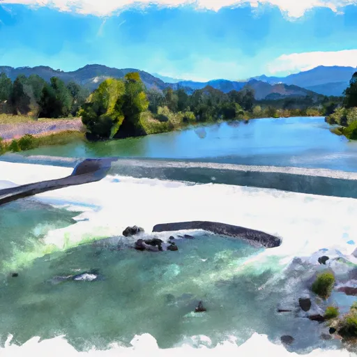
Sunrise Avenue to Watt Avenue
#1 Sunrise Avenue to Watt Avenue Good
· 4,410 cfs · in range (1,400-20,000)· Thunderstorms in forecast
The Sunrise Avenue to Watt Avenue river run on the American River in California is a leisurely Class I float suitable for families and beginners. The best time to float this…
Why 78: live conditions (good)
78Top-rated
B
Begins Immediately Southwest Of Fall River Mills, Ca To It Flows Into Shasta Lake And The Sacramento River.
#2 Begins Immediately Southwest Of Fall River Mills, Ca To It Flows Into Shasta Lake And The Sacramento River. Good
· 1,110 cfs · in range (600-5,000)· Rising +26% / 24h
The Whitewater River Run begins immediately southwest of Fall River Mills, Ca and flows into Shasta Lake and the Sacramento River. The ideal stream flow range for this river is…
Why 75: live conditions (good)
75Top-rated
B
Begins Near Muck Valley To Ends Two Miles From The Fall River Valley
#3 Begins Near Muck Valley To Ends Two Miles From The Fall River Valley Good
· 1,110 cfs · in range (600-5,000)· Rising +26% / 24h
The Whitewater River Run in California begins near Muck Valley and ends two miles from the Fall River Valley. The ideal streamflow range for this river run is between 500 and 2000…
Why 75: live conditions (good)
75Top-rated
C
Cache Creek
#4 Cache Creek Good
· 260 cfs · in range (80-5,000)
Cache Creek, located in the state of California, is a popular destination for whitewater enthusiasts. The ideal streamflow range for the river is between 400 and 1400 cubic feet…
Why 75: live conditions (good)
75Top-rated
C
Confluence With Fish Creek To Confluence With Rancheria Creek
#5 Confluence With Fish Creek To Confluence With Rancheria Creek Good
· 1,100 cfs · in range (700-8,000)
The Whitewater River run from Confluence With Fish Creek To Confluence With Rancheria Creek in California is a popular destination for whitewater enthusiasts. The ideal streamflow…
Why 75: live conditions (good)
75Top-rated
C
Confluence With Rancheria Creek To Forest Road 46N24X
#6 Confluence With Rancheria Creek To Forest Road 46N24X Good
· 1,100 cfs · in range (700-8,000)
The Whitewater River run from Confluence with Rancheria Creek to Forest Road 46N24X is a popular kayaking and rafting stretch in California. The ideal streamflow range for this…
Why 75: live conditions (good)
75Top-rated
F
From Toe Of Dam On West End Of Ukonom Lake To Confluence With Klamath River
#7 From Toe Of Dam On West End Of Ukonom Lake To Confluence With Klamath River Good
· 1,100 cfs · in range (700-8,000)
The whitewater river run from Toe of Dam on West End of Ukonom Lake to Confluence with Klamath River is located in the state of California. The ideal streamflow range for this run…
Why 75: live conditions (good)
75Top-rated
L
Lower Pit River Canyon
#8 Lower Pit River Canyon Good
· 1,110 cfs · in range (600-5,000)· Rising +26% / 24h
The Lower Pit River Canyon in California is a popular destination for whitewater enthusiasts. The ideal streamflow range for this river run is between 800 and 2,000 cubic feet per…
Why 75: live conditions (good)
75Top-rated
U
Upper Pit River Canyon
#9 Upper Pit River Canyon Good
· 1,110 cfs · in range (600-5,000)· Rising +26% / 24h
The Upper Pit River Canyon in California is a popular whitewater destination with a range of rapids and challenging obstacles. The ideal streamflow range for the Upper Pit River…
Why 75: live conditions (good)
75Top-rated
S
Sluice Box to Green Riffle
#10 Sluice Box to Green Riffle Good
· 1,100 cfs · in range (700-10,000)· Thunderstorms in forecast
The Sluice Box to Green Riffle river run on the Klamath River in California is an exciting and challenging stretch of water that offers stunning scenery and thrilling rapids. The…
Why 73: live conditions (good)
73Top-rated
T
Tahoe City to River Ranch
#11 Tahoe City to River Ranch Good
· 543 cfs · in range (450-5,000)· Windy · 30 mph
The Tahoe City to River Ranch river run on the Truckee River in California has some challenging obstacles such as Class III rapids, low bridges, and fallen trees. The river run…
Why 72: live conditions (good)
72Top-rated
I
Iron Gate Dam to Happy Camp
#12 Iron Gate Dam to Happy Camp Good
· 895 cfs · in range (500-50,000)· Windy · 38 mph
The Iron Gate Dam to Happy Camp River Run on the Klamath River is a Class III+ section that requires intermediate to advanced experience. The run is approximately 20 miles long…
Why 69: live conditions (good)
69Top-rated
 Headwaters In The Santa Monica Mountains To  Mouth At Pacific Ocean
#13 Headwaters In The Santa Monica Mountains To Mouth At Pacific Ocean
The Whitewater River is located in Southern California and stretches from its headwaters in the Santa Monica Mountains to its mouth at the Pacific Ocean. The ideal streamflow…
Why 65: a defined runnable stretch
65Top-rated
B
Bell Creek Headwaters To One-Tenth  Mile Upstream Of Crabtree Trailhead
#14 Bell Creek Headwaters To One-Tenth Mile Upstream Of Crabtree Trailhead
The Bell Creek Headwaters to one-tenth of a mile upstream of Crabtree Trailhead is a Class IV-V river run, with a segment mileage of approximately 5 miles. The ideal streamflow…
Why 65: a defined runnable stretch
65Top-rated
B
Below Deep Creek Lake  To Below 2W01 Crossing
#15 Below Deep Creek Lake To Below 2W01 Crossing
The Whitewater River run below Deep Creek Lake to below 2W01 Crossing in California is a popular destination for whitewater enthusiasts. The ideal streamflow range for this…
Why 65: a defined runnable stretch
65Top-rated

Paddling in California

California has 503 paddle runs on Snoflo, ranked by live conditions, visitor reviews, and logged trips — so the best, closest options rise to the top.

How we rank the best paddling in California

How are these paddle runs ranked?

Each gets a daily Snoflo score blending live conditions, visitor review ratings, and logged trips. The order reflects what's best right now and re-ranks every day.

How often does it update?

Daily, as new conditions, reviews, and trips arrive — so "best right now" means right now.

What do the numbers on the map mean?

Each pin shows that spot's current Snoflo score; tap it for the breakdown and a link to the full report.

Paddling near you in California