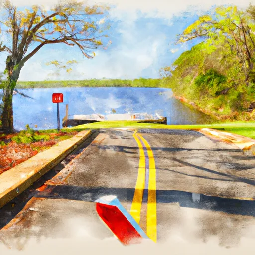
County Road 400 848, Shelby Boat Launch
Community Reviews
Been here? Share the conditions.
Reviews, ratings & photos are added in the free Snoflo iOS app — rate a spot, tag the conditions, and your visit is verified by location. Add or manage your reviews from the app.
County Road 400 848, Shelby
The Coosa River is a popular waterway for recreational activities such as fishing, boating, and swimming. According to the latest information available from the Alabama Department of Conservation and Natural Resources, the Coosa River is home to a variety of fish species, including bass, catfish, and crappie. The Department also notes that the river is suitable for a range of boating activities, including power boating, sailing, and kayaking.
In terms of craft permitted on the water, it is important for boaters to comply with Alabama state boating laws and regulations. These regulations require all boats to have the necessary safety equipment on board, including life jackets and fire extinguishers. Additionally, boats with motors must be registered with the state and display the appropriate decals.
In summary, County Road 400 848 boat ramp in Shelby, Alabama is a public boat ramp that provides access to the Coosa River. It is a concrete ramp that is approximately 20 feet wide, suitable for launching small to medium-sized boats. The Coosa River is a popular destination for recreational activities such as fishing and boating, and a variety of craft are permitted on the water as long as they comply with state regulations.
Plan your launch down to the hour
Same weather feed Snoflo's iOS app uses -- updated continuously from NOAA / yr.no.
Next 5 days, hour by hour
Temperature line with weather symbols on top, snow + rain accumulation as columns, humidity as a dotted line.
5-day forecast table
Every 3 hours, broken out across temperature, snow, rain, humidity, and wind.
| Time | Condition | Temp (°F) | Snow (in) | Rain (in) | Humidity (%) | Wind (mps) | Wind dir |
|---|---|---|---|---|---|---|---|
| Loading detailed forecast… | |||||||
15-day temperature & precipitation
Daily temperatures, snow, and rain projected over the next two weeks.
Area streamflow levels
USGS streamgauges around County Road 400 848, Shelby -- the same readings that determine whether your launch is safe and your boat is the right craft.
| Streamgauge | Discharge | View |
|---|---|---|
| Hatchet Creek Below Rockford Al | 155 cfs | → |
| Coosa River At Childersburg Al | 494 cfs | → |
| Cahaba Valley Creek At Cross Cr Rd At Pelham | 24 cfs | → |
| Cahaba River Near Helena Al | 220 cfs | → |
| Cahaba River Near Hoover | 92 cfs | → |
| Talladega Creek At Alpine Al | 287 cfs | → |
Plan a longer trip
The closest paddle runs, fishing spots, and other boat launches so you can extend a day on the water.
Boating safety & etiquette
- Check the conditions before you launch
- Use the streamflow numbers, weather, and wind forecast on this page. High-cfs whitewater requires whitewater-specific craft and skill.
- Wear your life jacket
- Statistically the single biggest survival factor in a boating incident. State law often requires one per passenger.
- File a float plan
- Tell someone on shore your put-in, take-out, and expected return time. Especially for multi-day or remote trips.
- Yield at the ramp
- Prep gear in the parking lot, not on the ramp. Launch and clear quickly so others can use the lane.
- Clean, drain, dry
- Inspect, clean, drain and dry your boat between waters to prevent the spread of aquatic invasive species.
Set push alerts in the Snoflo app
Save County Road 400 848, Shelby as a favorite, set a discharge threshold or a wind/precipitation alert, and the iOS app will push the moment conditions cross.
About County Road 400 848, Shelby
Can I launch a motorboat here?
Most Snoflo-tracked launches support motorboats; check the operator for any horsepower restrictions, paddle-only zones, or seasonal closures.
How fresh is the streamflow data?
USGS streamgauges report continuously (every 15 minutes); the table on this page pulls the latest reading at page load.
Is there a fee?
Many federal and state boat launches charge a day-use fee. Check the operator's site before driving out.
What boat is right for these conditions?
Use the nearby streamflow numbers and river-run panel on this page to gauge current conditions. Wider, slower water is friendly for casual paddling and powerboats; high-cfs whitewater requires whitewater-specific craft and skill.
Can I get alerts when conditions change?
Yes -- alerts are managed in the Snoflo iOS app. Favorite this launch, set a threshold (discharge, wind), and you'll get a push the moment it crosses.
Other launches near here
Snoflo-tracked boat launches within driving distance of County Road 400 848, Shelby.