County Road 8 Winston County Boat Launch
Community Reviews
Been here? Share the conditions.
Reviews, ratings & photos are added in the free Snoflo iOS app — rate a spot, tag the conditions, and your visit is verified by location. Add or manage your reviews from the app.
County Road 8 Winston County
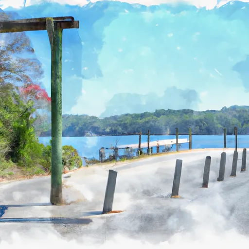
The boat ramp is approximately 15 feet wide and provides easy access to the water. It services a small lake called Smith Lake, which is known for its crystal-clear water and excellent fishing opportunities. The lake covers an area of approximately 21,000 acres and has over 500 miles of shoreline.
There are no restrictions on the type of watercraft that are permitted on Smith Lake, but users are reminded to follow all safety guidelines and regulations while on the water. Popular water activities on the lake include fishing, boating, water skiing, tubing, and swimming.
In terms of amenities, the boat ramp at County Road 8 Winston County offers a parking lot that can accommodate vehicles with boat trailers. There are also picnic tables and restrooms available for public use.
Overall, the County Road 8 Winston County boat ramp is a great spot for anyone looking to launch their boat and explore the beautiful Smith Lake.
Plan your launch down to the hour
Same weather feed Snoflo's iOS app uses -- updated continuously from NOAA / yr.no.
Next 5 days, hour by hour
Temperature line with weather symbols on top, snow + rain accumulation as columns, humidity as a dotted line.
5-day forecast table
Every 3 hours, broken out across temperature, snow, rain, humidity, and wind.
| Time | Condition | Temp (°F) | Snow (in) | Rain (in) | Humidity (%) | Wind (mps) | Wind dir |
|---|---|---|---|---|---|---|---|
| Loading detailed forecast… | |||||||
15-day temperature & precipitation
Daily temperatures, snow, and rain projected over the next two weeks.
Area streamflow levels
USGS streamgauges around County Road 8 Winston County -- the same readings that determine whether your launch is safe and your boat is the right craft.
| Streamgauge | Discharge | View |
|---|---|---|
| Blackwater Creek Near Manchester Al | 96 cfs | → |
| Clear C At New Hope Church Nr Poplar Springs | 163 cfs | → |
| Mulberry Fork At Cordova Al | 2,600 cfs | → |
| Lost Creek Above Parrish | 128 cfs | → |
| Sipsey Fork Near Grayson Al | 130 cfs | → |
| Mulberry Fork Near Arkadelphia | 338 cfs | → |
Plan a longer trip
The closest paddle runs, fishing spots, and other boat launches so you can extend a day on the water.
Boating safety & etiquette
- Check the conditions before you launch
- Use the streamflow numbers, weather, and wind forecast on this page. High-cfs whitewater requires whitewater-specific craft and skill.
- Wear your life jacket
- Statistically the single biggest survival factor in a boating incident. State law often requires one per passenger.
- File a float plan
- Tell someone on shore your put-in, take-out, and expected return time. Especially for multi-day or remote trips.
- Yield at the ramp
- Prep gear in the parking lot, not on the ramp. Launch and clear quickly so others can use the lane.
- Clean, drain, dry
- Inspect, clean, drain and dry your boat between waters to prevent the spread of aquatic invasive species.
Set push alerts in the Snoflo app
Save County Road 8 Winston County as a favorite, set a discharge threshold or a wind/precipitation alert, and the iOS app will push the moment conditions cross.
About County Road 8 Winston County
Can I launch a motorboat here?
Most Snoflo-tracked launches support motorboats; check the operator for any horsepower restrictions, paddle-only zones, or seasonal closures.
How fresh is the streamflow data?
USGS streamgauges report continuously (every 15 minutes); the table on this page pulls the latest reading at page load.
Is there a fee?
Many federal and state boat launches charge a day-use fee. Check the operator's site before driving out.
What boat is right for these conditions?
Use the nearby streamflow numbers and river-run panel on this page to gauge current conditions. Wider, slower water is friendly for casual paddling and powerboats; high-cfs whitewater requires whitewater-specific craft and skill.
Can I get alerts when conditions change?
Yes -- alerts are managed in the Snoflo iOS app. Favorite this launch, set a threshold (discharge, wind), and you'll get a push the moment it crosses.
Other launches near here
Snoflo-tracked boat launches within driving distance of County Road 8 Winston County.