Tropical Cyclone Statement
Until 2024-10-09T17:00:00-04:00
•
National Weather Service
HLSTBW
This product covers West Central and Southwest Florida
**MILTON EXPECTED TO MAKE LANDFALL OVER WEST CENTRAL AND SOUTHWEST
FLORIDA AS A MAJOR HURRICANE TONIGHT**
NEW INFORMATION
---------------
* CHANGES TO WATCHES AND WARNINGS:
- None
* CURRENT WATCHES AND WARNINGS:
- A Storm Surge Warning and Hurricane Warning are in effect for
Coastal Charlotte, Coastal Citrus, Coastal Hernando, Coastal
Hillsborough, Coastal Lee, Coastal Manatee, Coastal Pasco,
Coastal Sarasota, Inland Lee, and Pinellas
- A Hurricane Warning is in effect for Coastal Levy, DeSoto,
Hardee, Highlands, Inland Charlotte, Inland Citrus, Inland
Hernando, Inland Hillsborough, Inland Levy, Inland Manatee,
Inland Pasco, Inland Sarasota, Polk, and Sumter
* STORM INFORMATION:
- About 220 miles southwest of Mouth of Tampa Bay FL
- 25.0N 84.8W
- Storm Intensity 155 mph
- Movement Northeast or 40 degrees at 16 mph
SITUATION OVERVIEW
------------------
Milton remains a powerful and very dangerous major hurricane moving
northeast into the eastern Gulf of Mexico this morning, and will bring
devastating to life-threatening impacts across parts of West Central
and Southwest Florida beginning later today and continuing through
early Thursday. Extremely life-threatening, catastrophic storm surge
impacts are expected along the coast with destructive winds extending
from the coast to inland locations along with heavy rainfall with
possible flash flooding along with the threat of tornadoes.
* Storm Surge - Life threatening storm surge is expected Wednesday
into Thursday. Potential peak surge amounts are 10 to 15 feet from Anna
Marie Island to Boca Grande, 8 to 12 feet from the Anclote River to Anna
Marie Island including Tampa Bay, 8 to 12 feet from Boca Grande to Bonita
Beach including Charlotte Harbor, 4 to 7 feet from the Anclote River to
Aripeka, and 2 to 4 feet from Aripeka to Yankeetown.
* Rain - Flooding rain threat will run from Wednesday through Thursday
with rainfall amounts of 6 to 12 inches with locally higher amounts up
to 18 inches possible.
* Wind - Hurricane and tropical storm force winds will be possible
beginning on Wednesday with the highest probabilities along the coast.
* Tornadoes - Isolated tornadoes are possible Wednesday into Thursday
across the area.
POTENTIAL IMPACTS
-----------------
* SURGE:
Protect against life-threatening surge having possible catastrophic
impacts across Nature Coast, West-Central Florida, and Southwest
Florida. Potential impacts in this area include:
- Widespread deep inundation, with storm surge flooding greatly
accentuated by powerful battering waves. Structural damage to
buildings, with many washing away. Damage greatly compounded
from considerable floating debris. Locations may be
uninhabitable for an extended period.
- Near-shore escape routes and secondary roads washed out or
severely flooded. Flood control systems and barriers may become
stressed.
- Extreme beach erosion. New shoreline cuts possible.
- Massive damage to marinas, docks, boardwalks, and piers.
Numerous small craft broken away from moorings with many lifted
onshore and stranded.
Elsewhere across West Central and Southwest Florida, little to no
impact is anticipated.
* WIND:
Protect against life-threatening wind having possible devastating
impacts across Nature Coast, West-Central Florida, and Southwest
Florida.Potential impacts in this area include:
- Structural damage to sturdy buildings, some with complete roof
and wall failures. Complete destruction of mobile homes. Damage
greatly accentuated by large airborne projectiles. Locations
may be uninhabitable for weeks or months.
- Numerous large trees snapped or uprooted along with fences and
roadway signs blown over.
- Many roads impassable from large debris, and more within urban
or heavily wooded places. Many bridges, causeways, and access
routes impassable.
- Widespread power and communications outages.
Also, protect against life-threatening wind having possible limited
to extensive impacts across Nature Coast, West-Central Florida, and Southwest
Florida.
* FLOODING RAIN:
Protect against life-threatening rainfall flooding having possible
devastating impacts across the Nature Coast, West-Central Florida, and
Southwest Florida. Potential impacts include:
- Extreme rainfall flooding may prompt numerous evacuations and
rescues.
- Rivers and tributaries may overwhelmingly overflow their banks
in many places with deep moving water. Small streams, creeks,
canals, and ditches may become raging rivers. Flood control
systems and barriers may become stressed.
- Flood waters can enter numerous structures within multiple
communities, some structures becoming uninhabitable or washed
away. Numerous places where flood waters may cover escape
routes. Streets and parking lots become rivers of raging water
with underpasses submerged. Driving conditions become very
dangerous. Numerous road and bridge closures with some weakened
or washed out.
Protect against life-threatening rainfall flooding having possible
extensive impacts across the Nature Coast, West-Central Florida, and Southwest
Florida.
* TORNADOES:
Protect against a particularly dangerous tornado event having
possible extensive impacts across the Nature Coast, West-Central Florida, and
Southwest Florida.Potential impacts include:
- The occurrence of numerous tornadoes can greatly hinder the
execution of emergency plans during tropical events.
- Many places may experience tornado damage with a few spots of
immense destruction, power loss, and communications failures.
- Locations could realize roof and wall failures of sturdy
buildings with some being leveled, structures upon weak
foundations blown away, mobile homes obliterated, large trees
twisted and snapped with forested trees uprooted, vehicles
lifted off the ground and thrown, and boats destroyed. Large
and deadly projectiles can add to the toll.
Protect against a dangerous tornado event having possible limited to
significant impacts across the Nature Coast, West-Central Florida, and Southwest
Florida.
PRECAUTIONARY/PREPAREDNESS ACTIONS
----------------------------------
* EVACUATIONS:
Follow the advice of local officials.
* OTHER PREPAREDNESS INFORMATION:
Now is the time to complete all preparations to protect life and
property in accordance with your emergency plan. Ensure you are in a
safe location before the onset of strong winds or possible flooding.
If you are relocating to safe shelter, leave as early as possible.
Allow extra time to reach your destination. Many roads and bridges
will be closed once strong winds arrive. Check the latest weather
forecast before departing and drive with caution.
If heading to a community shelter, become familiar with the shelter
rules before arrival, especially if you have special needs or have
pets. Take essential items with you from your Emergency Supplies Kit.
Failure to adequately shelter may result in serious injury or loss of
life. Always heed the advice of local officials and comply with any
orders that are issued. Remember, during the storm 9 1 1 Emergency
Services may not be able to immediately respond if conditions are
unsafe. This should be a big factor in your decision making.
Storm surge is the leading killer associated with tropical storms and
hurricanes! Make sure you are in a safe area away from the surge
zone. Even if you are not in a surge-prone area, you could find
yourself cutoff by flood waters during and after the storm. Heed
evacuation orders issued by the local authorities.
If in a place that is vulnerable to high wind, such as near large
trees, a manufactured home, upper floors of a high-rise building, or
on a boat, consider moving to a safer shelter before the onset of
strong winds or flooding.
Closely monitor weather.gov, NOAA Weather radio or local news outlets
for official storm information. Be ready to adapt to possible changes
to the forecast. Ensure you have multiple ways to receive weather
warnings.
* ADDITIONAL SOURCES OF INFORMATION:
- For information on appropriate preparations see ready.gov
- For information on creating an emergency plan see getagameplan.org
- For additional disaster preparedness information see redcross.org
NEXT UPDATE
-----------
The next local statement will be issued by the National Weather
Service in Tampa Bay Ruskin FL around 12 PM, or sooner if conditions
warrant.
OSOWAW BOULEVARD HERNANDO COUNTY
Put Ins
•
Take Outs
•
Weather
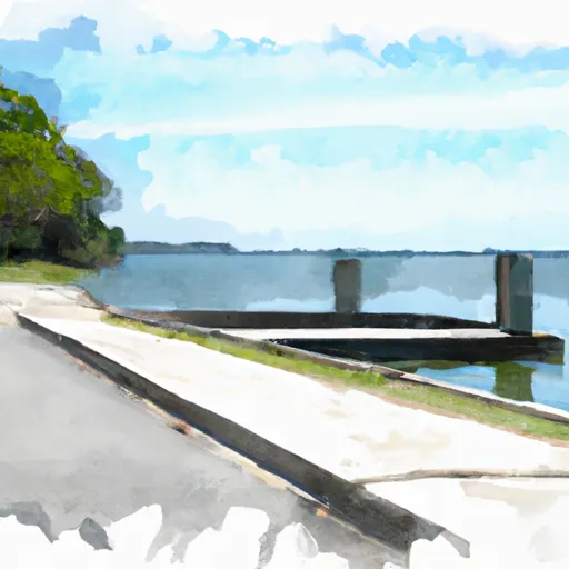
The Osowaw Boulevard boat ramp is a public boat ramp located in Hernando County, Florida. It provides access to the Weeki Wachee River, which is a popular destination for boating and fishing enthusiasts. The boat ramp is approximately 20 feet wide, which allows for easy launching and retrieval of boats.
According to the latest information available, the Osowaw Boulevard boat ramp can accommodate a variety of watercraft, including powerboats, kayaks, canoes, and paddleboards. However, it is important to note that the use of personal watercraft such as jet skis is prohibited on the Weeki Wachee River.
The Weeki Wachee River is a pristine waterway that is known for its crystal-clear waters and abundant wildlife. It is a designated Outstanding Florida Water, which means that it is protected under state law. Boaters are encouraged to follow all boating regulations and to take care not to disturb the natural environment.
Overall, the Osowaw Boulevard boat ramp is a well-maintained and popular launching point for boaters looking to explore the beautiful Weeki Wachee River in Hernando County, Florida.
Osceola National Forest is located in northeastern Florida and covers more than 200,000 acres of land. It is home to a diverse range of wildlife, including black bears, panthers, and alligators, as well as a variety of plant species. There are several good reasons to visit Osceola National Forest. Nature enthusiasts will appreciate the numerous hiking, biking, and equestrian trails that wind through the park. Visitors can also enjoy fishing, hunting, and camping activities in designated areas. Some of the specific points of interest in Osceola National Forest include the Olustee Battlefield, where a Civil War battle was fought in ...