Grabill Road 10943-10999, Leo-Cedarville Boat Launch
Community Reviews
Been here? Share the conditions.
Reviews, ratings & photos are added in the free Snoflo iOS app — rate a spot, tag the conditions, and your visit is verified by location. Add or manage your reviews from the app.
Grabill Road 10943-10999, Leo-Cedarville
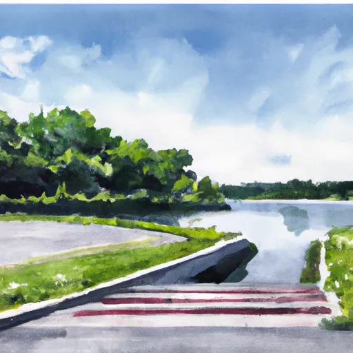
The Cedarville Reservoir is a 410-acre man-made lake that is used for fishing, boating, and other recreational activities. The lake is stocked with a variety of fish, including bluegill, crappie, largemouth bass, and channel catfish, making it a popular destination for anglers.
According to the latest information available, there are no restrictions on the type of watercraft that are permitted on the lake, as long as they are properly registered and meet all safety requirements. However, it is important to note that Cedarville Reservoir is a no-wake lake, which means that all boats must operate at a slow speed to prevent damage to the shoreline and minimize noise and disturbance for other lake users.
Overall, the Grabill Road Boat Ramp is a convenient and accessible launch point for anyone looking to explore the beautiful Cedarville Reservoir, whether they are fishing, boating, or simply enjoying the natural scenery.
Plan your launch down to the hour
Same weather feed Snoflo's iOS app uses -- updated continuously from NOAA / yr.no.
Next 5 days, hour by hour
Temperature line with weather symbols on top, snow + rain accumulation as columns, humidity as a dotted line.
5-day forecast table
Every 3 hours, broken out across temperature, snow, rain, humidity, and wind.
| Time | Condition | Temp (°F) | Snow (in) | Rain (in) | Humidity (%) | Wind (mps) | Wind dir |
|---|---|---|---|---|---|---|---|
| Loading detailed forecast… | |||||||
15-day temperature & precipitation
Daily temperatures, snow, and rain projected over the next two weeks.
Area streamflow levels
USGS streamgauges around Grabill Road 10943-10999, Leo-Cedarville -- the same readings that determine whether your launch is safe and your boat is the right craft.
| Streamgauge | Discharge | View |
|---|---|---|
| Cedar Creek Near Cedarville | 39 cfs | → |
| St. Joseph River Near Fort Wayne | 386 cfs | → |
| Maumee River At New Haven | 348 cfs | → |
| Cedar Creek At 18th Street At Auburn | 8 cfs | → |
| Maumee River At Fort Wayne | 231 cfs | → |
| Maumee River At Antwerp Oh | 345 cfs | → |
Plan a longer trip
The closest paddle runs, fishing spots, and other boat launches so you can extend a day on the water.
Boating safety & etiquette
- Check the conditions before you launch
- Use the streamflow numbers, weather, and wind forecast on this page. High-cfs whitewater requires whitewater-specific craft and skill.
- Wear your life jacket
- Statistically the single biggest survival factor in a boating incident. State law often requires one per passenger.
- File a float plan
- Tell someone on shore your put-in, take-out, and expected return time. Especially for multi-day or remote trips.
- Yield at the ramp
- Prep gear in the parking lot, not on the ramp. Launch and clear quickly so others can use the lane.
- Clean, drain, dry
- Inspect, clean, drain and dry your boat between waters to prevent the spread of aquatic invasive species.
Set push alerts in the Snoflo app
Save Grabill Road 10943-10999, Leo-Cedarville as a favorite, set a discharge threshold or a wind/precipitation alert, and the iOS app will push the moment conditions cross.
About Grabill Road 10943-10999, Leo-Cedarville
Can I launch a motorboat here?
Most Snoflo-tracked launches support motorboats; check the operator for any horsepower restrictions, paddle-only zones, or seasonal closures.
How fresh is the streamflow data?
USGS streamgauges report continuously (every 15 minutes); the table on this page pulls the latest reading at page load.
Is there a fee?
Many federal and state boat launches charge a day-use fee. Check the operator's site before driving out.
What boat is right for these conditions?
Use the nearby streamflow numbers and river-run panel on this page to gauge current conditions. Wider, slower water is friendly for casual paddling and powerboats; high-cfs whitewater requires whitewater-specific craft and skill.
Can I get alerts when conditions change?
Yes -- alerts are managed in the Snoflo iOS app. Favorite this launch, set a threshold (discharge, wind), and you'll get a push the moment it crosses.
Other launches near here
Snoflo-tracked boat launches within driving distance of Grabill Road 10943-10999, Leo-Cedarville.