Milton Boat Ramp Boat Launch
Community Reviews
Been here? Share the conditions.
Reviews, ratings & photos are added in the free Snoflo iOS app — rate a spot, tag the conditions, and your visit is verified by location. Add or manage your reviews from the app.
Milton Boat Ramp
After conducting research, it appears that the Milton boat ramp is located in the Milton State Recreation Area, which is situated in southeastern Indiana, near the border with Kentucky. This boat ramp provides access to the Ohio River, which is a significant waterway that flows through six different states in the eastern United States.
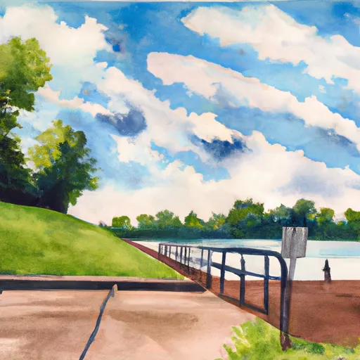
The Milton boat ramp is a concrete ramp that is approximately 25 feet wide, which makes it suitable for launching and retrieving a wide variety of watercraft. However, it should be noted that the Ohio River can sometimes experience strong currents and high water levels, which may make it difficult or dangerous to launch some types of boats.
According to the Indiana Department of Natural Resources, the Ohio River is open to all types of watercraft, including powerboats, sailboats, canoes, and kayaks. However, boaters are advised to be aware of potential hazards on the river, such as commercial barges, submerged debris, and changing water levels.
In conclusion, the Milton boat ramp is a concrete ramp located in the Milton State Recreation Area in Indiana. It is approximately 25 feet wide and provides access to the Ohio River, which is open to all types of watercraft. Boaters should be aware of potential hazards on the river and take appropriate safety precautions.
Plan your launch down to the hour
Same weather feed Snoflo's iOS app uses -- updated continuously from NOAA / yr.no.
Next 5 days, hour by hour
Temperature line with weather symbols on top, snow + rain accumulation as columns, humidity as a dotted line.
5-day forecast table
Every 3 hours, broken out across temperature, snow, rain, humidity, and wind.
| Time | Condition | Temp (°F) | Snow (in) | Rain (in) | Humidity (%) | Wind (mps) | Wind dir |
|---|---|---|---|---|---|---|---|
| Loading detailed forecast… | |||||||
15-day temperature & precipitation
Daily temperatures, snow, and rain projected over the next two weeks.
Area streamflow levels
USGS streamgauges around Milton Boat Ramp -- the same readings that determine whether your launch is safe and your boat is the right craft.
| Streamgauge | Discharge | View |
|---|---|---|
| Indian-Kentuck Creek Nr Canaan | 1 cfs | → |
| Muscatatuck River Near Deputy | 15 cfs | → |
| Vernon Fork Muscatatuck River At Vernon | 31 cfs | → |
| Ohio River At Markland Dam Near Warsaw | 34,300 cfs | → |
| Brush Creek Near Nebraska | 2 cfs | → |
| Harrods Creek At Highway 329 Nr Goshen | 579 cfs | → |
Plan a longer trip
The closest paddle runs, fishing spots, and other boat launches so you can extend a day on the water.
Boating safety & etiquette
- Check the conditions before you launch
- Use the streamflow numbers, weather, and wind forecast on this page. High-cfs whitewater requires whitewater-specific craft and skill.
- Wear your life jacket
- Statistically the single biggest survival factor in a boating incident. State law often requires one per passenger.
- File a float plan
- Tell someone on shore your put-in, take-out, and expected return time. Especially for multi-day or remote trips.
- Yield at the ramp
- Prep gear in the parking lot, not on the ramp. Launch and clear quickly so others can use the lane.
- Clean, drain, dry
- Inspect, clean, drain and dry your boat between waters to prevent the spread of aquatic invasive species.
Set push alerts in the Snoflo app
Save Milton Boat Ramp as a favorite, set a discharge threshold or a wind/precipitation alert, and the iOS app will push the moment conditions cross.
About Milton Boat Ramp
Can I launch a motorboat here?
Most Snoflo-tracked launches support motorboats; check the operator for any horsepower restrictions, paddle-only zones, or seasonal closures.
How fresh is the streamflow data?
USGS streamgauges report continuously (every 15 minutes); the table on this page pulls the latest reading at page load.
Is there a fee?
Many federal and state boat launches charge a day-use fee. Check the operator's site before driving out.
What boat is right for these conditions?
Use the nearby streamflow numbers and river-run panel on this page to gauge current conditions. Wider, slower water is friendly for casual paddling and powerboats; high-cfs whitewater requires whitewater-specific craft and skill.
Can I get alerts when conditions change?
Yes -- alerts are managed in the Snoflo iOS app. Favorite this launch, set a threshold (discharge, wind), and you'll get a push the moment it crosses.
Other launches near here
Snoflo-tracked boat launches within driving distance of Milton Boat Ramp.