Rogers County boat launch
Community Reviews
Been here? Share the conditions.
Reviews, ratings & photos are added in the free Snoflo iOS app — rate a spot, tag the conditions, and your visit is verified by location. Add or manage your reviews from the app.
Rogers County
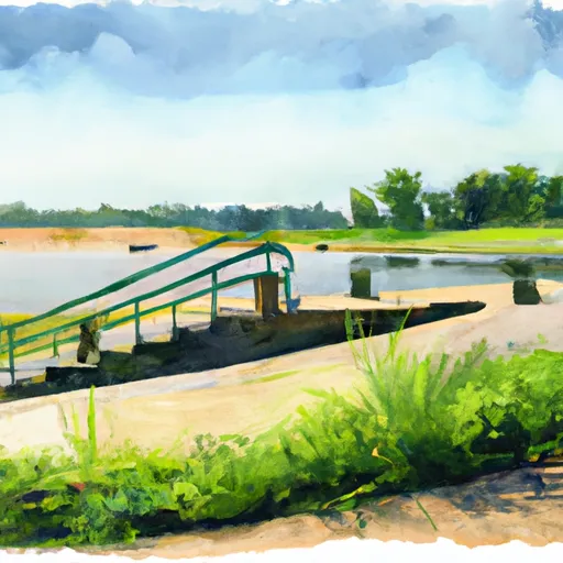
However, based on general information about boat ramps in Oklahoma, it can be assumed that the Rogers County boat ramp would be a concrete or paved ramp with a gradual slope into the water. The width of the ramp would likely vary, but most boat ramps in Oklahoma are designed to accommodate a single vehicle and trailer at a time.
As for the body of water that the Rogers County boat ramp might service, Oklahoma has several large lakes and reservoirs that are popular for boating and fishing. Some of the most well-known bodies of water in the state include Lake Texoma, Lake Eufaula, and Grand Lake. Without more specific information, it is impossible to determine which body of water the Rogers County boat ramp might be located on.
In terms of the types of watercraft permitted on the water, this would depend on the specific regulations for the body of water in question. In general, Oklahoma requires all boats to be registered and operated in compliance with state and federal laws and regulations. Most lakes and reservoirs in the state allow a variety of watercraft, including motorboats, sailboats, canoes, and kayaks, but there may be restrictions on certain types of boats or activities in certain areas.
In summary, while I could not find any specific information on the Rogers County boat ramp in Oklahoma, it can be assumed that it would be a standard concrete or paved ramp with a variable width. The body of water it services and the types of boats permitted on it would depend on the specific location.
Plan your launch down to the hour
Same weather feed Snoflo's iOS app uses -- updated continuously from NOAA / yr.no.
Next 5 days, hour by hour
Temperature line with weather symbols on top, snow + rain accumulation as columns, humidity as a dotted line.
5-day forecast table
Every 3 hours, broken out across temperature, snow, rain, humidity, and wind.
| Time | Condition | Temp (°F) | Snow (in) | Rain (in) | Humidity (%) | Wind (mps) | Wind dir |
|---|---|---|---|---|---|---|---|
| Loading detailed forecast… | |||||||
15-day temperature & precipitation
Daily temperatures, snow, and rain projected over the next two weeks.
Area streamflow levels
USGS streamgauges around Rogers County -- the same readings that determine whether your launch is safe and your boat is the right craft.
| Streamgauge | Discharge | View |
|---|---|---|
| Verdigris River Near Claremore | 7,930 cfs | → |
| Caney River Near Ramona | 4,220 cfs | → |
| Bird Ck At State Highway 266 Near Catoosa | 712 cfs | → |
| Bird Creek Near Owasso | 583 cfs | → |
| Bird Creek Near Sperry | 414 cfs | → |
| Coal Creek At Tulsa | 5 cfs | → |
Plan a longer trip
The closest paddle runs, fishing spots, and other boat launches so you can extend a day on the water.
Boating safety & etiquette
- Check the conditions before you launch
- Use the streamflow numbers, weather, and wind forecast on this page. High-cfs whitewater requires whitewater-specific craft and skill.
- Wear your life jacket
- Statistically the single biggest survival factor in a boating incident. State law often requires one per passenger.
- File a float plan
- Tell someone on shore your put-in, take-out, and expected return time. Especially for multi-day or remote trips.
- Yield at the ramp
- Prep gear in the parking lot, not on the ramp. Launch and clear quickly so others can use the lane.
- Clean, drain, dry
- Inspect, clean, drain and dry your boat between waters to prevent the spread of aquatic invasive species.
Set push alerts in the Snoflo app
Save Rogers County as a favorite, set a discharge threshold or a wind/precipitation alert, and the iOS app will push the moment conditions cross.
About Rogers County
Can I launch a motorboat here?
Most Snoflo-tracked launches support motorboats; check the operator for any horsepower restrictions, paddle-only zones, or seasonal closures.
How fresh is the streamflow data?
USGS streamgauges report continuously (every 15 minutes); the table on this page pulls the latest reading at page load.
Is there a fee?
Many federal and state boat launches charge a day-use fee. Check the operator's site before driving out.
What boat is right for these conditions?
Use the nearby streamflow numbers and river-run panel on this page to gauge current conditions. Wider, slower water is friendly for casual paddling and powerboats; high-cfs whitewater requires whitewater-specific craft and skill.
Can I get alerts when conditions change?
Yes -- alerts are managed in the Snoflo iOS app. Favorite this launch, set a threshold (discharge, wind), and you'll get a push the moment it crosses.
Other launches near here
Snoflo-tracked boat launches within driving distance of Rogers County.