West Side-Lyndell boat launch
Community Reviews
Been here? Share the conditions.
Reviews, ratings & photos are added in the free Snoflo iOS app — rate a spot, tag the conditions, and your visit is verified by location. Add or manage your reviews from the app.
West Side-Lyndell
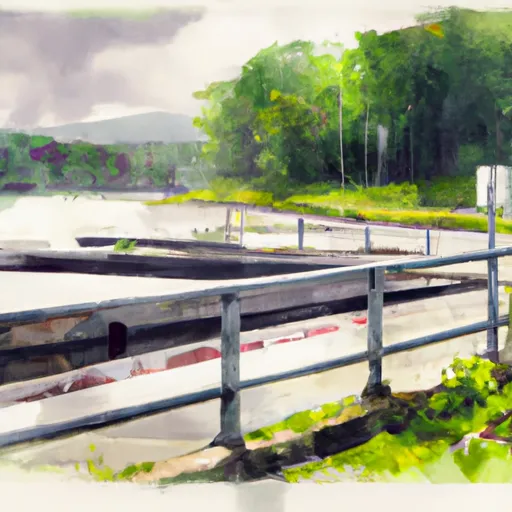
The boat ramp is approximately 20 feet wide and has a gentle slope, making it easy for boaters to launch and retrieve their watercraft. The ramp has a floating dock that provides additional access to the river, making it easier for boaters to board and disembark from their boats.
West Side-Lyndell boat ramp services the Schuylkill River, which is a popular destination for recreational boaters, kayakers, and fishermen. This river is approximately 135 miles long and runs through the heart of Pennsylvania. The Schuylkill River is navigable for most of its length, and it is a popular destination for boaters and anglers alike.
The West Norriton Township Parks and Recreation Department allows a wide variety of watercraft to be launched from the West Side-Lyndell boat ramp. Visitors can bring their kayaks, canoes, and small boats to the ramp and launch them into the river. However, it is worth noting that motorized boats may not be permitted on certain parts of the river, so it is important to check local regulations before launching a motorized craft from this ramp.
In conclusion, West Side-Lyndell is a well-maintained boat ramp in Pennsylvania, which provides easy access to the Schuylkill River. It is a popular destination for kayakers, canoeists, and small boat owners and is managed by the West Norriton Township Parks and Recreation Department. The ramp is approximately 20 feet wide and has a floating dock, making it easy for boaters to launch and retrieve their watercraft.
Plan your launch down to the hour
Same weather feed Snoflo's iOS app uses -- updated continuously from NOAA / yr.no.
Next 5 days, hour by hour
Temperature line with weather symbols on top, snow + rain accumulation as columns, humidity as a dotted line.
5-day forecast table
Every 3 hours, broken out across temperature, snow, rain, humidity, and wind.
| Time | Condition | Temp (°F) | Snow (in) | Rain (in) | Humidity (%) | Wind (mps) | Wind dir |
|---|---|---|---|---|---|---|---|
| Loading detailed forecast… | |||||||
15-day temperature & precipitation
Daily temperatures, snow, and rain projected over the next two weeks.
Area streamflow levels
USGS streamgauges around West Side-Lyndell -- the same readings that determine whether your launch is safe and your boat is the right craft.
| Streamgauge | Discharge | View |
|---|---|---|
| Marsh Creek Near Downingtown | 24 cfs | → |
| East Branch Brandywine Creek Near Downingtown | 54 cfs | → |
| Marsh Creek Near Glenmoore | 1 cfs | → |
| Birch Run Near Wagontown | 2 cfs | → |
| West Branch Brandywine Creek Near Honey Brook | 5 cfs | → |
| East Branch Brandywine Creek Below Downingtown | 58 cfs | → |
Plan a longer trip
The closest paddle runs, fishing spots, and other boat launches so you can extend a day on the water.
Boating safety & etiquette
- Check the conditions before you launch
- Use the streamflow numbers, weather, and wind forecast on this page. High-cfs whitewater requires whitewater-specific craft and skill.
- Wear your life jacket
- Statistically the single biggest survival factor in a boating incident. State law often requires one per passenger.
- File a float plan
- Tell someone on shore your put-in, take-out, and expected return time. Especially for multi-day or remote trips.
- Yield at the ramp
- Prep gear in the parking lot, not on the ramp. Launch and clear quickly so others can use the lane.
- Clean, drain, dry
- Inspect, clean, drain and dry your boat between waters to prevent the spread of aquatic invasive species.
Set push alerts in the Snoflo app
Save West Side-Lyndell as a favorite, set a discharge threshold or a wind/precipitation alert, and the iOS app will push the moment conditions cross.
About West Side-Lyndell
Can I launch a motorboat here?
Most Snoflo-tracked launches support motorboats; check the operator for any horsepower restrictions, paddle-only zones, or seasonal closures.
How fresh is the streamflow data?
USGS streamgauges report continuously (every 15 minutes); the table on this page pulls the latest reading at page load.
Is there a fee?
Many federal and state boat launches charge a day-use fee. Check the operator's site before driving out.
What boat is right for these conditions?
Use the nearby streamflow numbers and river-run panel on this page to gauge current conditions. Wider, slower water is friendly for casual paddling and powerboats; high-cfs whitewater requires whitewater-specific craft and skill.
Can I get alerts when conditions change?
Yes -- alerts are managed in the Snoflo iOS app. Favorite this launch, set a threshold (discharge, wind), and you'll get a push the moment it crosses.
Other launches near here
Snoflo-tracked boat launches within driving distance of West Side-Lyndell.