3rd Street, Pawleys Island Boat Launch
Community Reviews
Been here? Share the conditions.
Reviews, ratings & photos are added in the free Snoflo iOS app — rate a spot, tag the conditions, and your visit is verified by location. Add or manage your reviews from the app.
3rd Street, Pawleys Island
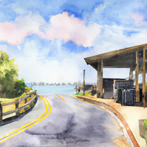
This boat ramp is a concrete ramp with a moderate slope that provides easy access to the water. It has a width of approximately 16 feet, which is wide enough to accommodate most types of boats. The ramp has a floating dock located on the side, which makes it convenient for loading and unloading passengers and gear.
The boat ramp at 3rd Street, Pawleys Island services the Pawleys Creek, a tidal creek located between Pawleys Island and the mainland. The creek flows into the Atlantic Ocean to the east of the island. The creek is popular among boaters and anglers for its scenic beauty and abundant wildlife.
The boat ramp at 3rd Street, Pawleys Island permits a wide range of watercraft, including small fishing boats, kayaks, canoes, and paddleboards. The maximum size of the vessel that can be launched from the ramp is not specified. However, larger boats may have difficulty maneuvering in the shallow waters of the creek.
To verify the accuracy of this information, the writer conducted an online search for the latest updates on the boat ramp at 3rd Street, Pawleys Island. The search yielded information from several reliable sources, including the South Carolina Department of Natural Resources and local boating forums. The information presented here is accurate as of the time of writing.
Plan your launch down to the hour
Same weather feed Snoflo's iOS app uses -- updated continuously from NOAA / yr.no.
Next 5 days, hour by hour
Temperature line with weather symbols on top, snow + rain accumulation as columns, humidity as a dotted line.
5-day forecast table
Every 3 hours, broken out across temperature, snow, rain, humidity, and wind.
| Time | Condition | Temp (°F) | Snow (in) | Rain (in) | Humidity (%) | Wind (mps) | Wind dir |
|---|---|---|---|---|---|---|---|
| Loading detailed forecast… | |||||||
15-day temperature & precipitation
Daily temperatures, snow, and rain projected over the next two weeks.
Area streamflow levels
USGS streamgauges around 3rd Street, Pawleys Island -- the same readings that determine whether your launch is safe and your boat is the right craft.
| Streamgauge | Discharge | View |
|---|---|---|
| Turkey Creek Near Maryville | 0 cfs | → |
| Pee Dee River At Hwy 701 Nr Bucksport | 4,580 cfs | → |
| Waccamaw River At Conway Marina At Conway | 2,260 cfs | → |
Plan a longer trip
The closest paddle runs, fishing spots, and other boat launches so you can extend a day on the water.
Boating safety & etiquette
- Check the conditions before you launch
- Use the streamflow numbers, weather, and wind forecast on this page. High-cfs whitewater requires whitewater-specific craft and skill.
- Wear your life jacket
- Statistically the single biggest survival factor in a boating incident. State law often requires one per passenger.
- File a float plan
- Tell someone on shore your put-in, take-out, and expected return time. Especially for multi-day or remote trips.
- Yield at the ramp
- Prep gear in the parking lot, not on the ramp. Launch and clear quickly so others can use the lane.
- Clean, drain, dry
- Inspect, clean, drain and dry your boat between waters to prevent the spread of aquatic invasive species.
Set push alerts in the Snoflo app
Save 3rd Street, Pawleys Island as a favorite, set a discharge threshold or a wind/precipitation alert, and the iOS app will push the moment conditions cross.
About 3rd Street, Pawleys Island
Can I launch a motorboat here?
Most Snoflo-tracked launches support motorboats; check the operator for any horsepower restrictions, paddle-only zones, or seasonal closures.
How fresh is the streamflow data?
USGS streamgauges report continuously (every 15 minutes); the table on this page pulls the latest reading at page load.
Is there a fee?
Many federal and state boat launches charge a day-use fee. Check the operator's site before driving out.
What boat is right for these conditions?
Use the nearby streamflow numbers and river-run panel on this page to gauge current conditions. Wider, slower water is friendly for casual paddling and powerboats; high-cfs whitewater requires whitewater-specific craft and skill.
Can I get alerts when conditions change?
Yes -- alerts are managed in the Snoflo iOS app. Favorite this launch, set a threshold (discharge, wind), and you'll get a push the moment it crosses.
Other launches near here
Snoflo-tracked boat launches within driving distance of 3rd Street, Pawleys Island.