Cannon Bridge Road , boat launch
Community Reviews
Been here? Share the conditions.
Reviews, ratings & photos are added in the free Snoflo iOS app — rate a spot, tag the conditions, and your visit is verified by location. Add or manage your reviews from the app.
Cannon Bridge Road ,
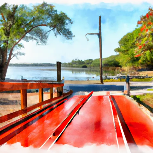
The ramp is described as a concrete boat ramp that is relatively wide, with enough space for multiple vehicles and boats at the same time. The latest available information suggests that the ramp is well-maintained and in good condition, making it easy for boaters to launch and retrieve their vessels.
As for the body of water that the ramp services, the Cooper River is a navigable waterway that flows for approximately 50 miles before emptying into the Atlantic Ocean. Boaters can use this river for a variety of purposes, including fishing, recreational boating, and transportation.
In terms of the types of craft that are permitted on the water, the Cooper River is generally open to most types of vessels, including powerboats, sailboats, kayaks, and canoes. However, it is always advisable to check with local authorities and regulations to ensure that your particular craft and boating activities are allowed on the water.
Overall, the Cannon Bridge Road boat ramp appears to be a well-maintained and convenient option for boaters looking to access the Cooper River in South Carolina.
Plan your launch down to the hour
Same weather feed Snoflo's iOS app uses -- updated continuously from NOAA / yr.no.
Next 5 days, hour by hour
Temperature line with weather symbols on top, snow + rain accumulation as columns, humidity as a dotted line.
5-day forecast table
Every 3 hours, broken out across temperature, snow, rain, humidity, and wind.
| Time | Condition | Temp (°F) | Snow (in) | Rain (in) | Humidity (%) | Wind (mps) | Wind dir |
|---|---|---|---|---|---|---|---|
| Loading detailed forecast… | |||||||
15-day temperature & precipitation
Daily temperatures, snow, and rain projected over the next two weeks.
Area streamflow levels
USGS streamgauges around Cannon Bridge Road , -- the same readings that determine whether your launch is safe and your boat is the right craft.
| Streamgauge | Discharge | View |
|---|---|---|
| South Fork Edisto River Near Bamberg | 387 cfs | → |
| South Fork Edisto River Near Cope | 381 cfs | → |
| South Fork Edisto River Near Denmark | 423 cfs | → |
| North Fork Edisto River At Orangeburg | 389 cfs | → |
| Salkehatchie River Near Miley | 50 cfs | → |
Plan a longer trip
The closest paddle runs, fishing spots, and other boat launches so you can extend a day on the water.
Boating safety & etiquette
- Check the conditions before you launch
- Use the streamflow numbers, weather, and wind forecast on this page. High-cfs whitewater requires whitewater-specific craft and skill.
- Wear your life jacket
- Statistically the single biggest survival factor in a boating incident. State law often requires one per passenger.
- File a float plan
- Tell someone on shore your put-in, take-out, and expected return time. Especially for multi-day or remote trips.
- Yield at the ramp
- Prep gear in the parking lot, not on the ramp. Launch and clear quickly so others can use the lane.
- Clean, drain, dry
- Inspect, clean, drain and dry your boat between waters to prevent the spread of aquatic invasive species.
Set push alerts in the Snoflo app
Save Cannon Bridge Road , as a favorite, set a discharge threshold or a wind/precipitation alert, and the iOS app will push the moment conditions cross.
About Cannon Bridge Road ,
Can I launch a motorboat here?
Most Snoflo-tracked launches support motorboats; check the operator for any horsepower restrictions, paddle-only zones, or seasonal closures.
How fresh is the streamflow data?
USGS streamgauges report continuously (every 15 minutes); the table on this page pulls the latest reading at page load.
Is there a fee?
Many federal and state boat launches charge a day-use fee. Check the operator's site before driving out.
What boat is right for these conditions?
Use the nearby streamflow numbers and river-run panel on this page to gauge current conditions. Wider, slower water is friendly for casual paddling and powerboats; high-cfs whitewater requires whitewater-specific craft and skill.
Can I get alerts when conditions change?
Yes -- alerts are managed in the Snoflo iOS app. Favorite this launch, set a threshold (discharge, wind), and you'll get a push the moment it crosses.
Other launches near here
Snoflo-tracked boat launches within driving distance of Cannon Bridge Road ,.