Lake Michigan -- Red Arrow City Park Boat Launch
Community Reviews
Been here? Share the conditions.
Reviews, ratings & photos are added in the free Snoflo iOS app — rate a spot, tag the conditions, and your visit is verified by location. Add or manage your reviews from the app.
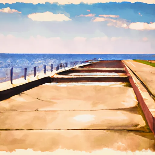
Lake Michigan -- Red Arrow City Park
As a public ramp, it can accommodate a wide range of watercraft, including powerboats, sailboats, kayaks, canoes, and jet skis. However, there may be restrictions on the size of watercraft that can be launched, depending on the water level and weather conditions. Therefore, it is recommended that boaters check local regulations and weather conditions before launching.
In terms of facilities, the ramp has a parking area for vehicles and trailers, as well as restrooms and picnic areas nearby. The ramp can get busy during peak season, so it is advisable to arrive early to avoid crowds and to ensure a smooth launch.
Overall, the Lake Michigan - Red Arrow City Park ramp is a popular and well-maintained facility that provides convenient access to one of the largest freshwater lakes in the world. It is suitable for a variety of watercraft and is a great starting point for exploring the natural beauty and recreational opportunities of Lake Michigan.
Plan your launch down to the hour
Same weather feed Snoflo's iOS app uses -- updated continuously from NOAA / yr.no.
Next 5 days, hour by hour
Temperature line with weather symbols on top, snow + rain accumulation as columns, humidity as a dotted line.
5-day forecast table
Every 3 hours, broken out across temperature, snow, rain, humidity, and wind.
| Time | Condition | Temp (°F) | Snow (in) | Rain (in) | Humidity (%) | Wind (mps) | Wind dir |
|---|---|---|---|---|---|---|---|
| Loading detailed forecast… | |||||||
15-day temperature & precipitation
Daily temperatures, snow, and rain projected over the next two weeks.
Area streamflow levels
USGS streamgauges around Lake Michigan -- Red Arrow City Park -- the same readings that determine whether your launch is safe and your boat is the right craft.
| Streamgauge | Discharge | View |
|---|---|---|
| Manitowoc River At Manitowoc | 35 cfs | → |
| Sheboygan River At Sheboygan | 66 cfs | → |
| Otter Creek At Willow Road Near Plymouth | 31 cfs | → |
| Kewaunee River Near Kewaunee | 27 cfs | → |
| East River At Ct Highway Zz Near Greenleaf | 1 cfs | → |
Plan a longer trip
The closest paddle runs, fishing spots, and other boat launches so you can extend a day on the water.
Boating safety & etiquette
- Check the conditions before you launch
- Use the streamflow numbers, weather, and wind forecast on this page. High-cfs whitewater requires whitewater-specific craft and skill.
- Wear your life jacket
- Statistically the single biggest survival factor in a boating incident. State law often requires one per passenger.
- File a float plan
- Tell someone on shore your put-in, take-out, and expected return time. Especially for multi-day or remote trips.
- Yield at the ramp
- Prep gear in the parking lot, not on the ramp. Launch and clear quickly so others can use the lane.
- Clean, drain, dry
- Inspect, clean, drain and dry your boat between waters to prevent the spread of aquatic invasive species.
Set push alerts in the Snoflo app
Save Lake Michigan -- Red Arrow City Park as a favorite, set a discharge threshold or a wind/precipitation alert, and the iOS app will push the moment conditions cross.
About Lake Michigan -- Red Arrow City Park
Can I launch a motorboat here?
Most Snoflo-tracked launches support motorboats; check the operator for any horsepower restrictions, paddle-only zones, or seasonal closures.
How fresh is the streamflow data?
USGS streamgauges report continuously (every 15 minutes); the table on this page pulls the latest reading at page load.
Is there a fee?
Many federal and state boat launches charge a day-use fee. Check the operator's site before driving out.
What boat is right for these conditions?
Use the nearby streamflow numbers and river-run panel on this page to gauge current conditions. Wider, slower water is friendly for casual paddling and powerboats; high-cfs whitewater requires whitewater-specific craft and skill.
Can I get alerts when conditions change?
Yes -- alerts are managed in the Snoflo iOS app. Favorite this launch, set a threshold (discharge, wind), and you'll get a push the moment it crosses.
Other launches near here
Snoflo-tracked boat launches within driving distance of Lake Michigan -- Red Arrow City Park.