Little River Boat Launch Boat Launch
Community Reviews
Been here? Share the conditions.
Reviews, ratings & photos are added in the free Snoflo iOS app — rate a spot, tag the conditions, and your visit is verified by location. Add or manage your reviews from the app.
Little River Boat Launch
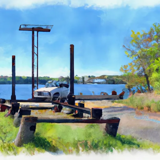
Based on the latest available information, the Little River Boat Launch is a concrete boat ramp located in Door County, Wisconsin. It is approximately 12 feet wide and 92 feet long, providing sufficient space for small to medium-sized watercraft. The ramp features a gentle slope, making it easy for boaters to launch and retrieve their vessels.
The Little River Boat Launch services the Little River, which flows into Green Bay. This body of water is a popular destination for anglers and boaters alike, offering a variety of fish species such as walleye, smallmouth bass, and northern pike. Additionally, the Little River is a picturesque location, offering scenic views of the surrounding forested areas.
As for the types of craft permitted on the water, Wisconsin Department of Natural Resources mandates that all boats equipped with motors must be registered and have valid Wisconsin registration stickers. Non-motorized watercraft, such as canoes, kayaks, and paddleboards, are not required to be registered but must still comply with state safety regulations.
In conclusion, the Little River Boat Launch is a concrete boat ramp in Door County, Wisconsin, serving the Little River that flows into Green Bay. It is 12 feet wide, 92 feet long, and can accommodate small to medium-sized watercraft. The boat ramp is a popular destination for anglers and boaters, and motorized boats must be registered.
Plan your launch down to the hour
Same weather feed Snoflo's iOS app uses -- updated continuously from NOAA / yr.no.
Next 5 days, hour by hour
Temperature line with weather symbols on top, snow + rain accumulation as columns, humidity as a dotted line.
5-day forecast table
Every 3 hours, broken out across temperature, snow, rain, humidity, and wind.
| Time | Condition | Temp (°F) | Snow (in) | Rain (in) | Humidity (%) | Wind (mps) | Wind dir |
|---|---|---|---|---|---|---|---|
| Loading detailed forecast… | |||||||
15-day temperature & precipitation
Daily temperatures, snow, and rain projected over the next two weeks.
Area streamflow levels
USGS streamgauges around Little River Boat Launch -- the same readings that determine whether your launch is safe and your boat is the right craft.
| Streamgauge | Discharge | View |
|---|---|---|
| Peshtigo River At Peshtigo | 329 cfs | → |
| Peshtigo River At Porterfield | 338 cfs | → |
| Menominee River Near Mc Allister | 1,730 cfs | → |
| Oconto River Near Oconto | 343 cfs | → |
| Menominee River At Koss | 1,770 cfs | → |
Plan a longer trip
The closest paddle runs, fishing spots, and other boat launches so you can extend a day on the water.
Other boat launches
Boating safety & etiquette
- Check the conditions before you launch
- Use the streamflow numbers, weather, and wind forecast on this page. High-cfs whitewater requires whitewater-specific craft and skill.
- Wear your life jacket
- Statistically the single biggest survival factor in a boating incident. State law often requires one per passenger.
- File a float plan
- Tell someone on shore your put-in, take-out, and expected return time. Especially for multi-day or remote trips.
- Yield at the ramp
- Prep gear in the parking lot, not on the ramp. Launch and clear quickly so others can use the lane.
- Clean, drain, dry
- Inspect, clean, drain and dry your boat between waters to prevent the spread of aquatic invasive species.
Set push alerts in the Snoflo app
Save Little River Boat Launch as a favorite, set a discharge threshold or a wind/precipitation alert, and the iOS app will push the moment conditions cross.
About Little River Boat Launch
Can I launch a motorboat here?
Most Snoflo-tracked launches support motorboats; check the operator for any horsepower restrictions, paddle-only zones, or seasonal closures.
How fresh is the streamflow data?
USGS streamgauges report continuously (every 15 minutes); the table on this page pulls the latest reading at page load.
Is there a fee?
Many federal and state boat launches charge a day-use fee. Check the operator's site before driving out.
What boat is right for these conditions?
Use the nearby streamflow numbers and river-run panel on this page to gauge current conditions. Wider, slower water is friendly for casual paddling and powerboats; high-cfs whitewater requires whitewater-specific craft and skill.
Can I get alerts when conditions change?
Yes -- alerts are managed in the Snoflo iOS app. Favorite this launch, set a threshold (discharge, wind), and you'll get a push the moment it crosses.
Other launches near here
Snoflo-tracked boat launches within driving distance of Little River Boat Launch.