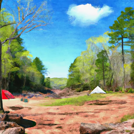
Gunflint Wilderness Camp Campground
Community Reviews
Been here? Share the conditions.
Reviews, ratings & photos are added in the free Snoflo iOS app — rate a spot, tag the conditions, and your visit is verified by location. Add or manage your reviews from the app.
Gunflint Wilderness Camp
Reservations are accepted at Gunflint Wilderness Camp, allowing campers to secure their spot in advance. This is particularly recommended during peak season when the campground tends to get crowded. Speaking of the best time to visit, it is suggested to plan a trip during the summer months, from June to August, when the weather is pleasant for outdoor activities like hiking, fishing, and boating.
While camping at Gunflint Wilderness Camp, campers should be aware of a few things. Firstly, it is important to always practice proper food storage to avoid encounters with wildlife, as the campground is located in a wilderness area. Additionally, campers should be cautious of ticks and mosquitoes, so it is advisable to bring insect repellent. Lastly, it is always recommended to check the current weather conditions and be prepared for sudden changes in temperature and precipitation. Overall, Gunflint Wilderness Camp offers a beautiful and well-equipped camping experience for nature enthusiasts in Arkansas.
What's on-site at Gunflint Wilderness Camp
Key facilities Snoflo tracks for this campground. Confirm with the operator before booking -- amenities can change seasonally.
Plan your trip down to the hour
Same weather feed Snoflo's iOS app uses -- updated continuously from NOAA / yr.no.
Next 5 days, hour by hour
Temperature line with weather symbols on top, snow + rain accumulation as columns, humidity as a dotted line.
5-day forecast table
Every 3 hours, broken out across temperature, snow, rain, humidity, and wind. Each cell is colour-coded relative to the column min/max so trends jump out at a glance.
| Time | Condition | Temp (°F) | Snow (in) | Rain (in) | Humidity (%) | Wind (mps) | Wind dir |
|---|---|---|---|---|---|---|---|
| Loading detailed forecast… | |||||||
15-day temperature & precipitation
Daily temperatures, snow, and rain projected over the next two weeks. Hover any point for the full breakdown.
Other campgrounds in the area
Snoflo-tracked campsites within driving distance of Gunflint Wilderness Camp, with reservations status.
| Campground | Reservations | Toilets | View |
|---|---|---|---|
| Camp Birchwood For Boys | ✗ | ✗ | → |
| Trails End Campground | ✗ | ✗ | → |
| Cte-Usda National Forest | ✗ | ✗ | → |
| Ham Lake | ✗ | ✗ | → |
| Gunflint Pines Resort & Campground | ✗ | ✗ | → |
Nearby streamflow
USGS streamgauges within reach of Gunflint Wilderness Camp -- pulled live from the National Water Information System.
| Streamgauge | Discharge | View |
|---|---|---|
| Kawishiwi River Near Ely | 51 cfs | → |
| Basswood River Near Winton | 413 cfs | → |
| South Kawishiwi River Near Ely | 85 cfs | → |
| South Kawishiwi R Abv White Iron Lake Nr Ely | 105 cfs | → |
| Pigeon River At Middle Falls Nr Grand Portage Mn | 121 cfs | → |
Nearby snow depths
NRCS SNOTEL stations within reach of Gunflint Wilderness Camp -- relevant when planning a shoulder-season or alpine trip.
| SNOTEL station | Snowpack | 24h Snowfall | View |
|---|---|---|---|
| Gunflint Lake | 0.0 in | 0.0 in | → |
| Grand Marais 36.2 Nw | 0.0 in | 0.0 in | → |
| Grand Marais 30.5 Nw | 0.0 in | 0.0 in | → |
| Ely 25e | 14.0 in | 0.0 in | → |
| Grand Marais 4.4 W | 0.0 in | 0.0 in | → |
| Nohrsc Grand Marais 4.4 Wsw | 0.0 in | 0.0 in | → |
Plan a longer trip
The closest parks, lakes, boat launches, and paddle runs so a camping night can grow into a full weekend.
Parks
Boat launches
Fishing spots
Points of interest
- Gunflint Trail Historical Society
- Chik-Wauk Museum And Nature Center
- Magnetic Rock
- Hog Creek Trail Launch
Paddle runs
- North Temperance Lake In T63n, R4w To Bwcaw Boundary In T62n, R4w
- Horshoe Lake In T64n, R1w To Bwcaw Boundary
- Bwcaw Boundary To Confluence With Plouff Creek
- Bwcaw Boundary To Forest Boundary In T62n, R2e
- Confluence With Plouff Creek To Lake Superior In T59n, R4w
- South Fowl Lake In T64n, R3e To Lake Superior In T64n, R7e
Camping essentials & Leave No Trace
- Pack it in, pack it out
- Take all trash, food scraps, and gear back with you to keep campsites clean and protect wildlife.
- Respect wildlife
- Observe animals from a distance, store food securely, and never feed wildlife to maintain natural behavior and safety.
- Know before you go
- Check weather, fire restrictions, trail conditions, and permit requirements to ensure a safe and well-planned trip.
- Minimize campfire impact
- Use established fire rings, keep fires small, fully extinguish them, or opt for a camp stove when fires are restricted.
- Leave what you find
- Preserve natural and cultural features by avoiding removal of plants, rocks, artifacts, or other elements of the environment.
Set push alerts in the Snoflo app
Save Gunflint Wilderness Camp as a favorite, set a custom threshold (precipitation, snowpack, freezing temperatures), and the iOS app will push the moment conditions cross.
About Gunflint Wilderness Camp
Can I make reservations at Gunflint Wilderness Camp?
This campground does not appear to accept reservations -- it's typically first-come, first-served. Arrive early on summer weekends.
How fresh is the weather data on this page?
The hourly forecast updates throughout the day from the NOAA / yr.no public feeds. Streamflow data is pulled live from USGS streamgauges and snowpack from the NRCS SNOTEL network.
What's the best time of year to visit?
Use the 15-day temperature & precipitation outlook on this page to plan -- pick a window with comfortable temperatures and low precipitation. For longer trips, the 5-day hourly meteogram shows snow + rain accumulation hour-by-hour.
How do I get to Gunflint Wilderness Camp?
Tap Directions in the hero above to open driving directions in Google Maps, or Open in map to center the Snoflo interactive map on the campground.
Can I get alerts when conditions change?
Yes -- alerts are managed through the Snoflo iOS app. Favorite this campground, set a threshold (temperature, snowpack, precipitation), and you'll get a push the moment it crosses.
Other campgrounds near here
Snoflo-tracked campgrounds within driving distance of Gunflint Wilderness Camp.