Mooney Dam County Park Campground
Community Reviews
Been here? Share the conditions.
Reviews, ratings & photos are added in the free Snoflo iOS app — rate a spot, tag the conditions, and your visit is verified by location. Add or manage your reviews from the app.
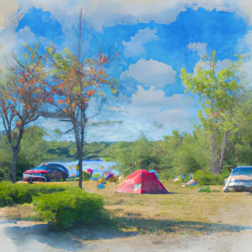
Mooney Dam County Park
Reservations are accepted at Mooney Dam County Park, allowing campers to secure a spot in advance. This feature ensures that visitors can plan their trips smoothly and avoid any last-minute disappointments. It is recommended to make reservations, especially during peak seasons, to guarantee availability.
The best time to visit Mooney Dam County Park is during the summer months when the weather is favorable for outdoor activities such as hiking, fishing, and boating. The park boasts beautiful trails that offer breathtaking views of the surrounding landscape. Campers should be cautious during tick season and take necessary precautions to prevent tick bites. Additionally, it is advised to be mindful of the water levels in the dam area and follow any safety guidelines provided by the park authorities.
Overall, Mooney Dam County Park in Wisconsin is a well-equipped campground that provides a serene and enjoyable experience for nature lovers.
What's on-site at Mooney Dam County Park
Key facilities Snoflo tracks for this campground. Confirm with the operator before booking -- amenities can change seasonally.
Plan your trip down to the hour
Same weather feed Snoflo's iOS app uses -- updated continuously from NOAA / yr.no.
Next 5 days, hour by hour
Temperature line with weather symbols on top, snow + rain accumulation as columns, humidity as a dotted line.
5-day forecast table
Every 3 hours, broken out across temperature, snow, rain, humidity, and wind. Each cell is colour-coded relative to the column min/max so trends jump out at a glance.
| Time | Condition | Temp (°F) | Snow (in) | Rain (in) | Humidity (%) | Wind (mps) | Wind dir |
|---|---|---|---|---|---|---|---|
| Loading detailed forecast… | |||||||
15-day temperature & precipitation
Daily temperatures, snow, and rain projected over the next two weeks. Hover any point for the full breakdown.
Other campgrounds in the area
Snoflo-tracked campsites within driving distance of Mooney Dam County Park, with reservations status.
| Campground | Reservations | Toilets | View |
|---|---|---|---|
| Mooney Dam Cp | ✗ | ✓ | → |
| Lucius Woods County Park | ✗ | ✓ | → |
| Cable Campground | ✗ | ✗ | → |
| Phipps Landing | ✗ | ✗ | → |
| Phipps Landing - St. Croix National Scenic River | ✗ | ✓ | → |
Nearby streamflow
USGS streamgauges within reach of Mooney Dam County Park -- pulled live from the National Water Information System.
| Streamgauge | Discharge | View |
|---|---|---|
| Namekagon River At Leonards | 63 cfs | → |
| Bois Brule River At Brule | 109 cfs | → |
| North Fish Creek Near Moquah | 55 cfs | → |
| St. Croix River Near Danbury | 642 cfs | → |
| Nemadji River Near South Superior | 85 cfs | → |
| White River Near Ashland | 178 cfs | → |
Nearby snow depths
NRCS SNOTEL stations within reach of Mooney Dam County Park -- relevant when planning a shoulder-season or alpine trip.
| SNOTEL station | Snowpack | 24h Snowfall | View |
|---|---|---|---|
| Hayward 9.2 Nne | 0.0 in | 0.0 in | → |
| Ranger Station | 0.0 in | 0.0 in | → |
| Springbrook 4.0 N | 0.0 in | 0.0 in | → |
| Iron River 5.4 Sse | 0.0 in | 0.0 in | → |
| Hayward 4.4 Sse | 0.0 in | 0.0 in | → |
| South Range 7.0 Sse | 18.5 in | 0.0 in | → |
Plan a longer trip
The closest parks, lakes, boat launches, and paddle runs so a camping night can grow into a full weekend.
Parks
- Mooney Dam County Park
- Totagatic Wildlife Area
- Brule River State Forest
- Lucius Woods State Park
- Uhrenholdt Memorial State Forest
- Wilderness Rainbow Lake
Boat launches
- Lower Eau Claire Lake -- Mooney Dam Park Boat Landing
- Middle Eau Claire Lake -- Access At Boat Landing Rd.
- Pickerel Lake -- Access At Pickerel Lake Fishery Area
- Upper Eau Claire Lake -- Access At Peninsula Road
- Alexander Lake -- E Alexander Lake Rd Access
- Beauregard Lake -- Access At N End Lk Off Beauregard Lake Rd
Camping essentials & Leave No Trace
- Pack it in, pack it out
- Take all trash, food scraps, and gear back with you to keep campsites clean and protect wildlife.
- Respect wildlife
- Observe animals from a distance, store food securely, and never feed wildlife to maintain natural behavior and safety.
- Know before you go
- Check weather, fire restrictions, trail conditions, and permit requirements to ensure a safe and well-planned trip.
- Minimize campfire impact
- Use established fire rings, keep fires small, fully extinguish them, or opt for a camp stove when fires are restricted.
- Leave what you find
- Preserve natural and cultural features by avoiding removal of plants, rocks, artifacts, or other elements of the environment.
Set push alerts in the Snoflo app
Save Mooney Dam County Park as a favorite, set a custom threshold (precipitation, snowpack, freezing temperatures), and the iOS app will push the moment conditions cross.
About Mooney Dam County Park
Can I make reservations at Mooney Dam County Park?
This campground does not appear to accept reservations -- it's typically first-come, first-served. Arrive early on summer weekends.
How fresh is the weather data on this page?
The hourly forecast updates throughout the day from the NOAA / yr.no public feeds. Streamflow data is pulled live from USGS streamgauges and snowpack from the NRCS SNOTEL network.
What's the best time of year to visit?
Use the 15-day temperature & precipitation outlook on this page to plan -- pick a window with comfortable temperatures and low precipitation. For longer trips, the 5-day hourly meteogram shows snow + rain accumulation hour-by-hour.
How do I get to Mooney Dam County Park?
Tap Directions in the hero above to open driving directions in Google Maps, or Open in map to center the Snoflo interactive map on the campground.
Can I get alerts when conditions change?
Yes -- alerts are managed through the Snoflo iOS app. Favorite this campground, set a threshold (temperature, snowpack, precipitation), and you'll get a push the moment it crosses.
Other campgrounds near here
Snoflo-tracked campgrounds within driving distance of Mooney Dam County Park.