South Fourche Recreation Area Campground
Community Reviews
Been here? Share the conditions.
Reviews, ratings & photos are added in the free Snoflo iOS app — rate a spot, tag the conditions, and your visit is verified by location. Add or manage your reviews from the app.
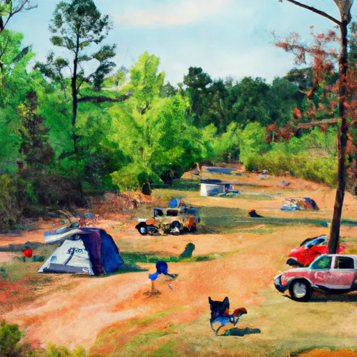
South Fourche Recreation Area
Reservations are not accepted at South Fourche Recreation Area, making it a first-come, first-served campground. It is recommended to arrive early, especially during peak seasons, to secure a camping spot. The best time to visit this camping area is generally during the spring and fall when the weather is pleasant, and the foliage adds to the scenic beauty. Summers can be hot and humid, while winters can be cold, so it is advisable to check the weather forecast before planning a trip.
While camping at South Fourche Recreation Area, visitors can explore various activities such as hiking, fishing, and wildlife watching. The surrounding Fourche LaFave River offers opportunities for fishing enthusiasts. However, caution must be exercised as the river's current can be strong. It is important to be aware of wildlife in the area and take necessary precautions to avoid encounters. Overall, South Fourche Recreation Area is a fantastic camping destination for nature lovers seeking a tranquil and adventurous experience in Arkansas.
What's on-site at South Fourche Recreation Area
Key facilities Snoflo tracks for this campground. Confirm with the operator before booking -- amenities can change seasonally.
Plan your trip down to the hour
Same weather feed Snoflo's iOS app uses -- updated continuously from NOAA / yr.no.
Next 5 days, hour by hour
Temperature line with weather symbols on top, snow + rain accumulation as columns, humidity as a dotted line.
5-day forecast table
Every 3 hours, broken out across temperature, snow, rain, humidity, and wind. Each cell is colour-coded relative to the column min/max so trends jump out at a glance.
| Time | Condition | Temp (°F) | Snow (in) | Rain (in) | Humidity (%) | Wind (mps) | Wind dir |
|---|---|---|---|---|---|---|---|
| Loading detailed forecast… | |||||||
15-day temperature & precipitation
Daily temperatures, snow, and rain projected over the next two weeks. Hover any point for the full breakdown.
Other campgrounds in the area
Snoflo-tracked campsites within driving distance of South Fourche Recreation Area, with reservations status.
| Campground | Reservations | Toilets | View |
|---|---|---|---|
| River Road | ✓ | ✗ | → |
| Quarry Cove | ✗ | ✗ | → |
| County Line | ✓ | ✗ | → |
| Carter Cove | ✓ | ✗ | → |
| Lena Landing - Lake Ouachita | ✗ | ✓ | → |
Nearby streamflow
USGS streamgauges within reach of South Fourche Recreation Area -- pulled live from the National Water Information System.
| Streamgauge | Discharge | View |
|---|---|---|
| Fourche Lafave River Near Aplin | 326 cfs | → |
| Alum Fork Saline River Near Reform | 1 cfs | → |
| Maumelle River At Williams Junction | 4 cfs | → |
| Petit Jean River At Danville | 432 cfs | → |
| West Fork Hot Springs Creek At Hot Springs | · | → |
| Lake Maumelle At State Hwy 10 Near Wye | 293 cfs | → |
Plan a longer trip
The closest parks, lakes, boat launches, and paddle runs so a camping night can grow into a full weekend.
Parks
- Flatside Wilderness
- Oak Mountain National Game Refuge
- Iron Spring Roadside Park
- Petit Jean River Wildlife Management Area
- Holla Bend National Wildlife Refuge
- Lake Ouachita State Park
Boat launches
- Quarry Cove Recreation Area
- Carden Point Recreation Area
- Anderson Branch
- South Fourche Site Six Reservoir
- Carter Cove Recreation Area
- Lake Winona
Fishing spots
Points of interest
- Wallace Bridge Road
- Davies Bridge
- Magic Springs Theme & Water Park
- Bathhouse Row
- Hot Springs Confederate Monument
- County Road 35
Paddle runs
- Headwaters Sec 2, T1n, R20w To Sec 7, T1n, R19w
- Headwaters Sec 2, T2n, R18w To Forest Road 132c
- Lake Winona Dam To Southern Line Of Sec 16, T2n, R17w
- Forest Road 132c To Forest Raod 179
- Forest Road 179 To East Line Of Nw 1/4 Sec 22, T2n, R17w
- East Line Of Nw 1/4, Sec 22, T2n, R17w To West Line Of Sec 26, T2n, R17w
Camping essentials & Leave No Trace
- Pack it in, pack it out
- Take all trash, food scraps, and gear back with you to keep campsites clean and protect wildlife.
- Respect wildlife
- Observe animals from a distance, store food securely, and never feed wildlife to maintain natural behavior and safety.
- Know before you go
- Check weather, fire restrictions, trail conditions, and permit requirements to ensure a safe and well-planned trip.
- Minimize campfire impact
- Use established fire rings, keep fires small, fully extinguish them, or opt for a camp stove when fires are restricted.
- Leave what you find
- Preserve natural and cultural features by avoiding removal of plants, rocks, artifacts, or other elements of the environment.
Set push alerts in the Snoflo app
Save South Fourche Recreation Area as a favorite, set a custom threshold (precipitation, snowpack, freezing temperatures), and the iOS app will push the moment conditions cross.
About South Fourche Recreation Area
Can I make reservations at South Fourche Recreation Area?
This campground does not appear to accept reservations -- it's typically first-come, first-served. Arrive early on summer weekends.
How fresh is the weather data on this page?
The hourly forecast updates throughout the day from the NOAA / yr.no public feeds. Streamflow data is pulled live from USGS streamgauges and snowpack from the NRCS SNOTEL network.
What's the best time of year to visit?
Use the 15-day temperature & precipitation outlook on this page to plan -- pick a window with comfortable temperatures and low precipitation. For longer trips, the 5-day hourly meteogram shows snow + rain accumulation hour-by-hour.
How do I get to South Fourche Recreation Area?
Tap Directions in the hero above to open driving directions in Google Maps, or Open in map to center the Snoflo interactive map on the campground.
Can I get alerts when conditions change?
Yes -- alerts are managed through the Snoflo iOS app. Favorite this campground, set a threshold (temperature, snowpack, precipitation), and you'll get a push the moment it crosses.
Other campgrounds near here
Snoflo-tracked campgrounds within driving distance of South Fourche Recreation Area.