Rucky A Chucky - Auburn State Rec Area campground
Community Reviews
Been here? Share the conditions.
Reviews, ratings & photos are added in the free Snoflo iOS app — rate a spot, tag the conditions, and your visit is verified by location. Add or manage your reviews from the app.
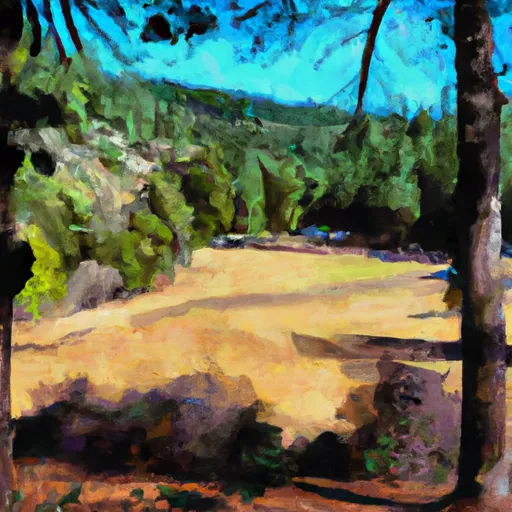
Rucky A Chucky - Auburn State Rec Area
Reservations are required to secure a camping spot at Rucky A Chucky. It is highly recommended to book in advance, especially during peak seasons, as this campground tends to fill up quickly. Campers can make reservations online or by phone, guaranteeing their spot and avoiding any disappointment upon arrival.
The best time to visit Rucky A Chucky - Auburn State Recreation Area is during the spring and fall seasons when the weather is mild and enjoyable. Summers can get hot, reaching high temperatures, so it's essential to pack plenty of water and sunscreen. Additionally, it is advised to be cautious of wildlife in the area, such as snakes and bears. Campers should be mindful of their surroundings and take necessary precautions to ensure a safe and enjoyable camping experience.
In summary, Rucky A Chucky - Auburn State Recreation Area offers a range of amenities for campers, including picnic tables, fire rings, and potable water. Reservations are required, and it is recommended to book in advance. The best time to visit is during spring and fall, while being cautious of wildlife in the area. Overall, this campground provides a picturesque setting for outdoor enthusiasts to enjoy various recreational activities.
What's on-site at Rucky A Chucky - Auburn State Rec Area
Key facilities Snoflo tracks for this campground. Confirm with the operator before booking -- amenities can change seasonally.
Plan your trip down to the hour
Same weather feed Snoflo's iOS app uses -- updated continuously from NOAA / yr.no.
Next 5 days, hour by hour
Temperature line with weather symbols on top, snow + rain accumulation as columns, humidity as a dotted line.
5-day forecast table
Every 3 hours, broken out across temperature, snow, rain, humidity, and wind. Each cell is colour-coded relative to the column min/max so trends jump out at a glance.
| Time | Condition | Temp (°F) | Snow (in) | Rain (in) | Humidity (%) | Wind (mps) | Wind dir |
|---|---|---|---|---|---|---|---|
| Loading detailed forecast… | |||||||
15-day temperature & precipitation
Daily temperatures, snow, and rain projected over the next two weeks. Hover any point for the full breakdown.
Other campgrounds in the area
Snoflo-tracked campsites within driving distance of Rucky A Chucky - Auburn State Rec Area, with reservations status.
| Campground | Reservations | Toilets | View |
|---|---|---|---|
| Georgetown Airport Campground | ✗ | ✗ | → |
| Bear River County Park | ✗ | ✓ | → |
| Dru Barner | ✗ | ✗ | → |
| Dru Barner Campground | ✓ | ✗ | → |
| Mother Lode River Center | ✗ | ✗ | → |
Nearby streamflow
USGS streamgauges within reach of Rucky A Chucky - Auburn State Rec Area -- pulled live from the National Water Information System.
| Streamgauge | Discharge | View |
|---|---|---|
| Nf American R A North Fork Dam Ca | 84 cfs | → |
| Pilot C Bl Mutton Canyon Nr Georgetown Ca | 2 cfs | → |
| Pilot C Ab Stumpy Meadows Res Ca | 3 cfs | → |
| Deer C Nr Cameron Park Ca | 8 cfs | → |
| Dry C A Vernon St Bridge A Roseville Ca | 159 cfs | → |
| Deer C Nr Smartville Ca | 3 cfs | → |
Nearby snow depths
NRCS SNOTEL stations within reach of Rucky A Chucky - Auburn State Rec Area -- relevant when planning a shoulder-season or alpine trip.
| SNOTEL station | Snowpack | 24h Snowfall | View |
|---|---|---|---|
| Grass Valley No. 2 | 0.0 in | 0.0 in | → |
| Blue Canyon Alert | 0.0 in | 0.0 in | → |
| Blue Canyon | 21.0 in | 3.0 in | → |
| Soda Springs 1.5 Ssw | 0.0 in | 0.0 in | → |
| Nohrsc Meadow Lk Snow Course | 21.2 in | 0.2 in | → |
| Nohrsc Palisades Tahoe | 0.0 in | 0.0 in | → |
Plan a longer trip
The closest parks, lakes, boat launches, and paddle runs so a camping night can grow into a full weekend.
Parks
- Meadow Vista Park
- Ashford Park
- Auburn Ravine Trail Park
- Auburn Regional Park
- Auburn Recreation District 6
- Auburn Recreation District 4
Boat launches
- Auburn State Recreation Area (Lake Clementine )
- River Trail El Dorado County
- Oxbow Raft Put-In Site
- Rollins Lake
- Orchard Springs Resort
- Rattlesnake Road Placer County
Fishing spots
- Lake Clementine
- Lake Combie
- Pg&E Rock Creek Lake Fishing Access
- Lake Of The Pines
- Lake Rollins
- Folsom Lake
Camping essentials & Leave No Trace
- Pack it in, pack it out
- Take all trash, food scraps, and gear back with you to keep campsites clean and protect wildlife.
- Respect wildlife
- Observe animals from a distance, store food securely, and never feed wildlife to maintain natural behavior and safety.
- Know before you go
- Check weather, fire restrictions, trail conditions, and permit requirements to ensure a safe and well-planned trip.
- Minimize campfire impact
- Use established fire rings, keep fires small, fully extinguish them, or opt for a camp stove when fires are restricted.
- Leave what you find
- Preserve natural and cultural features by avoiding removal of plants, rocks, artifacts, or other elements of the environment.
Set push alerts in the Snoflo app
Save Rucky A Chucky - Auburn State Rec Area as a favorite, set a custom threshold (precipitation, snowpack, freezing temperatures), and the iOS app will push the moment conditions cross.
About Rucky A Chucky - Auburn State Rec Area
Can I make reservations at Rucky A Chucky - Auburn State Rec Area?
This campground does not appear to accept reservations -- it's typically first-come, first-served. Arrive early on summer weekends.
How fresh is the weather data on this page?
The hourly forecast updates throughout the day from the NOAA / yr.no public feeds. Streamflow data is pulled live from USGS streamgauges and snowpack from the NRCS SNOTEL network.
What's the best time of year to visit?
Use the 15-day temperature & precipitation outlook on this page to plan -- pick a window with comfortable temperatures and low precipitation. For longer trips, the 5-day hourly meteogram shows snow + rain accumulation hour-by-hour.
How do I get to Rucky A Chucky - Auburn State Rec Area?
Tap Directions in the hero above to open driving directions in Google Maps, or Open in map to center the Snoflo interactive map on the campground.
Can I get alerts when conditions change?
Yes -- alerts are managed through the Snoflo iOS app. Favorite this campground, set a threshold (temperature, snowpack, precipitation), and you'll get a push the moment it crosses.
Other campgrounds near here
Snoflo-tracked campgrounds within driving distance of Rucky A Chucky - Auburn State Rec Area.