Tish Tang Campground
Community Reviews
Been here? Share the conditions.
Reviews, ratings & photos are added in the free Snoflo iOS app — rate a spot, tag the conditions, and your visit is verified by location. Add or manage your reviews from the app.
Tish Tang
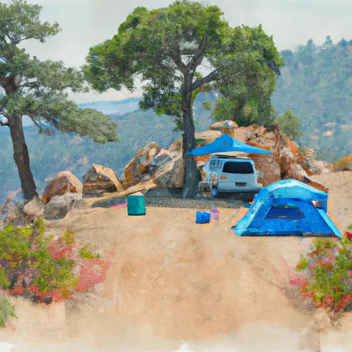
The campground amenities include potable water, picnic tables, fire rings, and vault toilets. The campground operates on a first-come, first-serve basis, with a total of 20 campsites available.
An interesting fact about Tish Tang is that it is named after a Native American legend involving a fierce battle between two tribes. The legend states that the area was once a sacred battleground.
The best time of year to visit Tish Tang is during the summer months when temperatures range from 60 to 80 degrees Fahrenheit. Visitors can enjoy warm weather and clear skies for outdoor activities. It is important to note that the campground is not accessible during the winter season due to heavy snowfall.
Overall, Tish Tang campground is a beautiful and peaceful retreat, perfect for those seeking a quiet getaway in nature.
What's on-site at Tish Tang
Key facilities Snoflo tracks for this campground. Confirm with the operator before booking -- amenities can change seasonally.
Plan your trip down to the hour
Same weather feed Snoflo's iOS app uses -- updated continuously from NOAA / yr.no.
Next 5 days, hour by hour
Temperature line with weather symbols on top, snow + rain accumulation as columns, humidity as a dotted line.
5-day forecast table
Every 3 hours, broken out across temperature, snow, rain, humidity, and wind. Each cell is colour-coded relative to the column min/max so trends jump out at a glance.
| Time | Condition | Temp (°F) | Snow (in) | Rain (in) | Humidity (%) | Wind (mps) | Wind dir |
|---|---|---|---|---|---|---|---|
| Loading detailed forecast… | |||||||
15-day temperature & precipitation
Daily temperatures, snow, and rain projected over the next two weeks. Hover any point for the full breakdown.
Other campgrounds in the area
Snoflo-tracked campsites within driving distance of Tish Tang, with reservations status.
| Campground | Reservations | Toilets | View |
|---|---|---|---|
| Kimtu Camping | ✗ | ✗ | → |
| Boise Creek Campground | ✓ | ✗ | → |
| Boise Creek | ✓ | ✓ | → |
| Grays Falls | ✗ | ✓ | → |
| Denny | ✗ | ✓ | → |
Nearby streamflow
USGS streamgauges within reach of Tish Tang -- pulled live from the National Water Information System.
| Streamgauge | Discharge | View |
|---|---|---|
| Trinity R A Hoopa Ca | 714 cfs | → |
| Redwood C Nr Blue Lake Ca | 7 cfs | → |
| Trinity R Nr Burnt Ranch Ca | 561 cfs | → |
| Klamath R A Orleans | 1,000 cfs | → |
| Little R Nr Trinidad Ca | 6 cfs | → |
| Mad R Nr Arcata Ca | 50 cfs | → |
Nearby snow depths
NRCS SNOTEL stations within reach of Tish Tang -- relevant when planning a shoulder-season or alpine trip.
| SNOTEL station | Snowpack | 24h Snowfall | View |
|---|---|---|---|
| Eureka | 0.0 in | 0.0 in | → |
| Big Flat | 0.0 in | 0.0 in | → |
| Nohrsc Red Rock Mountain | 0.0 in | 0.0 in | → |
| Nohrsc Middle Boulder 3 Snow Course | 0.0 in | 0.0 in | → |
Plan a longer trip
The closest parks, lakes, boat launches, and paddle runs so a camping night can grow into a full weekend.
Parks
- National Wild And Scenic River Klamath, California
- Redwood National And State Parks
- Arcata Community Forest
- Azalea State Reserve
- Pierson Park
- Little River State Beach
Boat launches
- Ishi-Pishi Road 797, Orleans
- Nordheimer Flat River Access
- Bloomer Falls River Access
- Methodist Creek River Access
- Butler Creek River Access
- Matthews Creek River Access
Fishing spots
Points of interest
Paddle runs
- Lacks Creek
- Sounthern Boundary Of Redwood National And State Parks To Northern Boundary Of Redwood National And State Parks
- Headwaters To Confluence With New River
- Headwaters In Sw 1/4, Sec 24, T8n, R12w To Trinity Wsr (At Hobo Gulch Trailhead And Campground)
- Mad River (Segment 2)
- Mad River (Segment 1)
Camping essentials & Leave No Trace
- Pack it in, pack it out
- Take all trash, food scraps, and gear back with you to keep campsites clean and protect wildlife.
- Respect wildlife
- Observe animals from a distance, store food securely, and never feed wildlife to maintain natural behavior and safety.
- Know before you go
- Check weather, fire restrictions, trail conditions, and permit requirements to ensure a safe and well-planned trip.
- Minimize campfire impact
- Use established fire rings, keep fires small, fully extinguish them, or opt for a camp stove when fires are restricted.
- Leave what you find
- Preserve natural and cultural features by avoiding removal of plants, rocks, artifacts, or other elements of the environment.
Set push alerts in the Snoflo app
Save Tish Tang as a favorite, set a custom threshold (precipitation, snowpack, freezing temperatures), and the iOS app will push the moment conditions cross.
About Tish Tang
Can I make reservations at Tish Tang?
This campground does not appear to accept reservations -- it's typically first-come, first-served. Arrive early on summer weekends.
How fresh is the weather data on this page?
The hourly forecast updates throughout the day from the NOAA / yr.no public feeds. Streamflow data is pulled live from USGS streamgauges and snowpack from the NRCS SNOTEL network.
What's the best time of year to visit?
Use the 15-day temperature & precipitation outlook on this page to plan -- pick a window with comfortable temperatures and low precipitation. For longer trips, the 5-day hourly meteogram shows snow + rain accumulation hour-by-hour.
How do I get to Tish Tang?
Tap Directions in the hero above to open driving directions in Google Maps, or Open in map to center the Snoflo interactive map on the campground.
Can I get alerts when conditions change?
Yes -- alerts are managed through the Snoflo iOS app. Favorite this campground, set a threshold (temperature, snowpack, precipitation), and you'll get a push the moment it crosses.
Other campgrounds near here
Snoflo-tracked campgrounds within driving distance of Tish Tang.