Upper Shake Campground Campground
Community Reviews
Been here? Share the conditions.
Reviews, ratings & photos are added in the free Snoflo iOS app — rate a spot, tag the conditions, and your visit is verified by location. Add or manage your reviews from the app.
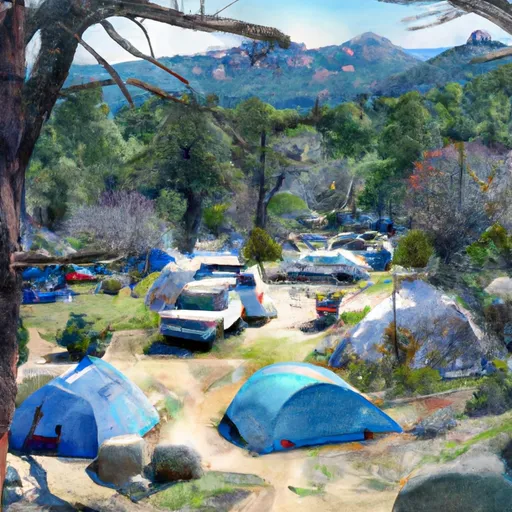
Upper Shake Campground
There are several nearby points of interest, including the scenic South Fork American River, where visitors can enjoy swimming, rafting, and fishing. The area also features several hiking trails, including the popular Pacific Crest Trail.
The campground offers several amenities, including picnic tables, fire pits, and access to potable water. There are 12 first-come-first-serve campsites available on a limited basis. Visitors are advised to arrive early to secure a spot.
An interesting fact about the area is that it was once home to a thriving gold mining community in the mid-1800s. The Shake Ridge Gold Rush drew thousands of people to the area, and many small mining towns sprung up in the surrounding hills.
The best time to visit Upper Shake Campground is during the summer months when temperatures are warm and ideal for outdoor activities. Average temperatures during this time range between 70-85 degrees Fahrenheit. However, visitors should be prepared for cooler nighttime temperatures in the upper 40s to lower 50s.
What's on-site at Upper Shake Campground
Key facilities Snoflo tracks for this campground. Confirm with the operator before booking -- amenities can change seasonally.
Plan your trip down to the hour
Same weather feed Snoflo's iOS app uses -- updated continuously from NOAA / yr.no.
Next 5 days, hour by hour
Temperature line with weather symbols on top, snow + rain accumulation as columns, humidity as a dotted line.
5-day forecast table
Every 3 hours, broken out across temperature, snow, rain, humidity, and wind. Each cell is colour-coded relative to the column min/max so trends jump out at a glance.
| Time | Condition | Temp (°F) | Snow (in) | Rain (in) | Humidity (%) | Wind (mps) | Wind dir |
|---|---|---|---|---|---|---|---|
| Loading detailed forecast… | |||||||
15-day temperature & precipitation
Daily temperatures, snow, and rain projected over the next two weeks. Hover any point for the full breakdown.
Other campgrounds in the area
Snoflo-tracked campsites within driving distance of Upper Shake Campground, with reservations status.
| Campground | Reservations | Toilets | View |
|---|---|---|---|
| Upper Shake | ✗ | ✓ | → |
| Cottonwood Campground | ✗ | ✗ | → |
| Bear | ✗ | ✗ | → |
| Bear Campground | ✓ | ✗ | → |
| Cienaga Campground | ✗ | ✗ | → |
Nearby streamflow
USGS streamgauges within reach of Upper Shake Campground -- pulled live from the National Water Information System.
| Streamgauge | Discharge | View |
|---|---|---|
| Piru C Ab Frenchmans Flat Ca | 16 cfs | → |
| Piru Creek Above Lake Piru Ca | 18 cfs | → |
| Piru Creek Below Santa Felicia Dam Ca | 21 cfs | → |
| Santa Clara R Nr Piru Ca | 25 cfs | → |
| Sespe C Nr Fillmore | 11 cfs | → |
| Big Tujunga C Bl Hansen Dam Ca | 2 cfs | → |
Plan a longer trip
The closest parks, lakes, boat launches, and paddle runs so a camping night can grow into a full weekend.
Parks
- Arthur B. Ripley Desert Woodland State Park
- Antelope Valley California Poppy Reserve
- Saint Francis Dam Disaster National Monument
- Castaic Lake State Recreational Area
- Del Valle County Park
- Castaic Sports Complex
Boat launches
- Elizabeth Lake
- Castaic Lake State Recreation Area (West)
- Castaic Lake State Recreation Area (East)
- Interstate 5, Lebec
- Csu Northridge Aquatic Center
- Vista Del Lago Road 21, Lebec
Fishing spots
Points of interest
Paddle runs
- Green Valley At The Nf Boundary To Site Of St Francis Dam Disaster
- Site Of St Francis Dam Disaster To Seco Canyon At The Nf Boundary
- Castaic To Pyramid Reservoir
- Lower Piru Creek (Oulet At Pyramid Reservoir) To Piru Reservoir
- Confluence With Gold Hill Creek To Castaic
- Wilderness Boundary To Confluence With Gold Hill Creek
Camping essentials & Leave No Trace
- Pack it in, pack it out
- Take all trash, food scraps, and gear back with you to keep campsites clean and protect wildlife.
- Respect wildlife
- Observe animals from a distance, store food securely, and never feed wildlife to maintain natural behavior and safety.
- Know before you go
- Check weather, fire restrictions, trail conditions, and permit requirements to ensure a safe and well-planned trip.
- Minimize campfire impact
- Use established fire rings, keep fires small, fully extinguish them, or opt for a camp stove when fires are restricted.
- Leave what you find
- Preserve natural and cultural features by avoiding removal of plants, rocks, artifacts, or other elements of the environment.
Set push alerts in the Snoflo app
Save Upper Shake Campground as a favorite, set a custom threshold (precipitation, snowpack, freezing temperatures), and the iOS app will push the moment conditions cross.
About Upper Shake Campground
Can I make reservations at Upper Shake Campground?
This campground does not appear to accept reservations -- it's typically first-come, first-served. Arrive early on summer weekends.
How fresh is the weather data on this page?
The hourly forecast updates throughout the day from the NOAA / yr.no public feeds. Streamflow data is pulled live from USGS streamgauges and snowpack from the NRCS SNOTEL network.
What's the best time of year to visit?
Use the 15-day temperature & precipitation outlook on this page to plan -- pick a window with comfortable temperatures and low precipitation. For longer trips, the 5-day hourly meteogram shows snow + rain accumulation hour-by-hour.
How do I get to Upper Shake Campground?
Tap Directions in the hero above to open driving directions in Google Maps, or Open in map to center the Snoflo interactive map on the campground.
Can I get alerts when conditions change?
Yes -- alerts are managed through the Snoflo iOS app. Favorite this campground, set a threshold (temperature, snowpack, precipitation), and you'll get a push the moment it crosses.
Other campgrounds near here
Snoflo-tracked campgrounds within driving distance of Upper Shake Campground.