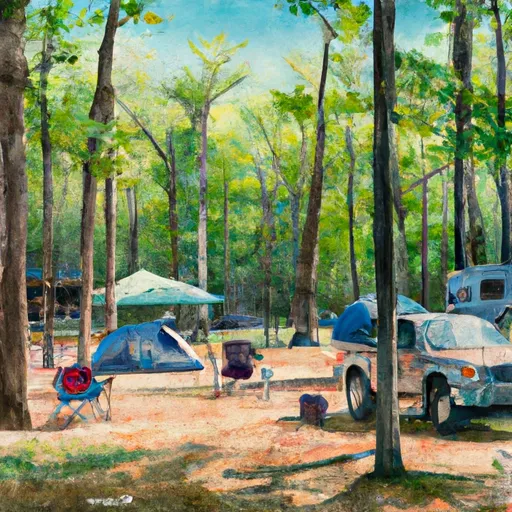
Sequoya Park Campground
Community Reviews
Been here? Share the conditions.
Reviews, ratings & photos are added in the free Snoflo iOS app — rate a spot, tag the conditions, and your visit is verified by location. Add or manage your reviews from the app.
Sequoya Park
Reservations are accepted at Sequoya Park camping area, which allows visitors to secure their preferred campsite in advance. It is recommended to make reservations, especially during peak seasons, to ensure availability. The campground is open year-round, but the best time to visit is during the spring and fall seasons when the weather is pleasant and the park is less crowded.
While visiting Sequoya Park camping area, campers can explore several points of interest nearby. The campground is situated in the beautiful Ozark Mountains, offering stunning views and opportunities for outdoor adventures such as hiking, mountain biking, and wildlife spotting. It is advisable to be cautious of wildlife encounters, including snakes and ticks, as these are prevalent in the area. Additionally, campers should be mindful of fire safety and follow any guidelines or restrictions provided by the park. Overall, Sequoya Park camping area is a well-equipped and scenic campground that provides a great opportunity for outdoor enthusiasts to enjoy the beauty of Arkansas.
What's on-site at Sequoya Park
Key facilities Snoflo tracks for this campground. Confirm with the operator before booking -- amenities can change seasonally.
Plan your trip down to the hour
Same weather feed Snoflo's iOS app uses -- updated continuously from NOAA / yr.no.
Next 5 days, hour by hour
Temperature line with weather symbols on top, snow + rain accumulation as columns, humidity as a dotted line.
5-day forecast table
Every 3 hours, broken out across temperature, snow, rain, humidity, and wind. Each cell is colour-coded relative to the column min/max so trends jump out at a glance.
| Time | Condition | Temp (°F) | Snow (in) | Rain (in) | Humidity (%) | Wind (mps) | Wind dir |
|---|---|---|---|---|---|---|---|
| Loading detailed forecast… | |||||||
15-day temperature & precipitation
Daily temperatures, snow, and rain projected over the next two weeks. Hover any point for the full breakdown.
Other campgrounds in the area
Snoflo-tracked campsites within driving distance of Sequoya Park, with reservations status.
| Campground | Reservations | Toilets | View |
|---|---|---|---|
| Cherokee | ✗ | ✗ | → |
| Point Remove Park | ✗ | ✗ | → |
| Petit Jean State Park | ✓ | ✗ | → |
| Harris Brake Lake Resort | ✗ | ✗ | → |
| Toad Suck Ferry Campground | ✗ | ✗ | → |
Nearby streamflow
USGS streamgauges within reach of Sequoya Park -- pulled live from the National Water Information System.
| Streamgauge | Discharge | View |
|---|---|---|
| West Fork Point Remove Creek Near Hattieville | 30 cfs | → |
| Fourche Lafave River Near Aplin | 268 cfs | → |
| Maumelle River At Williams Junction | 5 cfs | → |
| Lake Maumelle At State Hwy 10 Near Wye | 293 cfs | → |
| Alum Fork Saline River Near Reform | 1 cfs | → |
| Maumelle River At Maumelle Dam At Natural Steps | · | → |
Nearby snow depths
NRCS SNOTEL stations within reach of Sequoya Park -- relevant when planning a shoulder-season or alpine trip.
| SNOTEL station | Snowpack | 24h Snowfall | View |
|---|---|---|---|
| Alum Fork | 0.0 in | 0.0 in | → |
| Damascus 2 Nne | 0.0 in | 0.0 in | → |
| Alexander 4.5 Nw | 0.0 in | 0.0 in | → |
| Benton | 0.0 in | 0.0 in | → |
Plan a longer trip
The closest parks, lakes, boat launches, and paddle runs so a camping night can grow into a full weekend.
Parks
- Sequoya Park
- Ring Slough Wildlife Management Area
- Ed Gordon Point Remove Wildlife Management Area
- Petit Jean Mountain
- Harris Brake Wildlife Management Area
- Galla Creek Wildlife Management Area
Boat launches
- Cherokee Park
- Charlies Hidden Harbor
- Point Remove Park
- Simpson Street
- Lakeview Landing
- Overcup Landing
Fishing spots
Points of interest
- Davies Bridge
- Southeast 4th Street
- Missouri-Pacific Depot
- Conway Confederate Monument
- Wallace Bridge Road
- Lemley House Art Guild
Paddle runs
- Forest Road 132c To Forest Raod 179
- Headwaters Sec 2, T2n, R18w To Forest Road 132c
- Forest Road 179 To East Line Of Nw 1/4 Sec 22, T2n, R17w
- East Line Of Nw 1/4, Sec 22, T2n, R17w To West Line Of Sec 26, T2n, R17w
- Lake Winona Dam To Southern Line Of Sec 16, T2n, R17w
- Headwaters Sec 2, T1n, R20w To Sec 7, T1n, R19w
Camping essentials & Leave No Trace
- Pack it in, pack it out
- Take all trash, food scraps, and gear back with you to keep campsites clean and protect wildlife.
- Respect wildlife
- Observe animals from a distance, store food securely, and never feed wildlife to maintain natural behavior and safety.
- Know before you go
- Check weather, fire restrictions, trail conditions, and permit requirements to ensure a safe and well-planned trip.
- Minimize campfire impact
- Use established fire rings, keep fires small, fully extinguish them, or opt for a camp stove when fires are restricted.
- Leave what you find
- Preserve natural and cultural features by avoiding removal of plants, rocks, artifacts, or other elements of the environment.
Set push alerts in the Snoflo app
Save Sequoya Park as a favorite, set a custom threshold (precipitation, snowpack, freezing temperatures), and the iOS app will push the moment conditions cross.
About Sequoya Park
Can I make reservations at Sequoya Park?
Yes -- this campground accepts reservations. Snoflo recommends booking early for peak season; check the operator (Recreation.gov / state park system / private operator) for the booking window and cancellation policy.
How fresh is the weather data on this page?
The hourly forecast updates throughout the day from the NOAA / yr.no public feeds. Streamflow data is pulled live from USGS streamgauges and snowpack from the NRCS SNOTEL network.
What's the best time of year to visit?
Use the 15-day temperature & precipitation outlook on this page to plan -- pick a window with comfortable temperatures and low precipitation. For longer trips, the 5-day hourly meteogram shows snow + rain accumulation hour-by-hour.
How do I get to Sequoya Park?
Tap Directions in the hero above to open driving directions in Google Maps, or Open in map to center the Snoflo interactive map on the campground.
Can I get alerts when conditions change?
Yes -- alerts are managed through the Snoflo iOS app. Favorite this campground, set a threshold (temperature, snowpack, precipitation), and you'll get a push the moment it crosses.
Other campgrounds near here
Snoflo-tracked campgrounds within driving distance of Sequoya Park.