Vermilion Trail Campground
Community Reviews
Been here? Share the conditions.
Reviews, ratings & photos are added in the free Snoflo iOS app — rate a spot, tag the conditions, and your visit is verified by location. Add or manage your reviews from the app.
Vermilion Trail
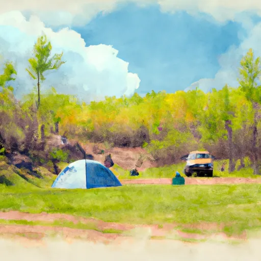
The campground has 33 campsites, with amenities such as fire rings, picnic tables, and access to potable water. There are also several vault toilets located throughout the camping area. The campsites are available on a first-come, first-served basis, so visitors should plan accordingly.
One interesting fact about the Vermilion Trail Camping Area is that it is located near the historic Vermilion Iron Range, which played a significant role in the development of the iron and steel industry in the region.
The best time to visit the Vermilion Trail Camping Area is during the summer months, when temperatures average in the mid-70s. Visitors should be aware that the campground is only open from May through September, so planning ahead is essential.
What's on-site at Vermilion Trail
Key facilities Snoflo tracks for this campground. Confirm with the operator before booking -- amenities can change seasonally.
Plan your trip down to the hour
Same weather feed Snoflo's iOS app uses -- updated continuously from NOAA / yr.no.
Next 5 days, hour by hour
Temperature line with weather symbols on top, snow + rain accumulation as columns, humidity as a dotted line.
5-day forecast table
Every 3 hours, broken out across temperature, snow, rain, humidity, and wind. Each cell is colour-coded relative to the column min/max so trends jump out at a glance.
| Time | Condition | Temp (°F) | Snow (in) | Rain (in) | Humidity (%) | Wind (mps) | Wind dir |
|---|---|---|---|---|---|---|---|
| Loading detailed forecast… | |||||||
15-day temperature & precipitation
Daily temperatures, snow, and rain projected over the next two weeks. Hover any point for the full breakdown.
Other campgrounds in the area
Snoflo-tracked campsites within driving distance of Vermilion Trail, with reservations status.
| Campground | Reservations | Toilets | View |
|---|---|---|---|
| Vermilion Trail Park Campground | ✗ | ✗ | → |
| Sherwood Forest City Campground | ✗ | ✗ | → |
| Sherwood Forest Campground | ✓ | ✗ | → |
| Fishermans Point City Campground | ✗ | ✗ | → |
| Fisherman's Point Citycampground | ✓ | ✗ | → |
Nearby streamflow
USGS streamgauges within reach of Vermilion Trail -- pulled live from the National Water Information System.
| Streamgauge | Discharge | View |
|---|---|---|
| South Kawishiwi R Abv White Iron Lake Nr Ely | 124 cfs | → |
| South Kawishiwi River Near Ely | 85 cfs | → |
| Kawishiwi River Near Ely | 54 cfs | → |
| Knife River Near Two Harbors | 3 cfs | → |
| Basswood River Near Winton | 437 cfs | → |
| Prairie River Near Taconite | 40 cfs | → |
Nearby snow depths
NRCS SNOTEL stations within reach of Vermilion Trail -- relevant when planning a shoulder-season or alpine trip.
Plan a longer trip
The closest parks, lakes, boat launches, and paddle runs so a camping night can grow into a full weekend.
Parks
- Pine Grove Park
- James Padgett Memorial Fields
- Eveleth Veterans Park
- Eveleth Northside Playground
- Eveleth Southside Park
- Bear Island State Forest
Boat launches
- Embarrass Lake (South)
- Mesabi Trail Biwabik
- Embarrass Mine Lake
- Wynne Lake
- Sabin Lake
- St. James Mine Pit Lake
Fishing spots
Camping essentials & Leave No Trace
- Pack it in, pack it out
- Take all trash, food scraps, and gear back with you to keep campsites clean and protect wildlife.
- Respect wildlife
- Observe animals from a distance, store food securely, and never feed wildlife to maintain natural behavior and safety.
- Know before you go
- Check weather, fire restrictions, trail conditions, and permit requirements to ensure a safe and well-planned trip.
- Minimize campfire impact
- Use established fire rings, keep fires small, fully extinguish them, or opt for a camp stove when fires are restricted.
- Leave what you find
- Preserve natural and cultural features by avoiding removal of plants, rocks, artifacts, or other elements of the environment.
Set push alerts in the Snoflo app
Save Vermilion Trail as a favorite, set a custom threshold (precipitation, snowpack, freezing temperatures), and the iOS app will push the moment conditions cross.
About Vermilion Trail
Can I make reservations at Vermilion Trail?
This campground does not appear to accept reservations -- it's typically first-come, first-served. Arrive early on summer weekends.
How fresh is the weather data on this page?
The hourly forecast updates throughout the day from the NOAA / yr.no public feeds. Streamflow data is pulled live from USGS streamgauges and snowpack from the NRCS SNOTEL network.
What's the best time of year to visit?
Use the 15-day temperature & precipitation outlook on this page to plan -- pick a window with comfortable temperatures and low precipitation. For longer trips, the 5-day hourly meteogram shows snow + rain accumulation hour-by-hour.
How do I get to Vermilion Trail?
Tap Directions in the hero above to open driving directions in Google Maps, or Open in map to center the Snoflo interactive map on the campground.
Can I get alerts when conditions change?
Yes -- alerts are managed through the Snoflo iOS app. Favorite this campground, set a threshold (temperature, snowpack, precipitation), and you'll get a push the moment it crosses.
Other campgrounds near here
Snoflo-tracked campgrounds within driving distance of Vermilion Trail.