Chickasabogue Park Campground
Community Reviews
Been here? Share the conditions.
Reviews, ratings & photos are added in the free Snoflo iOS app — rate a spot, tag the conditions, and your visit is verified by location. Add or manage your reviews from the app.
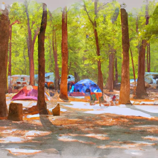
Chickasabogue Park
What's on-site at Chickasabogue Park
Key facilities Snoflo tracks for this campground. Confirm with the operator before booking -- amenities can change seasonally.
Plan your trip down to the hour
Same weather feed Snoflo's iOS app uses -- updated continuously from NOAA / yr.no.
Next 5 days, hour by hour
Temperature line with weather symbols on top, snow + rain accumulation as columns, humidity as a dotted line.
5-day forecast table
Every 3 hours, broken out across temperature, snow, rain, humidity, and wind. Each cell is colour-coded relative to the column min/max so trends jump out at a glance.
| Time | Condition | Temp (°F) | Snow (in) | Rain (in) | Humidity (%) | Wind (mps) | Wind dir |
|---|---|---|---|---|---|---|---|
| Loading detailed forecast… | |||||||
15-day temperature & precipitation
Daily temperatures, snow, and rain projected over the next two weeks. Hover any point for the full breakdown.
Other campgrounds in the area
Snoflo-tracked campsites within driving distance of Chickasabogue Park, with reservations status.
| Campground | Reservations | Toilets | View |
|---|---|---|---|
| Mobile County Marina | ✗ | ✗ | → |
| Meaher State Park | ✗ | ✗ | → |
| Blakeley State Park | ✓ | ✗ | → |
| Riverview Rv Park | ✗ | ✗ | → |
| Two Rivers Point Campsite | ✗ | ✗ | → |
Nearby streamflow
USGS streamgauges within reach of Chickasabogue Park -- pulled live from the National Water Information System.
| Streamgauge | Discharge | View |
|---|---|---|
| Chickasaw Creek Near Kushla Al | 84 cfs | → |
| Hamilton Creek At Snow Road Near Semmes | 15 cfs | → |
| Crooked Creek Near Fairview | 13 cfs | → |
| Big Creek At County Rd 63 Near Wilmer | 22 cfs | → |
| Fowl River At Half-Mile Rd Near Laurendine | 24 cfs | → |
| Escatawpa River Near Agricola Ms | 386 cfs | → |
Nearby snow depths
NRCS SNOTEL stations within reach of Chickasabogue Park -- relevant when planning a shoulder-season or alpine trip.
| SNOTEL station | Snowpack | 24h Snowfall | View |
|---|---|---|---|
| Saraland 3.1 Nw | 0.0 in | 0.0 in | → |
| Wilmer 3.4 Se | 0.0 in | 0.0 in | → |
| Mobile 10.8 Wsw | 0.0 in | 0.0 in | → |
| Tillmans Corner 4.3 Wnw | 0.0 in | 0.0 in | → |
| Daphne 1.2 Nnw | 0.0 in | 0.0 in | → |
| Fairhope 4.0 Ene | 0.0 in | 0.0 in | → |
Plan a longer trip
The closest parks, lakes, boat launches, and paddle runs so a camping night can grow into a full weekend.
Parks
- Chickasabogue Park
- John W Dotson Memorial Park
- Mauvilla Park
- C E Burrell Park
- Paul Devine Park
- James B Mcdonough Memorial Park
Boat launches
- Ruben Avenue 498, Saraland
- Steele Creek
- Battleship Parkway 1267-1989, Spanish Fort
- Coast Guard Wharf Mobile
- Battleship Parkway 1675, Spanish Fort
- Dog River Park
Fishing spots
Points of interest
- Chickasaw Shipyard Village Historic District
- Africatown Historic District
- The Catholic Cemetery Of Mobile
- D'Iberville Apartments
- Lafayette Heights Historic District
- Ashland Place Historic District
Paddle runs
- Begins Approximately 1 River Mile Upstream From The U.S. Highway 98 Bridge To The Jackson County Route 614 Bridge
- The Jackson County Route 614 Bridge To Ends Approximately 2 River Miles From The Southern Terminus Of The Study Area
- The Confluence With Scarsborough Creek To The Confluence With The Escatawpa River
- Begins Approximately 2 River Miles Downstream From The Yellowhouse Branch Confluence With The Escatawpa River Near The Town Of Deer Park, Alabama To Ends Approximately 1 River Mile Upstream From The U.S. Highway 98 Bridge
Camping essentials & Leave No Trace
- Pack it in, pack it out
- Take all trash, food scraps, and gear back with you to keep campsites clean and protect wildlife.
- Respect wildlife
- Observe animals from a distance, store food securely, and never feed wildlife to maintain natural behavior and safety.
- Know before you go
- Check weather, fire restrictions, trail conditions, and permit requirements to ensure a safe and well-planned trip.
- Minimize campfire impact
- Use established fire rings, keep fires small, fully extinguish them, or opt for a camp stove when fires are restricted.
- Leave what you find
- Preserve natural and cultural features by avoiding removal of plants, rocks, artifacts, or other elements of the environment.
Set push alerts in the Snoflo app
Save Chickasabogue Park as a favorite, set a custom threshold (precipitation, snowpack, freezing temperatures), and the iOS app will push the moment conditions cross.
About Chickasabogue Park
Can I make reservations at Chickasabogue Park?
This campground does not appear to accept reservations -- it's typically first-come, first-served. Arrive early on summer weekends.
How fresh is the weather data on this page?
The hourly forecast updates throughout the day from the NOAA / yr.no public feeds. Streamflow data is pulled live from USGS streamgauges and snowpack from the NRCS SNOTEL network.
What's the best time of year to visit?
Use the 15-day temperature & precipitation outlook on this page to plan -- pick a window with comfortable temperatures and low precipitation. For longer trips, the 5-day hourly meteogram shows snow + rain accumulation hour-by-hour.
How do I get to Chickasabogue Park?
Tap Directions in the hero above to open driving directions in Google Maps, or Open in map to center the Snoflo interactive map on the campground.
Can I get alerts when conditions change?
Yes -- alerts are managed through the Snoflo iOS app. Favorite this campground, set a threshold (temperature, snowpack, precipitation), and you'll get a push the moment it crosses.
Other campgrounds near here
Snoflo-tracked campgrounds within driving distance of Chickasabogue Park.