Calico Rocks Campsite campground
Community Reviews
Been here? Share the conditions.
Reviews, ratings & photos are added in the free Snoflo iOS app — rate a spot, tag the conditions, and your visit is verified by location. Add or manage your reviews from the app.
Calico Rocks Campsite
One of the most impressive nearby points of interest is the Chesapeake and Ohio Canal National Historical Park that runs along the Potomac River. Visitors can enjoy hiking, biking, and fishing along the canal, as well as exploring its historic lockhouses and aqueducts. Another must-see attraction is the Paw Paw Tunnel, a 3,118-foot-long tunnel that was built in the 19th century for the canal boats.
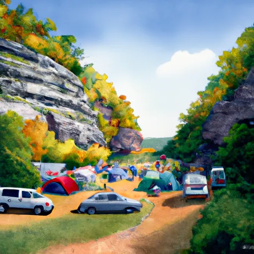
Calico Rocks Campsite has all the basic amenities required for a comfortable camping experience. It has a total of 15 campsites with fire rings, picnic tables, and access to drinking water, toilets, and trash disposal. There are no electricity or shower facilities available. However, visitors can enjoy a refreshing dip in the nearby Potomac River.
Green Ridge State Forest, where Calico Rocks Campsite is located, is renowned for its geological features and interesting history. The forest is home to over 100 miles of hiking trails, several historic sites, and the largest contiguous hardwood forest in Maryland. The area is also famous for its abundance of rare plant species and wildlife.
The best time to visit Calico Rocks Campsite is between April and October when the weather is mild. The average temperature during this time is around 70°F during the day and 50°F at night. However, visitors should be aware that the area can experience sudden changes in weather, so it is recommended to come prepared for all conditions.
In conclusion, if you're looking for a peaceful camping experience surrounded by breathtaking views and a rich natural and historic heritage, Calico Rocks Campsite in Green Ridge State Forest, Maryland, is the perfect destination for you.
What's on-site at Calico Rocks Campsite
Key facilities Snoflo tracks for this campground. Confirm with the operator before booking -- amenities can change seasonally.
Plan your trip down to the hour
Same weather feed Snoflo's iOS app uses -- updated continuously from NOAA / yr.no.
Next 5 days, hour by hour
Temperature line with weather symbols on top, snow + rain accumulation as columns, humidity as a dotted line.
5-day forecast table
Every 3 hours, broken out across temperature, snow, rain, humidity, and wind. Each cell is colour-coded relative to the column min/max so trends jump out at a glance.
| Time | Condition | Temp (°F) | Snow (in) | Rain (in) | Humidity (%) | Wind (mps) | Wind dir |
|---|---|---|---|---|---|---|---|
| Loading detailed forecast… | |||||||
15-day temperature & precipitation
Daily temperatures, snow, and rain projected over the next two weeks. Hover any point for the full breakdown.
Other campgrounds in the area
Snoflo-tracked campsites within driving distance of Calico Rocks Campsite, with reservations status.
| Campground | Reservations | Toilets | View |
|---|---|---|---|
| Calico Rocks | ✗ | ✓ | → |
| Bald Eagle Island | ✗ | ✓ | → |
| Bald Eagle Campsite | ✗ | ✗ | → |
| Brunswick City Campground | ✓ | ✗ | → |
| Indiant Flats Campsite | ✗ | ✗ | → |
Nearby streamflow
USGS streamgauges within reach of Calico Rocks Campsite -- pulled live from the National Water Information System.
| Streamgauge | Discharge | View |
|---|---|---|
| Potomac River At Point Of Rocks | 3,770 cfs | → |
| Catoctin Creek At Taylorstown | 20 cfs | → |
| Bennett Creek At Park Mills | 20 cfs | → |
| N F Catoctin Creek At Rt 681 Near Waterford | 4 cfs | → |
| Limestone Branch Near Leesburg | 1 cfs | → |
| S F Catoctin Creek At Rt 698 Near Waterford | 7 cfs | → |
Nearby snow depths
NRCS SNOTEL stations within reach of Calico Rocks Campsite -- relevant when planning a shoulder-season or alpine trip.
| SNOTEL station | Snowpack | 24h Snowfall | View |
|---|---|---|---|
| Purcellville Coop | 0.0 in | 0.0 in | → |
| Damascus 3 Ssw Coop | 0.0 in | 0.0 in | → |
| Harpers Ferry 12.8 Ssw | 0.0 in | 0.0 in | → |
| Round Hill 2.7 Wsw | 0.0 in | 0.0 in | → |
| Montgomery Village 1.1 Ene | 0.0 in | 0.0 in | → |
| Wfo Sterling Coop | 0.0 in | 0.0 in | → |
Plan a longer trip
The closest parks, lakes, boat launches, and paddle runs so a camping night can grow into a full weekend.
Parks
- Point Of Rocks Community Park
- Lucketts Community Park
- Carroll County Sports Complex
- Brunswick City Park
- Brunswick Heights Park
- Dickerson Conservation Park
Boat launches
- Chesapeake And Ohio Canal Trail Point Of Rocks
- Mckimmey (Point Of Rocks)
- Chesapeake And Ohio Canal Trail Frederick County
- South Maple Avenue 105, Brunswick
- Chesapeake And Ohio Canal Frederick County
- Petersville Road Brunswick
Camping essentials & Leave No Trace
- Pack it in, pack it out
- Take all trash, food scraps, and gear back with you to keep campsites clean and protect wildlife.
- Respect wildlife
- Observe animals from a distance, store food securely, and never feed wildlife to maintain natural behavior and safety.
- Know before you go
- Check weather, fire restrictions, trail conditions, and permit requirements to ensure a safe and well-planned trip.
- Minimize campfire impact
- Use established fire rings, keep fires small, fully extinguish them, or opt for a camp stove when fires are restricted.
- Leave what you find
- Preserve natural and cultural features by avoiding removal of plants, rocks, artifacts, or other elements of the environment.
Set push alerts in the Snoflo app
Save Calico Rocks Campsite as a favorite, set a custom threshold (precipitation, snowpack, freezing temperatures), and the iOS app will push the moment conditions cross.
About Calico Rocks Campsite
Can I make reservations at Calico Rocks Campsite?
This campground does not appear to accept reservations -- it's typically first-come, first-served. Arrive early on summer weekends.
How fresh is the weather data on this page?
The hourly forecast updates throughout the day from the NOAA / yr.no public feeds. Streamflow data is pulled live from USGS streamgauges and snowpack from the NRCS SNOTEL network.
What's the best time of year to visit?
Use the 15-day temperature & precipitation outlook on this page to plan -- pick a window with comfortable temperatures and low precipitation. For longer trips, the 5-day hourly meteogram shows snow + rain accumulation hour-by-hour.
How do I get to Calico Rocks Campsite?
Tap Directions in the hero above to open driving directions in Google Maps, or Open in map to center the Snoflo interactive map on the campground.
Can I get alerts when conditions change?
Yes -- alerts are managed through the Snoflo iOS app. Favorite this campground, set a threshold (temperature, snowpack, precipitation), and you'll get a push the moment it crosses.
Other campgrounds near here
Snoflo-tracked campgrounds within driving distance of Calico Rocks Campsite.