Baxter Bridge State Forest Campground Campground
Community Reviews
Been here? Share the conditions.
Reviews, ratings & photos are added in the free Snoflo iOS app — rate a spot, tag the conditions, and your visit is verified by location. Add or manage your reviews from the app.
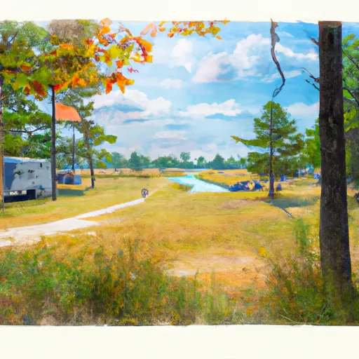
Baxter Bridge State Forest Campground
Reservations are not accepted at Baxter Bridge State Forest Campground, and campsites are available on a first-come, first-served basis. It is recommended to arrive early, especially during peak seasons, to secure a spot. The best time to visit this campground is during the summer months when the weather is mild and favorable for outdoor activities. The lush greenery and scenic views add to the charm of the campground during this time.
While exploring the camping area, campers can indulge in various recreational activities such as hiking, fishing, and wildlife viewing. It is advised to be cautious of wildlife encounters and to follow proper safety measures. Additionally, campers should be mindful of any fire restrictions or regulations in the area to prevent accidental wildfires. Overall, Baxter Bridge State Forest Campground offers a serene and enjoyable camping experience, perfect for those seeking a getaway in the natural beauty of Michigan.
What's on-site at Baxter Bridge State Forest Campground
Key facilities Snoflo tracks for this campground. Confirm with the operator before booking -- amenities can change seasonally.
Plan your trip down to the hour
Same weather feed Snoflo's iOS app uses -- updated continuously from NOAA / yr.no.
Next 5 days, hour by hour
Temperature line with weather symbols on top, snow + rain accumulation as columns, humidity as a dotted line.
5-day forecast table
Every 3 hours, broken out across temperature, snow, rain, humidity, and wind. Each cell is colour-coded relative to the column min/max so trends jump out at a glance.
| Time | Condition | Temp (°F) | Snow (in) | Rain (in) | Humidity (%) | Wind (mps) | Wind dir |
|---|---|---|---|---|---|---|---|
| Loading detailed forecast… | |||||||
15-day temperature & precipitation
Daily temperatures, snow, and rain projected over the next two weeks. Hover any point for the full breakdown.
Other campgrounds in the area
Snoflo-tracked campsites within driving distance of Baxter Bridge State Forest Campground, with reservations status.
| Campground | Reservations | Toilets | View |
|---|---|---|---|
| Old Us-131 State Forest Campground | ✗ | ✗ | → |
| Chippewa Landing | ✗ | ✗ | → |
| Lake Billings Campground | ✗ | ✗ | → |
| Spring Lake State Forest Campground | ✗ | ✗ | → |
| Hopkins Creek State Forest Campground | ✗ | ✗ | → |
Nearby streamflow
USGS streamgauges within reach of Baxter Bridge State Forest Campground -- pulled live from the National Water Information System.
| Streamgauge | Discharge | View |
|---|---|---|
| Manistee River Near Sherman | 1,210 cfs | → |
| Boardman R Above Brown Bridge Road Nr Mayfield | 200 cfs | → |
| Manistee River Near Mesick | 1,270 cfs | → |
| Pine River At High School Bridge Nr Hoxeyville | 238 cfs | → |
| Manistee River Near Wellston | 2,030 cfs | → |
| East Branch Pine River Near Tustin | 11 cfs | → |
Nearby snow depths
NRCS SNOTEL stations within reach of Baxter Bridge State Forest Campground -- relevant when planning a shoulder-season or alpine trip.
| SNOTEL station | Snowpack | 24h Snowfall | View |
|---|---|---|---|
| Kingsley 2.7 Ene | 0.0 in | 0.0 in | → |
| Fife Lake 2wnw | 0.0 in | 0.0 in | → |
| Grawn 1.3 Ssw | 0.0 in | 0.0 in | → |
| Traverse City 4.7 Ese | 0.0 in | 0.0 in | → |
| Traverse City 4.7ese | 0.0 in | 0.0 in | → |
| Lake City Exp Farm | 0.0 in | 0.0 in | → |
Plan a longer trip
The closest parks, lakes, boat launches, and paddle runs so a camping night can grow into a full weekend.
Parks
- Grace Macdonald Park
- Blair Township Park
- Green Lake Township Memorial Park
- Interlochen State Park
- Cadillac All Sports Park
- Traverse City State Park
Boat launches
- Old 131
- North Country National Scenic Trail Liberty Township
- Harvey Bridge River Access Hanover Township
- South Buckley Road Mayfield Township
- North Country National Scenic Trail Fife Lake Township
- Lake Shore Drive 11283, Fife Lake Township
Fishing spots
Points of interest
- Manton Area Historical Museum
- Fife Lake Historical Museum
- The Lake Cabin Resort
- Rope Swing
- Hill To The Lake
- Joseph H. Rogers Observatory
Paddle runs
- Southern Boundary Of Sleeping Bear Dunes National Lakeshore To Mouth At Lake Michigan
- Southeastern Boundary Of Sleeping Bear Dunes National Lakeshore To Northwetern Boundary Of Sleeping Bear Dunes National Lakeshore
- Kings Road Bridge (2 Miles West Of Town Of Luther In T19n, R12w To Slackwater Of The State Fish Weir In T21n, R16w
Camping essentials & Leave No Trace
- Pack it in, pack it out
- Take all trash, food scraps, and gear back with you to keep campsites clean and protect wildlife.
- Respect wildlife
- Observe animals from a distance, store food securely, and never feed wildlife to maintain natural behavior and safety.
- Know before you go
- Check weather, fire restrictions, trail conditions, and permit requirements to ensure a safe and well-planned trip.
- Minimize campfire impact
- Use established fire rings, keep fires small, fully extinguish them, or opt for a camp stove when fires are restricted.
- Leave what you find
- Preserve natural and cultural features by avoiding removal of plants, rocks, artifacts, or other elements of the environment.
Set push alerts in the Snoflo app
Save Baxter Bridge State Forest Campground as a favorite, set a custom threshold (precipitation, snowpack, freezing temperatures), and the iOS app will push the moment conditions cross.
About Baxter Bridge State Forest Campground
Can I make reservations at Baxter Bridge State Forest Campground?
This campground does not appear to accept reservations -- it's typically first-come, first-served. Arrive early on summer weekends.
How fresh is the weather data on this page?
The hourly forecast updates throughout the day from the NOAA / yr.no public feeds. Streamflow data is pulled live from USGS streamgauges and snowpack from the NRCS SNOTEL network.
What's the best time of year to visit?
Use the 15-day temperature & precipitation outlook on this page to plan -- pick a window with comfortable temperatures and low precipitation. For longer trips, the 5-day hourly meteogram shows snow + rain accumulation hour-by-hour.
How do I get to Baxter Bridge State Forest Campground?
Tap Directions in the hero above to open driving directions in Google Maps, or Open in map to center the Snoflo interactive map on the campground.
Can I get alerts when conditions change?
Yes -- alerts are managed through the Snoflo iOS app. Favorite this campground, set a threshold (temperature, snowpack, precipitation), and you'll get a push the moment it crosses.
Other campgrounds near here
Snoflo-tracked campgrounds within driving distance of Baxter Bridge State Forest Campground.