Leverentz Lake State Forest Campground Campground
Community Reviews
Been here? Share the conditions.
Reviews, ratings & photos are added in the free Snoflo iOS app — rate a spot, tag the conditions, and your visit is verified by location. Add or manage your reviews from the app.
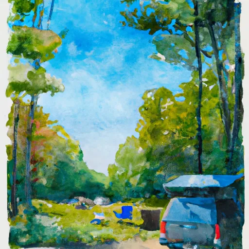
Leverentz Lake State Forest Campground
What's on-site at Leverentz Lake State Forest Campground
Key facilities Snoflo tracks for this campground. Confirm with the operator before booking -- amenities can change seasonally.
Plan your trip down to the hour
Same weather feed Snoflo's iOS app uses -- updated continuously from NOAA / yr.no.
Next 5 days, hour by hour
Temperature line with weather symbols on top, snow + rain accumulation as columns, humidity as a dotted line.
5-day forecast table
Every 3 hours, broken out across temperature, snow, rain, humidity, and wind. Each cell is colour-coded relative to the column min/max so trends jump out at a glance.
| Time | Condition | Temp (°F) | Snow (in) | Rain (in) | Humidity (%) | Wind (mps) | Wind dir |
|---|---|---|---|---|---|---|---|
| Loading detailed forecast… | |||||||
15-day temperature & precipitation
Daily temperatures, snow, and rain projected over the next two weeks. Hover any point for the full breakdown.
Other campgrounds in the area
Snoflo-tracked campsites within driving distance of Leverentz Lake State Forest Campground, with reservations status.
| Campground | Reservations | Toilets | View |
|---|---|---|---|
| Leverentz Lake - State Forest | ✗ | ✗ | → |
| Bray Creek State Forest Campground | ✗ | ✗ | → |
| Bray Creek - State Forest | ✗ | ✗ | → |
| Ivan's Campground And Cabins | ✗ | ✗ | → |
| Whispering Oaks Campground | ✗ | ✗ | → |
Nearby streamflow
USGS streamgauges within reach of Leverentz Lake State Forest Campground -- pulled live from the National Water Information System.
| Streamgauge | Discharge | View |
|---|---|---|
| Pine River At High School Bridge Nr Hoxeyville | 238 cfs | → |
| East Branch Pine River Near Tustin | 11 cfs | → |
| Pere Marquette River At Scottville | 523 cfs | → |
| Manistee River Near Wellston | 1,810 cfs | → |
| Muskegon River At Evart | 582 cfs | → |
| Manistee River Near Mesick | 1,180 cfs | → |
Nearby snow depths
NRCS SNOTEL stations within reach of Leverentz Lake State Forest Campground -- relevant when planning a shoulder-season or alpine trip.
| SNOTEL station | Snowpack | 24h Snowfall | View |
|---|---|---|---|
| Scottville 2.1 Ese | 0.0 in | 0.0 in | → |
| Scottville 2 Se | 0.0 in | 0.0 in | → |
| Water Works | 0.0 in | 0.0 in | → |
| White Cloud 7.5 Ene | 0.0 in | 0.0 in | → |
| Wellston 0.8 N | 0.0 in | 0.0 in | → |
| Wellston Tippy Dam | 0.0 in | 0.0 in | → |
Plan a longer trip
The closest parks, lakes, boat launches, and paddle runs so a camping night can grow into a full weekend.
Parks
- National Wild And Scenic River Pere Marquette, Michigan
- Northend Riverside Park
- Hemlock Park
- Rose Lake Park
- Mitchell State Park
- Kenwood Heritage Park
Boat launches
Fishing spots
- Idlewild Lake
- Log Mark Rest Stop Canoe And Fishing Landing
- Fishing Peir
- Suicide Bend Fishing Site
- St. Hubert Angler Parking
- Lake Cadillac
Points of interest
- Shrine Of The Pines
- Loda Lake National Wildflower Sanctuary
- Leroy Museum
- Jim Crow Museum Of Racist Imagery
- Udell Lookout Tower
- Caberfae Scenic Overlook
Paddle runs
- South Branch From Forest Boundary East Of Hesperia At West Section Line Of Sec 22, T14n, R14w To Echo Drive In Sec 6, T13n, R12w
- Kings Road Bridge (2 Miles West Of Town Of Luther In T19n, R12w To Slackwater Of The State Fish Weir In T21n, R16w
- Croton Dam In T12n, R11w To City Of Newaygo In T12n, R12w
- Morley Dam In T13n, R10w To Croton Dam Pond In T12n, R11w
- North Branch From Its Confluence With South Branch In Sec 22, T13n, R16 W To Mclaren Lake In Sec 11, T14n, R15w
- Mainstem To Forest Boundary At North Section Line Of Sec 2, T13n, R15w (1.5 Miles West Of Herperia)
Camping essentials & Leave No Trace
- Pack it in, pack it out
- Take all trash, food scraps, and gear back with you to keep campsites clean and protect wildlife.
- Respect wildlife
- Observe animals from a distance, store food securely, and never feed wildlife to maintain natural behavior and safety.
- Know before you go
- Check weather, fire restrictions, trail conditions, and permit requirements to ensure a safe and well-planned trip.
- Minimize campfire impact
- Use established fire rings, keep fires small, fully extinguish them, or opt for a camp stove when fires are restricted.
- Leave what you find
- Preserve natural and cultural features by avoiding removal of plants, rocks, artifacts, or other elements of the environment.
Set push alerts in the Snoflo app
Save Leverentz Lake State Forest Campground as a favorite, set a custom threshold (precipitation, snowpack, freezing temperatures), and the iOS app will push the moment conditions cross.
About Leverentz Lake State Forest Campground
Can I make reservations at Leverentz Lake State Forest Campground?
This campground does not appear to accept reservations -- it's typically first-come, first-served. Arrive early on summer weekends.
How fresh is the weather data on this page?
The hourly forecast updates throughout the day from the NOAA / yr.no public feeds. Streamflow data is pulled live from USGS streamgauges and snowpack from the NRCS SNOTEL network.
What's the best time of year to visit?
Use the 15-day temperature & precipitation outlook on this page to plan -- pick a window with comfortable temperatures and low precipitation. For longer trips, the 5-day hourly meteogram shows snow + rain accumulation hour-by-hour.
How do I get to Leverentz Lake State Forest Campground?
Tap Directions in the hero above to open driving directions in Google Maps, or Open in map to center the Snoflo interactive map on the campground.
Can I get alerts when conditions change?
Yes -- alerts are managed through the Snoflo iOS app. Favorite this campground, set a threshold (temperature, snowpack, precipitation), and you'll get a push the moment it crosses.
Other campgrounds near here
Snoflo-tracked campgrounds within driving distance of Leverentz Lake State Forest Campground.