Manistee Lake -E, 930 Acres, Manistee County boat launch
Community Reviews
Been here? Share the conditions.
Reviews, ratings & photos are added in the free Snoflo iOS app — rate a spot, tag the conditions, and your visit is verified by location. Add or manage your reviews from the app.
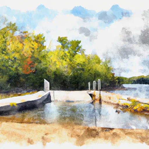
Manistee Lake -E, 930 Acres, Manistee County
According to the Michigan Department of Natural Resources, Manistee Lake is open to a variety of watercraft, including motorized boats, kayaks, canoes, and paddleboards. However, there are specific rules and regulations in place for each type of craft. For example, motorboats are required to have a valid registration and display a current boating safety certificate, while paddlecraft such as kayaks and canoes are required to have a personal flotation device for each person on board.
It is important to note that regulations and requirements may change over time, so it is always advisable to check the latest information before planning a trip to Manistee Lake or any other boating location.
Plan your launch down to the hour
Same weather feed Snoflo's iOS app uses -- updated continuously from NOAA / yr.no.
Next 5 days, hour by hour
Temperature line with weather symbols on top, snow + rain accumulation as columns, humidity as a dotted line.
5-day forecast table
Every 3 hours, broken out across temperature, snow, rain, humidity, and wind.
| Time | Condition | Temp (°F) | Snow (in) | Rain (in) | Humidity (%) | Wind (mps) | Wind dir |
|---|---|---|---|---|---|---|---|
| Loading detailed forecast… | |||||||
15-day temperature & precipitation
Daily temperatures, snow, and rain projected over the next two weeks.
Area streamflow levels
USGS streamgauges around Manistee Lake -E, 930 Acres, Manistee County -- the same readings that determine whether your launch is safe and your boat is the right craft.
| Streamgauge | Discharge | View |
|---|---|---|
| Manistee River Near Wellston | 2,050 cfs | → |
| Pere Marquette River At Scottville | 616 cfs | → |
| Manistee River Near Mesick | 1,320 cfs | → |
| Pine River At High School Bridge Nr Hoxeyville | 257 cfs | → |
Plan a longer trip
The closest paddle runs, fishing spots, and other boat launches so you can extend a day on the water.
River runs
- Kings Road Bridge (2 Miles West Of Town Of Luther In T19n, R12w To Slackwater Of The State Fish Weir In T21n, R16w
- Southern Boundary Of Sleeping Bear Dunes National Lakeshore To Mouth At Lake Michigan
Boating safety & etiquette
- Check the conditions before you launch
- Use the streamflow numbers, weather, and wind forecast on this page. High-cfs whitewater requires whitewater-specific craft and skill.
- Wear your life jacket
- Statistically the single biggest survival factor in a boating incident. State law often requires one per passenger.
- File a float plan
- Tell someone on shore your put-in, take-out, and expected return time. Especially for multi-day or remote trips.
- Yield at the ramp
- Prep gear in the parking lot, not on the ramp. Launch and clear quickly so others can use the lane.
- Clean, drain, dry
- Inspect, clean, drain and dry your boat between waters to prevent the spread of aquatic invasive species.
Set push alerts in the Snoflo app
Save Manistee Lake -E, 930 Acres, Manistee County as a favorite, set a discharge threshold or a wind/precipitation alert, and the iOS app will push the moment conditions cross.
About Manistee Lake -E, 930 Acres, Manistee County
Can I launch a motorboat here?
Most Snoflo-tracked launches support motorboats; check the operator for any horsepower restrictions, paddle-only zones, or seasonal closures.
How fresh is the streamflow data?
USGS streamgauges report continuously (every 15 minutes); the table on this page pulls the latest reading at page load.
Is there a fee?
Many federal and state boat launches charge a day-use fee. Check the operator's site before driving out.
What boat is right for these conditions?
Use the nearby streamflow numbers and river-run panel on this page to gauge current conditions. Wider, slower water is friendly for casual paddling and powerboats; high-cfs whitewater requires whitewater-specific craft and skill.
Can I get alerts when conditions change?
Yes -- alerts are managed in the Snoflo iOS app. Favorite this launch, set a threshold (discharge, wind), and you'll get a push the moment it crosses.
Other launches near here
Snoflo-tracked boat launches within driving distance of Manistee Lake -E, 930 Acres, Manistee County.