Minnie Pond Campground Campground
Community Reviews
Been here? Share the conditions.
Reviews, ratings & photos are added in the free Snoflo iOS app — rate a spot, tag the conditions, and your visit is verified by location. Add or manage your reviews from the app.
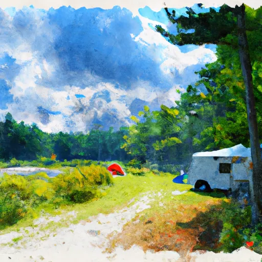
Minnie Pond Campground
Reservations are accepted at Minnie Pond Campground, which is beneficial for those who prefer to plan their camping trips in advance. This ensures that you have a guaranteed spot and reduces the risk of arriving and finding no availability. It is recommended to make reservations early, especially during peak seasons, to secure your preferred dates.
The best time of year to visit Minnie Pond Campground is during the summer months when the weather is mild and ideal for outdoor activities. The campground is open from May to October, providing ample opportunities for camping and exploration. However, it is important to note that the campground can become crowded during weekends and holidays, so planning your visit accordingly is advisable.
While Minnie Pond Campground offers a pleasant camping experience, it is important to be cautious of wildlife in the area. Michigan is known for its diverse wildlife population, including bears and coyotes, so it is essential to store food properly and avoid leaving any food scraps behind. It is also recommended to bring bug repellent, as mosquitoes can be prevalent in some areas. By taking these precautions, campers can have a safe and enjoyable experience at Minnie Pond Campground.
What's on-site at Minnie Pond Campground
Key facilities Snoflo tracks for this campground. Confirm with the operator before booking -- amenities can change seasonally.
Plan your trip down to the hour
Same weather feed Snoflo's iOS app uses -- updated continuously from NOAA / yr.no.
Next 5 days, hour by hour
Temperature line with weather symbols on top, snow + rain accumulation as columns, humidity as a dotted line.
5-day forecast table
Every 3 hours, broken out across temperature, snow, rain, humidity, and wind. Each cell is colour-coded relative to the column min/max so trends jump out at a glance.
| Time | Condition | Temp (°F) | Snow (in) | Rain (in) | Humidity (%) | Wind (mps) | Wind dir |
|---|---|---|---|---|---|---|---|
| Loading detailed forecast… | |||||||
15-day temperature & precipitation
Daily temperatures, snow, and rain projected over the next two weeks. Hover any point for the full breakdown.
Other campgrounds in the area
Snoflo-tracked campsites within driving distance of Minnie Pond Campground, with reservations status.
| Campground | Reservations | Toilets | View |
|---|---|---|---|
| Minnie Pond | ✗ | ✗ | → |
| Timbers Edge Campground | ✗ | ✗ | → |
| Benton Lake Campground | ✗ | ✗ | → |
| Benton Lake | ✗ | ✗ | → |
| Diamond Lake Co Park | ✓ | ✓ | → |
Nearby streamflow
USGS streamgauges within reach of Minnie Pond Campground -- pulled live from the National Water Information System.
| Streamgauge | Discharge | View |
|---|---|---|
| Muskegon River Near Croton | 1,190 cfs | → |
| White River Near Whitehall | 252 cfs | → |
| Little Muskegon River Near Oak Grove | 80 cfs | → |
| Bear Creek Near Muskegon | 4 cfs | → |
| Pere Marquette River At Scottville | 489 cfs | → |
| Muskegon River At Evart | 539 cfs | → |
Nearby snow depths
NRCS SNOTEL stations within reach of Minnie Pond Campground -- relevant when planning a shoulder-season or alpine trip.
| SNOTEL station | Snowpack | 24h Snowfall | View |
|---|---|---|---|
| White Cloud 7.5 Ene | 0.0 in | 0.0 in | → |
| Fremont | 2.0 in | 0.0 in | → |
| Water Works | 0.0 in | 0.0 in | → |
| Hart | 0.0 in | 0.0 in | → |
| Hart 3 Wsw | 0.0 in | 0.0 in | → |
| Scottville 2 Se | 0.0 in | 0.0 in | → |
Plan a longer trip
The closest parks, lakes, boat launches, and paddle runs so a camping night can grow into a full weekend.
Parks
- William J Branstrom Park
- National Wild And Scenic River Pere Marquette, Michigan
- Ed H. Henning County Park
- Sandy Beach County Park
- Newaygo State Park
- High Rollway Park
Boat launches
- Nfs 6902 Merrill Township
- Diamond Lake
- Nagek Drive Merrill Township
- Nfs 5140-A Merrill Township
- Robinson Lake
- Nfs 5536 Lilley Township
Fishing spots
- St. Hubert Angler Parking
- Idlewild Lake
- Blanch Lake
- Fishing Peir
- Log Mark Rest Stop Canoe And Fishing Landing
- Baptist Lake
Points of interest
- Loda Lake National Wildflower Sanctuary
- Shrine Of The Pines
- Hardy Hydroelectric Plant
- Croton Hydroelectric Plant
- Kolski High Ropes Course And Zipline
- Kolski Family Project C.O.P.E
Paddle runs
- South Branch From Forest Boundary East Of Hesperia At West Section Line Of Sec 22, T14n, R14w To Echo Drive In Sec 6, T13n, R12w
- Croton Dam In T12n, R11w To City Of Newaygo In T12n, R12w
- North Branch From Its Confluence With South Branch In Sec 22, T13n, R16 W To Mclaren Lake In Sec 11, T14n, R15w
- Morley Dam In T13n, R10w To Croton Dam Pond In T12n, R11w
- Mainstem To Forest Boundary At North Section Line Of Sec 2, T13n, R15w (1.5 Miles West Of Herperia)
- Kings Road Bridge (2 Miles West Of Town Of Luther In T19n, R12w To Slackwater Of The State Fish Weir In T21n, R16w
Camping essentials & Leave No Trace
- Pack it in, pack it out
- Take all trash, food scraps, and gear back with you to keep campsites clean and protect wildlife.
- Respect wildlife
- Observe animals from a distance, store food securely, and never feed wildlife to maintain natural behavior and safety.
- Know before you go
- Check weather, fire restrictions, trail conditions, and permit requirements to ensure a safe and well-planned trip.
- Minimize campfire impact
- Use established fire rings, keep fires small, fully extinguish them, or opt for a camp stove when fires are restricted.
- Leave what you find
- Preserve natural and cultural features by avoiding removal of plants, rocks, artifacts, or other elements of the environment.
Set push alerts in the Snoflo app
Save Minnie Pond Campground as a favorite, set a custom threshold (precipitation, snowpack, freezing temperatures), and the iOS app will push the moment conditions cross.
About Minnie Pond Campground
Can I make reservations at Minnie Pond Campground?
This campground does not appear to accept reservations -- it's typically first-come, first-served. Arrive early on summer weekends.
How fresh is the weather data on this page?
The hourly forecast updates throughout the day from the NOAA / yr.no public feeds. Streamflow data is pulled live from USGS streamgauges and snowpack from the NRCS SNOTEL network.
What's the best time of year to visit?
Use the 15-day temperature & precipitation outlook on this page to plan -- pick a window with comfortable temperatures and low precipitation. For longer trips, the 5-day hourly meteogram shows snow + rain accumulation hour-by-hour.
How do I get to Minnie Pond Campground?
Tap Directions in the hero above to open driving directions in Google Maps, or Open in map to center the Snoflo interactive map on the campground.
Can I get alerts when conditions change?
Yes -- alerts are managed through the Snoflo iOS app. Favorite this campground, set a threshold (temperature, snowpack, precipitation), and you'll get a push the moment it crosses.
Other campgrounds near here
Snoflo-tracked campgrounds within driving distance of Minnie Pond Campground.